Odeda

Last updated

Odeda
LGA and town
Motto: 
Odeda PAPADA
Nigeria location map.svg
Red pog.svg
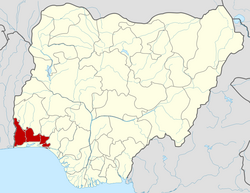
Odeda
Location in Nigeria
Coordinates: 7°13′55″N3°31′38″E / 7.23194°N 3.52722°E / 7.23194; 3.52722
CountryFlag of Nigeria.svg  Nigeria
State Ogun State
Government
  Local Government Chairman and the Head of the Local Government CouncilFolasade Adeyemo (APC)
Area
  Total
1,560 km2 (600 sq mi)
Population
 (2006 census)
  Total
109,449
Time zone UTC+1 (WAT)
3-digit postal code prefix
110
ISO 3166 code NG.OG.OD
Odeda

Odeda (or Awdeda) is a Local Government Area and town in Ogun State, Nigeria. The headquarters of the LGA are at Odeda on the A5 highway.

It has an area of 1,560 km2 and a population of 109,449 at the 2006 census. The local government is bounded at Bakatare. A small village close to Oyo State and also bounded at Alogi, a big urban centre that bound the local government area from Abeokuta-south.

The important landmarks in odeda includes Odeda farm institute, a Catholic church, odeda market, a police station, a quarry and the rail line that heads to Ibadan

The postal code of the area is 110. [1]

Related Research Articles

<span class="mw-page-title-main">Yorubaland</span> Cultural region of the Yoruba people in West Africa

Yorubaland is the homeland and cultural region of the Yoruba people in West Africa. It spans the modern-day countries of Nigeria, Togo and Benin, and covers a total land area of 142,114 km2 (54,871 sq mi). Of this land area, 106,016 km2 (74.6%) lies within Nigeria, 18.9% in Benin, and the remaining 6.5% is in Togo. Prior to European colonization, a portion of this area was known as Yoruba country. The geo-cultural space contains an estimated 55 million people, the majority of this population being ethnic Yoruba.

<span class="mw-page-title-main">Local government areas of Nigeria</span>

Nigeria has 774 local government areas (LGAs), each administered by a local government council consisting of a chairman, who is the chief executive, and other elected members, who are referred to as councillors. Each LGA is further subdivided into a minimum of ten and a maximum of twenty wards. A ward is administered by a councillor, who reports directly to the LGA chairman. The councillors fall under the legislative arm of the Local Government, the third tier of government in Nigeria, below the state governments and the federal government.

Mgbidi is the headquarters of Oru West, a local government area of Imo State in southeastern Nigeria. It is located at latitude 5.37° N and longitude 6.57° E. It was the headquarters of the Oru Local Government Area before its division into two local government areas, Oru West and Oru East, in 1996 under the presidency of Sani Abacha.

Suburbs and localities are the names of geographic subdivisions in Australia, used mainly for address purposes. The term locality is used in rural areas, while the term suburb is used in urban areas. Australian postcodes closely align with the boundaries of localities and suburbs.

Ogba–Egbema–Ndoni is a Local Government Area of Rivers State, in South-South Nigeria under Rivers West Senatorial District, with its headquarters at Omoku. With about 258,700 People according to 2006 Census. It is bounded by Imo, Delta, Bayelsa, and Anambra States and also by Ahoada West, Ahoada East and Emohua Local Government Areas of Rivers State. They are part of the Igboid speaking Areas of Rivers State with three Tribes starting with Ogba as the dominant tribe with 12 legislative wards, the Egbema and Ndoni people who are also found in Ogbaru L.G.A and Ukwuani L.G.A both with 2&3 legislative wards respectively. It is majorly upland and home to the highest upstream Oil and Gas exploration/exploitation activity in the State since the early 1960's with about 12 mining/producing fields operated by AGIP, Total Energies and Shell/NPDC with many other reserve/untapped fields. It is part of the Ogba / Egbema / Ndoni / Ahoada West constituency of the Nigerian House of Representatives. Hon. Vincent Job is the Executive Chairman of ONELGA.

<span class="mw-page-title-main">Ukwa West</span> LGA in Abia State, Nigeria

Ukwa West is a Local Government Area in Abia State, Nigeria. Its headquarters is in the town of Oke Ikpe.

Konshisha is a local government area of Benue State, Nigeria. Its headquarters are in the town of Tse-Agberagba.

Ekiti East is a Local Government Area of Ekiti State, Nigeria. Its headquarters are in the town of Omuo Ekiti. Ekiti East Local Government Area falls within the Southern Senatorial zone of Ekiti State otherwise known as Ekiti South Senatorial District alongside Ekiti South-West, Ikere, Emure, Ise/Orun and Gbonyin local government areas. Ekiti East Local Government Area also forms a Federal Constituency alongside Emure and Gbonyin Local Government Areas.

<span class="mw-page-title-main">Enugu South</span> Local Government Area in Enugu State, Nigeria

Enugu South is a Local Government Area of Enugu State, Nigeria. Its headquarters are in the town of Uwani, Nnobi Street Enugu, and covers the communities of Akwuke, Amechi, Ugwuaji, Obeagu, Awkunanaw and Amechi-Uwani. Enugu South is bounded to the north by Enugu North and to the east by Nkanu East local government areas. It falls within the Eastern senatorial districts of Enugu.

<span class="mw-page-title-main">Njaba</span> Local Government Area in Imo State, Nigeria

Njaba is a Local Government Area of Imo State, Nigeria. Its headquarters is located in the town of Nnenasa. It has an area of 84 km2 and a population of 143,485 at the 2006 census. The 2011 density projection is 2,004.5 inhabitants/km2. The postal code of the area is 474.

<span class="mw-page-title-main">Oru East</span> LGA in Imo State, Nigeria

Oru-East is a Local Government Area of Imo State, Nigeria. Its headquarters is at Omuma. The following are towns that make up Oru East: Akatta, Akuma, Amagu, Amiri, Awo-Omamma, and Omuma.

Rano is a Local Government Area and headquarters of Rano Emirate council in Kano State, Nigeria. Rano is a local government area in Kano State with administrative headquarters in the town of Rano. Rano local government area is a Hausa-Fulani community in the southern senatorial district of Kano State otherwise known as Kano South Senatorial District alongside Albasu, Bebeji, Bunkure, Doguwa, Gaya, Kiru, Takai, Ajingi, Rogo, Kibiya, Tudun Wada, Garko, Wudil and Sumaila local government areas. Rano local government area also forms a federal constituency alongside Bunkure and Kibiya local government areas. It has an area of 520 km2 and a population of 145,439 at the 2006 census. The local government area is bounded to the north by Garun Mallam and Bunkure local government areas, to the east by Kibiya local government area, to the south by Tudun Wada local government area, and to the west by Bebeji local government area. The Rano local government council is in charge of public administration in Rano local government area. The council is led by a chairman who is the executive head of the local government. The Rano legislative council make laws governing Rano local government area. It consists of 10 Councillors representing the 10 wards of the local government area.

<span class="mw-page-title-main">Imeko Afon</span> LGA in Ogun State, Nigeria

Imeko Afon is a Local Government Area in the west of Ogun State, Nigeria bordering the Republic of Benin. Its headquarters are in the town of Imeko at coordinates 7°29′00″N2°53′00″E.

<span class="mw-page-title-main">Obafemi Owode</span> LGA in Ogun state

Obafemi Owode is a Local Government Area in Ogun State, Nigeria. Its headquarters are in the town of Owode at 6°57′N3°30′E.

Ido is a Local Government Area in Oyo State, Nigeria. Its headquarters are in the town of Ido.

Ibarapa East is a Local Government Area in Oyo State, Nigeria, made up of the Ibarapa people. Its headquarters are in the town of Eruwa.

Atisbo is a Local Government Area in Okeogun, Oyo State, Nigeria. Its headquarters are in the town of Tede. Atisbo local Government which is erroneously spelt as ATIGBO by many online pages was created by former Head of State Late Gen. Sanni Abacha in 1996.

Ife North is a Local Government Area in Osun State, Nigeria. Its headquarters are in the town of Ipetumodu in the north of the area at7°31′00″N4°27′00″E.

References

  1. "Post Offices- with map of LGA". NIPOST. Archived from the original on October 7, 2009. Retrieved 2009-10-20..