Ipokia

Last updated

Ipokia
LGA and town
Nigeria location map.svg
Red pog.svg
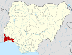
Ipokia
Location in Nigeria
Coordinates: 6°32′N2°51′E / 6.533°N 2.850°E / 6.533; 2.850
CountryFlag of Nigeria.svg  Nigeria
State Ogun State
Government
  Local Government ChairmanWale Agbetokun (APC)
Area
  Total629 km2 (243 sq mi)
Population
 (2006 census)
  Total150,426
Time zone UTC+1 (WAT)
3-digit postal code prefix
111
ISO 3166 code NG.OG.IP
Ipokia

Ipokia is the metropolitan headquarters of Anago kingdom. It is an ancient kingdom in old Oyo empire. Unlike the other kingdoms, which had at one time or the other engaged in the internecine wars that ravaged Yorubaland in the nineteenth century, Ipokia stood out as an unconquered sanctuary city-state throughout the period. The year it was founded was not known but can be traced to 13th to 14th century when some prince and princess of Oramiyan, the 6th Ooni of ife and founder of Oyo and Benni kingdom migrate from Oyo ile and settled in Ajase ipo in present-day kwara state due to a little misunderstanding among the prince, then move downward toward west,Lagos with the ancient crown gotten from their forefathers, Oduduwa. settled briefly in Lagos shores, Isale Eko before coming to Badagry axis and finally settled down and formed a small town named Ipokia meaning (Opo ko ara e sile, I.e Opo rejected its people) with the help and guidance of Ifa Oracle. Ipokia came to be a Local Government in 1996 carved from formally known as"Egbado south local government"but now "Yewa South local government in the west of Ogun State, Nigeria bordering the Republic of Benin. Its Capital is in Ipokia town. It is an exit route from Nigeria to outside world through road and water. It is also regarded as main gate to the gateway state due to its proximity and the boundary between Nigeria and Bennie republic. There are other towns like Idiroko, Oniro, Ita Egbe,Hunbo, Agosasa, Aseko, Maun, Koko, Ropo, Alaari, Tube, Ilashe, Ifonyintedo, Madoga, Idosemo, Ijofin and Tongeji Island in the town of Ipokia at 6°32′00″N2°51′00″E / 6.53333°N 2.85000°E / 6.53333; 2.85000 .

Contents

It has an area of 629 km2 and a population of 150,426 at the 2006 census. It the capital of Ipokia Local Government. The current traditional ruler (King) is Oba Yisa 'Sola Adeniyi Adelakun Olaniyan(JP), The 46th Onipokia of Ipokia kingdom. First class Obas who are in the same category with Alake of Egbas, Awujale of Ijebus, and some other few first class Obas in Ogun State.

Minerals/Natural resources

Ipokia town has large deposits of Kaolin and Red clay. The vast fertile land is available for Agriculture. It is equally rich in soft sand used in the construction industry. Large and commercial deposit of crude oil was discovered in Tongeji Island (a town under Ipokia) by the Federal government of Nigeria.The drilling will take effect soonest by the government and this will provide more revenue for the country and job creation for the beneficial of the indigene .Establishment of oil refinery will soon take effect.

Tourism

A mega tourist city and sea institute was being developed at Whekan Island by the team of Queens Atlantic Resorts Inc., of Las Vegas, Nevada U.S.A. there is room for Boat Regatta, Canoeing and fishing along the Badagry creek. Although the project has since stop due to issue not known. Tongeji Island is a holiday haven with its impressive water front and breathtaking scenery, the island is a beauty to behold. Onigbaale Forest is equally a major tourist attraction. It was reported that the 1st Onigbaale of Ipokia precisely disappeared there and has since not been seen.

Famous foods

Ipokia cuisine is rich with numerous delicacies original to the Town. Listed below are some of the foods peculiar to the towns and their recipe;

meat, oil, salt.

pepper

Pepper

and Pepper

Languages

The main languages of Ipokia is Anago and Gun.

Other languages include; Eyo and English language which is Nigeria official language.

Postal information

The postal code of the area is 111. [1]

Notable Towns and villages in Ipokia

Related Research Articles

<span class="mw-page-title-main">Lagos State</span> State in Nigeria

Lagos State is a state in southwestern Nigeria. Of the 36 states, it is both the most populous and smallest in area. Bounded to the south by the Bight of Benin and to the west by the international border with Benin, Lagos State borders Ogun State to the northeast making it the only Nigerian state to border only one other state. Named for the city of Lagos—the most populous city in Africa—the state was formed from the Western Region and the former Federal Capital Territory on 27 May 1967.

<span class="mw-page-title-main">Yorubaland</span> Cultural region of the Yoruba people in West Africa

Yorubaland is the homeland and cultural region of the Yoruba people in West Africa. It spans the modern-day countries of Nigeria, Togo and Benin, and covers a total land area of 142,114 km2 or about 60% of the land area of Ghana. Of this land area, 106,016 km2 (74.6%) lies within Nigeria, 18.9% in Benin, and the remaining 6.5% is in Togo. Prior to European colonization, a portion of this area was known as Yoruba country. The geo-cultural space contains an estimated 55 million people, the majority of this population being ethnic Yoruba.

<span class="mw-page-title-main">Oyo State</span> State of Nigeria

Oyo State is an inland state in southwestern Nigeria. Its capital is Ibadan, the third most populous city in the country and formerly the second most populous city in Africa. Oyo State is bordered to the north by Kwara State, to the east by Osun State, and to the southwest by Ogun State and the Republic of Benin. With a projected population of 7,840,864 in 2016, Oyo State is the fifth most populous in the Nigeria.

The Ẹgbado, now Yewa, are a subgroup of the Yoruba people and inhabit the eastern area of Ogun West Senatorial District, Ogun State, in south-west Nigeria, Africa. In 1995 they changed their name to the Yewa which comes from the Yewa River which in turn comes from the Yoruba goddess Yewa. Your clan now comprises 4 local Governments Yewa South, Yewa North, Imeko-Afon, and Ipokia, while the Ado-Odo/Ota LGA forms the 5th Awori part of the senatorial district.

<span class="mw-page-title-main">Ghanaian cuisine</span> Overview of culinary traditions of Ghana

Ghanaian cuisines refer to the meals of the Ghanaian people. The main dishes of Ghana are organized around starchy staple foods, which goes with either sauce or soup accompanied with a source of protein. The main ingredients for the vast majority of soups and stews are; tomatoes, hot peppers and onions. Most Ghanaian soups and stews are red or orange in appearance as a result of the main ingredients used.

Shaki is a city-town situated in the northern part of Oyo State in western Nigeria.

<span class="mw-page-title-main">Awori tribe</span> Tribe of the Yoruba people

The Awori is a subgroup of the Yoruba people speaking a dialect of the Yoruba language.The Awori people are the original inhabitants of Lagos State and some parts of Ogun State, namely Ado-Odo/Ota Local Government Area of Ogun State. The Awori people are landowners, farmers and fishermen.

<span class="mw-page-title-main">Nigerian cuisine</span> Culinary traditions of Nigeria

Nigerian cuisine consists of dishes or food items from the hundreds of Native African ethnic groups that comprise Nigeria. Like other West African cuisines, it uses spices and herbs with palm or groundnut oil to create deeply flavored sauces and soups.

<span class="mw-page-title-main">Iga Idunganran</span> Official Residence of the Oba of Lagos

Iga Idunganran is the Official Residence of the Oba of Lagos, situated on Lagos Island. It is also a tourist attraction.

Sepeteri is the biggest town in the Saki East Local Government Area of Oke-Ogun Oyo State, Nigeria. The Yoruba people of Sepeteri are related with fon of dahomey and Ifon in Osun State their crownship is Obatala, Obalufon lineage under Oyo Empire. Sepeteri is located between Igboho, Ago-amodu and Oje Owode to Shaki, Ago-Are and Iseyin.

Apa local government area was first created on 23 March 1981. It became defunct on 31 December 1983, and was later re-created in August, 1991. The local government is located in the northwestern part of Makurdi, the capital of Benue State. It is bounded to the North by Agatu local government, to the East by Gwer West, to the South by Otukpo and to West by Omala local government area of Kogi State.

<span class="mw-page-title-main">Ilaje</span> LGA and Sub-ethnic group in Ondo State, Nigeria

Ìlàje is a Local Government Area in Ondo State, South-West Nigeria. Its headquarters are in the town of Igbokoda. The Ilajes are a distinct migratory coastal linguistic group of Yoruba peoples spread along the coastal belts of Ondo, Ogun, Lagos and Delta states and originally made up of four geo-political entities, namely: Ode Ugbo, Ode Mahin, Ode Etikan and Aheri. While most towns and villages in the Mahin kingdom are distributed on arable lands, the towns and villages in the other three geo-politics of Ugbo, Aheri and Etikan kingdoms are spread out along the beaches and swampy terrains of the Atlantic Ocean coast.

Egbe Mekun, popularly called Egbe, is a historic town located in the Yagba West local government area of Kogi State, Nigeria, West Africa.

<span class="mw-page-title-main">Ogu people</span> Ethnic group in Nigeria

The Gun people, also rendered Ogũ, Ogun and Egun, is an ethnic group located majorly in Lagos and Ogun State in southwestern Nigeria, and Ouémé Department in the southeast of the Republic of Benin, who speak the Gun language. The Ogu account for about 15% of the indigenous population of Lagos State and 6% of the total population of the Republic of Benin.

Idiroko is a town in Ipokia local government of Ogun State, Nigeria. It is situated along the Nigeria-Benin border and has been an official border crossing point since at least the 1960s. The town is surrounded by many other towns and villages including Oniro, Oke Odan, Ilase, Ita Egbe, Ajilete amongst others.

The Òǹkò, otherwise known as Òkè Ògùn people, are a Yoruba people group inhabiting the areas drained by the upper Ogun river in Northwestern Oyo state in Nigeria. They were historically a part of the once expansive Oyo empire, but are distinct from the Oyo proper.

<span class="mw-page-title-main">Kosoko</span> Oba of Lagos

Kosoko was a member of the Ologun Kutere Lagos Royal Family who reigned as Oba of Lagos from 1845 to 1851. His father was Oba Osinlokun and his siblings were Idewu Ojulari, Olufunmi, Odunsi, Ladega, Ogunbambi, Akinsanya, Ogunjobi, Akimosa, Ibiyemi, Adebajo, Matimoju, Adeniyi, Isiyemi, Igbalu, Oresanya, and Idewu-Ojulari.

The Eletu Odibo of Lagos is the traditional nobleman that has historically served as the principal kingmaker of the Oba of Lagos. As head of the Akarigbere class of chiefs, the Eletu Odibo also serves as the prime minister of the Oba.

Ita Egbe is a village located in Ipokia Local Government Area of Ogun State with the population of 1776 as of 1963 according to the Nigeria Population Census, it is noted for its extensive agricultural activities around the area and by being one of the largest palm oil producers in Ipokia Local Government of Ogun state.

<span class="mw-page-title-main">Ilara-Ogudo Yewa</span> Town in Ogun State, Nigeria

Ilara Yewa is a Nigerian town in the west of Ogun State, Nigeria about 91 kilometers northwest of Abeokuta. It lies on the border between Nigeria and Benin. Its elevation is 600 feet above sea level. Ilara Yewa is about 50 kilometres by road from Ketu, a major trading town in Benin. The second-largest settlement, Ilara, merges into Ilara.

References

  1. "Post Offices- with map of LGA". NIPOST. Archived from the original on 2009-10-07. Retrieved 2009-10-20.