Sagamu

Last updated

Sagamu
Orisagamu
LGA
Sunset in developing Araromi in Sagamu Ogun State.jpg
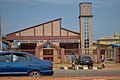
Araromi neighbourhood
Nigeria location map.svg
Red pog.svg
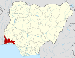
Sagamu
Location in Nigeria
Coordinates: 6°50′N3°39′E / 6.833°N 3.650°E / 6.833; 3.650
CountryFlag of Nigeria.svg  Nigeria
State Ogun State
LGA(s) Sagamu
Government
  Local Government ChairmanOdulate Olashile (APC)
Area
  Total614 km2 (237 sq mi)
Population
 (2006 census)
  Total253,412
Time zone UTC+1 (WAT)
3-digit postal code prefix
121 [1]
ISO 3166 code NG.OG.SH
National language Yorùbá
Sagamu
Roads and Vehicles in Sagamu Roads and Vehicles in Sagamu.jpg
Roads and Vehicles in Sagamu
Remo
Total population
~ 1,132,270 (2011)
Regions with significant populations
Ogun State - 512,750
 ·Remo North: 70,470
 ·Ikenne: 140,490
 ·Shagamu: 301,790 Lagos State - 619,520
 ·Ikorodu: 619,520
Religion
Christianity  · Islam  · Yoruba religion
Sagamu Road Transportation in Sagamu, Nigeria.jpg
Sagamu

Sagamu or Ishagamu is an agglomeration of thirteen towns in southwestern Nigeria. It is located in Ogun State along the Ibu River and Eruwuru Stream between Lagos and Ibadan. It was founded in the mid 19th century by members of the Remo branch of the Yoruba people. [2] The 13 towns are: Makun, Offin, Sonyindo, Epe, Ibido, Igbepa, Ado, Oko, Ipoji, Batoro, Ijoku, Ijagba and Latawa. [3] [4] It is the capital of Remo Kingdom, and the paramount ruler of the kingdom, the Akarigbo of Remo, has his palace is in the town of Offin.

Contents

The Sagamu region is underlain by major deposits of limestone, which is used in the city's major industry, the production of cement. Agricultural products of the region include cocoa and kola nuts. Sagamu is the largest kola nut collecting center in the country. The kola nut industry supports several secondary industries such as basket and rope manufacturing, which are used to store the kola nuts.

The city was founded in the mid-19th century when several small towns united for purpose of defense during the wars brought about by the fall of the Oyo Empire. Sagamu controlled the trade routes between the ports in the Niger Delta and the Yoruba mainland until the British occupied the city at the end of the 19th century. Sagamu has experienced both population and economic growth since the 1950s, due to its position between the cities of Ibadan and Lagos. The population in 1995 was 114,300 but 2007 estimates placed it as high as 228,382. The Olabisi Onabanjo University's college of medicine is located in Sagamu. [5]

Sagamu (Offin - Ile) is the new seat of the Akarigbo of Remo ("King" or "Lord" of Remo), the traditional ruler of the Remo Kingdom. The former seat was located in a farther area of Offin. Four ruling families are eligible to wear the beaded crown of the Akarigbo, all descending from the first Oba, Akarigbo, a prince of the house of Oduduwa. The current Akarigbo was installed and crowned as King in 2017. Notable areas within Sagamu include Offin, Itunshokun, Sabo, Makun, Ajaka, Makun Station, Isale-oko, Isote, Epe, Soyindo, Surulere, Ijagba, Ewu-Oluwo, Ogijo, Simawa, GRA, Ijokun, Batoro. Ijebu language, a dialect of the Yoruba language, is spoken in Sagamu.

Administration

The old Sagamu Local Government has been divided into Three(3) Local Council Development Areas namely Sagamu West LCDA, Sagamu Central LCDA and Sagamu South LCDA.

For Administrative convenience, Sagamu Local Government is divided into (15) Fifteen Political Wards, namely.

  1. Ward 1 – Oko, Epe & Itunla 1
  2. Ward 2 – Oko, Epe Itunla II
  3. Ward 3 – AiyegbamijIjoku
  4. Ward 4 – Sabo 1
  5. Ward 5 – Sabo II
  6. Ward 6 – Itunsokun Oyebajo
  7. Ward 7 – Ijagba
  8. Ward 8 – Latawa
  9. Ward 9 – Ode-lemo
  10. Ward 10 – OgijojIkosi
  11. Ward 11 – Surulere
  12. Ward 12 – Isote
  13. Ward 13 – Simawa
  14. Ward 14 – Agbowa
  15. Ward 15 – Ibidojitun Alara

Notable people

Wikivoyage-Logo-v3-icon.svg Sagamu travel guide from Wikivoyage

Related Research Articles

<span class="mw-page-title-main">Ibadan</span> Capital city of Oyo State, Nigeria

Ibadan is the capital and most populated city of Oyo State, in Nigeria. It is the third-largest city by population in Nigeria after Lagos and Kano, with a total population of 3,649,000 as of 2021, and over 6 million people within its metropolitan area. It is the country's largest city by geographical area. At the time of Nigeria's independence in 1960, Ibadan was the largest and most populated city in the country, and the second most populous in Africa behind Cairo. Ibadan is ranked the second fastest growing city on the African continent according to the UN Human settlements research program (2022). It is also ranked third in West Africa in the tech startups index. Ibadan joined the UNESCO Global Network of Learning Cities in 2016.

<span class="mw-page-title-main">Ijebu Ode</span> Place in Ogun, Nigeria

Ijebu-Ode is a town in Ogun State, South Western geopolitical zone in Nigeria, close to the A121 highway. The city is located 110 km by road Northeast of Lagos; it is within 100 km (62 mi) of the Atlantic Ocean in the eastern part of Ogun State and possesses a warm tropical climate.

<span class="mw-page-title-main">Yorubaland</span> Cultural region of the Yoruba people in West Africa

Yorubaland is the homeland and cultural region of the Yoruba people in West Africa. It spans the modern-day countries of Nigeria, Togo and Benin, and covers a total land area of 142,114 km2 or about 60% of the land area of Ghana. Of this land area, 106,016 km2 (74.6%) lies within Nigeria, 18.9% in Benin, and the remaining 6.5% is in Togo. Prior to European colonization, a portion of this area was known as Yoruba country. The geo-cultural space contains an estimated 55 million people, the majority of this population being ethnic Yorubas.

<span class="mw-page-title-main">Ogun State</span> State of Nigeria

Ogun State is a state in southwestern Nigeria. Created on 3 February 1976 from the former Western State. Ogun State borders Lagos State to the south, Oyo State and Osun State to the north, Ondo State to the east, and the Republic of Benin to the west. Abeokuta is both Ogun State's capital and most populous city; other important cities in the state include Ijebu Ode, the royal capital of the Ijebu Kingdom, and Sagamu, Nigeria's leading kola nut grower. Ogun state is covered predominantly by rain forest and has wooden savanna in the northwest. Ogun State had a total population of 3,751,140 residents as of 2006, making Ogun State the 16th most populated state in Nigeria In terms of landmass, Ogun State is the 24th largest State in Nigeria with land area of 16,762 kilometer square.

<span class="mw-page-title-main">Gbenga Daniel</span> Nigerian politician (born 1956)

Gbenga Daniel is a Nigerian politician who served as Senator for Ogun East since 2023. He previously served as governor of Ogun State from 2003 to 2011.

<span class="mw-page-title-main">Local government areas of Nigeria</span> Third-level administrative division of Nigeria

Nigeria has 774 local government areas (LGAs), each administered by a local government council consisting of a chairman, who is the chief executive, and other elected members, who are referred to as councillors. Each LGA is further subdivided into a minimum of ten and a maximum of twenty wards. A ward is administered to by a councillor, who reports directly to the LGA chairman. The councillors fall under the legislative arm of the local government, the third tier of government in Nigeria, below the state governments and the federal government.

<span class="mw-page-title-main">Epe, Lagos State</span> LGA and town in Lagos State, Nigeria

Epe is a town and Local Government Area (LGA) in Lagos State, Nigeria located on the north side of the Lekki Lagoon and about 90 km from Ibadan. During the 2006 Census, the population of Epe was approximately 181,409.

<span class="mw-page-title-main">Akarigbo of Remo</span> Royal title of the King of Remo

The Akarigbo of Remoland is the royal title of the paramount ruler of the thirty three (33) towns that makes up the Remo kingdom in Ogun state in Nigeria The capital of the kingdom is Sagamu or Shagamu also known as Ishagamu and it is made up of thirteen (13) of the thirty three towns that make up the Remo Kingdom. The thirteen towns that makes up Sagamu that congregated there in 1872 for greater security are : Offin, Makun, Sonyindo, Epe, Ibido, Igbepa, Ado, Oko, Ipoji, Batoro, Ijoku, Latawa and Ijagba. The other twenty (20) are: Ipara, Ikenne, Ogere, Okun-owa, Ilisan, Ibese, Ode Remo, Ilara, Isara, Irolu, Akaka, Ikorodu, Odogbolu, Emuren, Imota, Ijede, Gbogbo, Ikosi, and Ijesa-Ijebu.

<span class="mw-page-title-main">Abeokuta</span> Capital city of Ogun State, Nigeria

Abeokuta is the capital city of Ogun State in southwest Nigeria. It is situated on the east bank of the Ogun River, near a group of rocky outcrops in a wooded savanna; 77 kilometres (48 mi) north of Lagos by railway, or 130 kilometres (81 mi) by water. As of 2006, Abeokuta and the surrounding area had a population of 449,088.

Isara-Remo is an ancient town in the present-day Remo North Local Government Area in Ogun State in Nigeria. It is the headquarters of the Remo North LGA local government area (LGA). It has an area of 199 km2 and a population of 59,911 at the 2006 census. It is the 6th largest town in Ogun state following Abeokuta, Ijebu Ode, ijebu Igbo, Sagamu and Ago Iwoye. Isara-Remo is almost exactly halfway between Lagos and Ibadan, very large metropolitan cities that have strongly influenced the history of Nigeria. Isara also is a very agricultural city having large fields very fertile for agriculture as well as having large deposits of Muscovite, high quality clay, granite, quarry, and sand.

Iperu or Iperu Akesan Bale Oja is a town near the Ibu River in Ogun State in the southwestern region of Nigeria. It is the most populous town in the Remo Region of the Ikenne Local Government Area. The entire LGA has an area of 137.13 km² and a population of 178,412 at the 2006 census.

<span class="mw-page-title-main">Ogere Remo</span> LGA and Town in Ogun State, Nigeria

Ogere, is an ancient town in the present Remo Division of Ogun State, Nigeria. The town was founded circa 1401 A.D. Ogere is part of the Ikenne Local Government Area of Ogun State.

Imota is a district in Ikorodu, Lagos State. Their leaders are called Oba Ranodu of Imota. They are Ijebu-speaking people.

HRM Oba William Christopher Adedoyin was a Nigerian Traditional ruler who held the title of Akarigbo of Remo Kingdom from 1916 to 1952.

William Frederick Mellor was an English missionary who spent considerable time of his missionary endeavour in Ijebu-Remo. He embraced some of the culture of Remo and ended up being conferred a chieftaincy title by the Akarigbo. Upon his retirement, he left Nigeria in 1957 but returned in 1966 to work with Tai Solarin at Mayflower School, Ikenne.

Mobolanle Ebunoluwa Sotunsa, also known as Bola Sotunsa is a Nigerian academic. She is a Professor of Gender Studies and African Oral Literatures in the Department of Languages and Literary Studies, Babcock University.https://www.babcock.edu.ng/faculty/Sotunsam

<span class="mw-page-title-main">Babatunde Adewale Ajayi</span> Nigerian king

Babatunde Adéwálé Àjàyí is a Nigeria monarch. He is the 19th and current Akarigbo of Remoland, a confederation of towns that neighbor the Ijebu Kingdom in Ogun State.

<span class="mw-page-title-main">Segun Okeowo</span> Nigerian educationist (1948-2014)

Segun Okeowo was a Nigerian educationist who is best known for being the president of the National Union of Nigerian Students at the forefront of the Ali Must Go protests.

References

  1. "Post Offices- with map of LGA". NIPOST. Archived from the original on 2012-11-26. Retrieved 2009-10-20.
  2. "Shagamu | Nigeria". Encyclopedia Britannica. Retrieved 2019-10-15.
  3. "Shagamu time now. Local current time and time zone in Shagamu / Ogun / Nigeria - Current-Time.World". current-time.world. Retrieved 2020-05-25.
  4. "Remo Town in Ogun Nigeria Guide". www.nigeriagalleria.com. Retrieved 2020-05-25.
  5. "The World Gazetteer". Archived from the original on 2013-02-10. Retrieved 2007-04-06.