Kandal Stueng District is a district (srok) of Kandal Province, Cambodia. The district is subdivided into 23 communes (khum) and 154 villages (phum).

Mukh Kampul District is a district (srok) of Kandal Province, Cambodia. The district is subdivided into 9 communes (khum) such as Bak Khaeng, Kaoh Dach, Preaek Anhchanh, Preaek Dambang ,Roka Kaong Muoy,Roka Kaong Pir, Ruessei Chrouy, Sambuor Meas, Svay Ampear and 47 villages (phum).

Angk Snuol District is a district (srok) of Kandal Province, Cambodia. The district is subdivided into 16 communes (khum) such as Baek Chan, Boeng Thum, Chhak Chheu Neang , Damnak Ampil, Kamboul, Kantaok, Krang Mkak, Lumhach ,Mkak, Ovlaok, Peuk,Ponsang, Prey Puok, Samraong Leu ,Snao, Tuol Prech and 307 villages (phum).

Batheay District is a district (srok) of Kampong Cham Province, Cambodia. The district capital is Ph'av town. The town is located on National Highway 6 around 64 kilometres east of the provincial capital at Kampong Cham city and 60 kilometres north of the Cambodian capital Phnom Penh. The district lies at the junction between two major waterways, the Mekong River and the Tonle Sap.

Chbar Mon District is a district located in Kompong Speu Province in central Cambodia. The provincial capital Chbar Mon city is located within the district.

Aoral District is a district located in Kampong Speu Province in central Cambodia. It includes Phnom Aural, the highest peak in Cambodia.

Samraong Tong District is a district located in Kampong Speu Province in central Cambodia.

Thpong District is a district (srok) located in Kampong Speu Province in central Cambodia.

Sameakki Mean Chey District is a district (srok) in the south of Kampong Chhnang Province, in central Cambodia. The district capital is Sameakki Mean Chey town located on the rail line some 52 kilometres south of the provincial capital of Kampong Chhnang by road. The district shares a border with Kandal and Kampong Speu provinces to the south. The National Railway line from Phnom Penh to Sisophon runs through the district crossing roughly from north to south.

Kampong Svay is a district within Kampong Thom Province, in central Cambodia. According to the 1998 census of Cambodia, it had a population of 74,843.

Stoung is a district within Kampong Thom Province, in central Cambodia. According to the 1998 census of Cambodia, it had a population of 94,119.

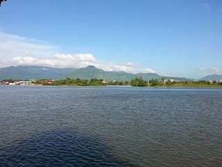
Krong Kampot is a district located in Kampot Province, in southern Cambodia.

Choam Khsant District is a district located in Preah Vihear Province, in northern Cambodia. The district capital is at Cheom Ksan town, near the Thai border. Cambodia's famous Preah Vihear Temple is located in this district of the Preah Vihear province. According to the 1998 census of Cambodia, it had a population of 16,073.

Rovieng District is a district located in Preah Vihear Province, in northern Cambodia. According to the 1998 census of Cambodia, it had a population of 26,552.

Prey Kabbas District is a district located in Takéo Province, in southern Cambodia. According to the 1998 census of Cambodia, it had a population of 85,880.
Samraŏng District is a district located in Takéo Province, in southern Cambodia. According to the 1998 census of Cambodia, it had a population of 101,455.

Tram Kak District is a district located in Takéo Province, in southern Cambodia. According to the 1998 census of Cambodia, it had a population of 144,032.

Treang District is a district located in Takéo Province, in southern Cambodia. According to the 1998 census of Cambodia, it had a population of 98,386.

Angkor Chum District is a district of Siem Reap Province, in north western Cambodia. According to the 1998 census of Cambodia, it had a population of 48,476.

Phnom Sruoch District is a district located in Kampong Speu Province in central Cambodia.


