Rovieng District

Last updated
Rovieng
រវៀង
រវៀង
District ( srok )
Nickname(s): រវៀង
Cambodia adm location map.svg
Red pog.svg
Rovieng
Location in Cambodia
Coordinates: 13°30′N104°50′E / 13.500°N 104.833°E / 13.500; 104.833
CountryFlag of Cambodia.svg  Cambodia
Province Preah Vihear
Time zone +7
Geocode 1305

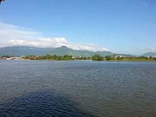
Rovieng District is a district located in Preah Vihear Province, in northern Cambodia. According to the 1998 census of Cambodia, it had a population of 26,552. [1]

Preah Vihear Province Province in Cambodia

Preah Vihear is a province (khaet) of Cambodia. It borders the provinces of Oddar Meanchey and Siem Reap to the west, Kampong Thom to the south and Stung Treng to the east. Its northern boundary forms part of Cambodia's international border with Thailand and Laos. Its capital is Preah Vihear.

Cambodia Southeast Asian sovereign state

Cambodia, officially the Kingdom of Cambodia, is a country located in the southern portion of the Indochina peninsula in Southeast Asia. It is 181,035 square kilometres in area, bordered by Thailand to the northwest, Laos to the northeast, Vietnam to the east and the Gulf of Thailand to the southwest. The sovereign state of Cambodia has a population of over 16 million. The official religion is Theravada Buddhism, practised by approximately 95 percent of the population. The country's minority groups include Vietnamese, Chinese, Chams and 30 hill tribes. The capital and largest city is Phnom Penh, the political, economic and cultural centre of Cambodia. The kingdom is an elective constitutional monarchy with a monarch, currently Norodom Sihamoni, chosen by the Royal Throne Council as head of state. The head of government is the Prime Minister, currently Hun Sen, the longest serving non-royal leader in Southeast Asia, ruling Cambodia since 1985. In 802 AD, Jayavarman II declared himself king, uniting the warring Khmer princes of Chenla under the name "Kambuja". This marked the beginning of the Khmer Empire, which flourished for over 600 years, allowing successive kings to control and exert influence over much of Southeast Asia and accumulate immense power and wealth. The Indianised kingdom facilitated the spread of first Hinduism and then Buddhism to much of Southeast Asia and undertook many religious infrastructural projects throughout the region, including the construction of more than 1,000 temples and monuments in Angkor alone. Angkor Wat is the most famous of these structures and is designated as a World Heritage Site. After the fall of Angkor to Ayutthaya in the 15th century, a reduced and weakened Cambodia was then ruled as a vassal state by its neighbours. In 1863, Cambodia became a protectorate of France, which doubled the size of the country by reclaiming the north and west from Thailand.

Related Research Articles

Kandal Stueng District District in Kandal Province, Cambodia

Kandal Stueng District is a district (srok) of Kandal Province, Cambodia. The district is subdivided into 23 communes (khum) and 154 villages (phum).

Krakor District District in Pursat, Cambodia

Krakor District is a district in Pursat Province, Cambodia. The district capital is Krakor town located 25 kilometres east of the provincial capital, Pursat town.

Chbar Mon Municipality Municipality in Kompong Speu, Cambodia

Chbar Mon District is a district located in Kompong Speu Province in central Cambodia. The provincial capital Chbar Mon city is located within the district.

Aoral District District in Kampong Speu, Cambodia

Aoral District is a district located in Kampong Speu Province in central Cambodia. It includes Phnom Aural, the highest peak in Cambodia.

Oudong District District in Kampong Speu, Cambodia

Odongk District is a district located in Kampong Speu Province in central Cambodia.

Kampong Svay District District in Kampong Thom, Cambodia

Kampong Svay is a district within Kampong Thom Province, in central Cambodia. According to the 1998 census of Cambodia, it had a population of 74,843.

Santuk District District in Kampong Thom, Cambodia

Santuk is a district within Kampong Thom Province, in central Cambodia. According to the 1998 census of Cambodia, it had a population of 58,434. Santuk Silk Farm and Phnom Santuk lie in the district.

Stoung District District in Kampong Thom, Cambodia

Stoung is a district within Kampong Thom Province, in central Cambodia. According to the 1998 census of Cambodia, it had a population of 94,119.

Tuek Chhou District District in Kampot, Cambodia

Tuek Chhou District is a district located in Kampot Province, in southern Cambodia. It surrounds Krong Kampot District, which contains the urban area of Kampot City.

Kampot Municipality Municipality in Kampot, Cambodia

Krong Kampot is a district located in Kampot Province, in southern Cambodia.

Choam Khsant District District in Preah Vihear, Cambodia

Choam Khsant District is a district located in Preah Vihear Province, in northern Cambodia. The district capital is at Cheom Ksan town, near the Thai border. Cambodia's famous Preah Vihear Temple is located in this district of the Preah Vihear province. According to the 1998 census of Cambodia, it had a population of 16,073.

Prey Kabbas District District in Takéo, Cambodia

Prey Kabbas District is a district located in Takéo Province, in southern Cambodia. According to the 1998 census of Cambodia, it had a population of 85,880.

Samraŏng District is a district located in Takéo Province, in southern Cambodia. According to the 1998 census of Cambodia, it had a population of 101,455.

Tram Kak District District in Takéo, Cambodia

Tram Kak District is a district located in Takéo Province, in southern Cambodia. According to the 1998 census of Cambodia, it had a population of 144,032.

Treang District District in Takéo, Cambodia

Treang District is a district located in Takéo Province, in southern Cambodia. According to the 1998 census of Cambodia, it had a population of 98,386.

Angkor Chum District District in Siem Reap, Cambodia

Angkor Chum District is a district of Siem Reap Province, in north western Cambodia. According to the 1998 census of Cambodia, it had a population of 48,476.

Kralanh District District in Siem Reap, Cambodia

Kralanh District is a district located in Siem Reap Province, in north-west Cambodia. According to the 1998 census of Cambodia, it had a population of 56,915.

Siem Reap Municipality Municipality in Siem Reap, Cambodia

Siem Reap District is an administrative district located in Siem Reap Province, in north-west Cambodia. According to the 1998 census of Cambodia, it had a population of 119,528. It surrounds the provincial city of Siem Reap.

Srei Snam District District in Siem Reap, Cambodia

Srei Snam District is a district of Siem Reap Province, in north western Cambodia. According to the 1998 census of Cambodia, it had a population of 26,738.

Pahal is a village in Tbaeng Meanchey District of Preah Vihear Province, Cambodia. According to the 1998 Census of Cambodia, it had a population of 719 persons.

References

  1. "General Population Census of Cambodia 1998, Final Census Results" (PDF). National Institute of Statistics, Ministry of Planning, Cambodia. August 2002. Retrieved 2010-11-25. See page 184.

Coordinates: 13°30′N104°50′E / 13.500°N 104.833°E / 13.500; 104.833

Geographic coordinate system Coordinate system

A geographic coordinate system is a coordinate system that enables every location on Earth to be specified by a set of numbers, letters or symbols. The coordinates are often chosen such that one of the numbers represents a vertical position and two or three of the numbers represent a horizontal position; alternatively, a geographic position may be expressed in a combined three-dimensional Cartesian vector. A common choice of coordinates is latitude, longitude and elevation. To specify a location on a plane requires a map projection.