Tram Kak District

Last updated
Tram Kak
ត្រាំកក់
District ( srok )
Cambodia adm location map.svg
Red pog.svg
Tram Kak
Location in Cambodia
Coordinates: 11°0′N104°35′E / 11.000°N 104.583°E / 11.000; 104.583
CountryFlag of Cambodia.svg  Cambodia
Province Takéo
Communes 6
Villages 34
Time zone +7
Geocode 2109

Tram Kak District is a district located in Takéo Province, in southern Cambodia. According to the 1998 census of Cambodia, it had a population of 144,032. [1]

Takéo Province Province in Cambodia

Takéo is a province (khaet) of Cambodia. Located in the southwest of Cambodia, Takeo borders the provinces of Kampot to the west, Kampong Speu to the northwest and Kandal to the north and east. Its southern boundary is the international border with Vietnam. The provincial capital, recently known as the provincial town Doun Kaev, is a small city with a population of 39,186.

Cambodia Southeast Asian sovereign state

Cambodia, officially the Kingdom of Cambodia, is a country located in the southern portion of the Indochina peninsula in Southeast Asia. It is 181,035 square kilometres in area, bordered by Thailand to the northwest, Laos to the northeast, Vietnam to the east and the Gulf of Thailand to the southwest.

Communes in Tram Kak

Number Commune Name(ឈ្មោះឃុំ) Villages(ភូមិ)
1 Cheang Torng ជាងទង Moeurng Char មឿងចារ, Sandoa សណ្ដោរ, Nor Moa នមោ, Tuol Tbaeng ទួលត្បែង, Srae Kruo ស្រែក្រួ, Ang Baksey អង្គបក្សី, Trapang Kak ត្រពាំងកក់, Ong Krolanh អង្គក្រឡាញ់, Ta Reap តារាប, Ta Teum តាតឹម, Ta Suon តាសួន, Tuol Rokar ទួលរកា, ...(Please help edit)
2 Tram Kak ត្រាំកក់ Please add villages
3 Oudom Soriya ឧត្តមសូរិយា Villages(ភូមិ)
4 Angtasom អង្គតាសោម Please add villages
5 Taphem តាភេម Please add villages
6 Leay Bo លាយបូរ Please add villages
7 Srae Kvav ស្រែខ្វាវ Please add villages
8 Osaray អូរសារាយ Please add villages
9 Trapang Thum Khang Tbong ត្រពាំងធំខាងត្បូង Please add villages
10 Trapang Thum Khang Cherng ត្រពាំងធំខាងជើង Please add villages
11 Nhaeng Nhorng ញ៉ែងញ៉ង Please add villages
12 Srae Nornoang ស្រែននោង Srae thnolស្រែថ្លុក Srae Chheuneangស្រែឈើនៀង,Trapang Thnalត្រពាំងថ្នល់, Trapang Tamlabត្រពាំងទំន្លាប់,Thmeiថ្មី, Samakiសាមគ្គី, Trapang Normoangត្រពាំងននោង, Trachត្រាច, Kok Roviengគោករវៀង, Chrei Vengជ្រៃវែង, Krang Svayក្រាំងស្វាយ, Prochoumប្រជុំ, Prey Moukព្រៃមោក,Takeoតាកែវ, Bravorl Nayប្រវលន័យ and Trapang Sambeumត្រពាំងសំបើម។
13 Kous គូស Please add villages
14 Trapang Kronhoung ត្រពាំងក្រញូង Please add villages
15 PorPel ពពេល Please add villages

Related Research Articles

Kandal Stueng District District in Kandal Province, Cambodia

Kandal Stueng District is a district (srok) of Kandal Province, Cambodia. The district is subdivided into 23 communes (khum) and 154 villages (phum).

Basedth District District in Kampong Speu, Cambodia

Borsedth District is a district (srok) in the south of Kampong Speu Province, in southern Cambodia. The district capital is Borsedth town located some 50 kilometres south of the provincial capital of Kampong Speu by road. The district shares a border with Kampot and Takeo provinces to the south.National Highway 3 forms the eastern district boundary. The district is made up of flat farmland and supports extensive agriculture and a large population.

Chbar Mon Municipality Municipality in Kompong Speu, Cambodia

Chbar Mon District is a district located in Kompong Speu Province in central Cambodia. The provincial capital Chbar Mon city is located within the district.

Aoral District District in Kampong Speu, Cambodia

Aoral District is a district located in Kampong Speu Province in central Cambodia. It includes Phnom Aural, the highest peak in Cambodia.

Oudong District District in Kampong Speu, Cambodia

Odongk District is a district located in Kampong Speu Province in central Cambodia.

Thpong District District in Kampong Speu, Cambodia

Thpong District is a district (srok) located in Kampong Speu Province in central Cambodia.

Baray District District in Kampong Thom, Cambodia

Baray is a district within Kampong Thom Province, in central Cambodia. According to the 1998 census of Cambodia, it had a population of 159,586.

Kampong Svay District District in Kampong Thom, Cambodia

Kampong Svay is a district within Kampong Thom Province, in central Cambodia. According to the 1998 census of Cambodia, it had a population of 74,843.

Stoung District District in Kampong Thom, Cambodia

Stoung is a district within Kampong Thom Province, in central Cambodia. According to the 1998 census of Cambodia, it had a population of 94,119.

Chong Kal District District in Oddar Meanchey, Cambodia

Chong Kal District is a district in Oddar Meancheay province in northern Cambodia. According to the 1998 census of Cambodia, it had a population of 18,843.

Samraong Municipality Municipality in Oddar Meanchey, Cambodia

Samraong District is a district in Oddar Meanchey province in northern Cambodia. It is the urban part of Oddar Meanchey province. The provincial capital Samraong is also located in the district. According to the 1998 census of Cambodia, it had a population of 22,361.

Choam Khsant District District in Preah Vihear, Cambodia

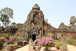
Choam Khsant District is a district located in Preah Vihear Province, in northern Cambodia. The district capital is at Cheom Ksan town, near the Thai border. Cambodia's famous Preah Vihear Temple is located in this district of the Preah Vihear province. According to the 1998 census of Cambodia, it had a population of 16,073.

Rovieng District District in Preah Vihear, Cambodia

Rovieng District is a district located in Preah Vihear Province, in northern Cambodia. According to the 1998 census of Cambodia, it had a population of 26,552.

Prey Kabbas District District in Takéo, Cambodia

Prey Kabbas District is a district located in Takéo Province, in southern Cambodia. According to the 1998 census of Cambodia, it had a population of 85,880.

Samraŏng District is a district located in Takéo Province, in southern Cambodia. According to the 1998 census of Cambodia, it had a population of 101,455.

Treang District District in Takéo, Cambodia

Treang District is a district located in Takéo Province, in southern Cambodia. According to the 1998 census of Cambodia, it had a population of 98,386.

Stung Treng District is a district located in Stung Treng Province, in north-east Cambodia. According to the 1998 census of Cambodia, it had a population of 24,493. The provincial capital Stung Treng town is located within the district.

Angkor Chum District District in Siem Reap, Cambodia

Angkor Chum District is a district of Siem Reap Province, in north western Cambodia. According to the 1998 census of Cambodia, it had a population of 48,476.

Kralanh District District in Siem Reap, Cambodia

Kralanh District is a district located in Siem Reap Province, in north-west Cambodia. According to the 1998 census of Cambodia, it had a population of 56,915.

Srei Snam District District in Siem Reap, Cambodia

Srei Snam District is a district of Siem Reap Province, in north western Cambodia. According to the 1998 census of Cambodia, it had a population of 26,738.

References

  1. "General Population Census of Cambodia 1998, Final Census Results" (PDF). National Institute of Statistics, Ministry of Planning, Cambodia. August 2002. Retrieved 2010-11-25. See page 269.

Coordinates: 11°0′N104°35′E / 11.000°N 104.583°E / 11.000; 104.583

Geographic coordinate system Coordinate system

A geographic coordinate system is a coordinate system that enables every location on Earth to be specified by a set of numbers, letters or symbols. The coordinates are often chosen such that one of the numbers represents a vertical position and two or three of the numbers represent a horizontal position; alternatively, a geographic position may be expressed in a combined three-dimensional Cartesian vector. A common choice of coordinates is latitude, longitude and elevation. To specify a location on a plane requires a map projection.