Oorpally

Last updated

Oorpally
town
Oorpally2.jpg
Oorpally, Koyileri
India Kerala location map.svg
Red pog.svg
Oorpally
Location in Kerala, India
India location map.svg
Red pog.svg
Oorpally
Oorpally (India)
Coordinates: 11°47′15″N76°3′5″E / 11.78750°N 76.05139°E / 11.78750; 76.05139
CountryFlag of India.svg  India
State Kerala
District Wayanad
Languages
  Official Malayalam, English
Time zone UTC+5:30 (IST)
Vehicle registration KL-72
Payyampalli Church Payyampalli church.jpg
Payyampalli Church

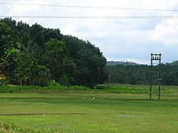
Oorpally is a small village near Koyileri, Mananthavady on the banks of the river Kabini in the Wayanad district of Kerala state, south India. [1]

Contents

Agriculture is the main stay of the economy. Coffee, black pepper and vanilla are the main cash crops.

People

River

Kabni River The Kabini or Kabani is a river of southern India. It originates in Wayanad District of Kerala state, south India from the confluence of the Panamaram River.

Access

View from the Koyileri Bridge Wayanad -views from Koileri Bridge3.jpg
View from the Koyileri Bridge

Nearest Schools

Religious place

Transportation

Oorpally village can be accessed from Mananthavady or Kalpetta. The Periya ghat road connects Mananthavady to Kannur and Thalassery. The Thamarassery mountain road connects Calicut with Kalpetta. The Kuttiady mountain road connects Vatakara with Kalpetta and Mananthavady. The Palchuram mountain road connects Kannur and Iritty with Mananthavady. The road from Nilambur to Ooty is also connected to Wayanad through the village of Meppadi.

The nearest railway station is at Mysore and the nearest airports are Kozhikode International Airport-120 km, Bengaluru International Airport-290 km, and Kannur International Airport, 58 km.

See also

References

  1. "Primary Census Abstract Data Tables – India: Final Population Totals". Office of the Registrar General & Census Commissioner, India. Ministry of Home Affairs, Government of India. 2011. Archived from the original on 11 July 2022. Retrieved 27 April 2025.