Opdyke West, Texas

Last updated
Opdyke West, Texas
TXMap-doton-OpdykeWest.PNG
Location of Opdyke West, Texas
Hockley County OpdykeWest.svg
Coordinates: 33°35′36″N102°17′56″W / 33.59333°N 102.29889°W / 33.59333; -102.29889
Country United States
State Texas
County Hockley
Area
[1]
  Total0.23 sq mi (0.58 km2)
  Land0.23 sq mi (0.58 km2)
  Water0.00 sq mi (0.00 km2)
Elevation
3,471 ft (1,058 m)
Population
 (2010)
  Total174
  Estimate 
(2019) [2]
194
  Density862.22/sq mi (333.35/km2)
Time zone UTC-6 (Central (CST))
  Summer (DST) UTC-5 (CDT)
FIPS code 48-54075 [3]
GNIS feature ID1388575 [4]

Opdyke West (pronounced "Oh-Pee-Dyke") is a town in Hockley County, Texas, United States. The population was 174 at the 2010 census. [5] It takes its name from the nearby community of Opdyke, founded 1925, which was named either for Charles W. Opdyke, railroad director, or for the family of W. A. Dykes, who established the first gin in the area by 1937. Opdyke West was incorporated in 1984. [6] [7] [8] [9]

Contents

Geography

Opdyke West is located in central Hockley County at 33°35′36″N102°17′56″W / 33.59333°N 102.29889°W / 33.59333; -102.29889 (33.593241, –102.298924). [10] Texas State Highway 114 passes through the north side of the town, leading west 4 miles (6 km) to Levelland, the county seat, and east 26 miles (42 km) to Lubbock.

According to the United States Census Bureau, the town has a total area of 2.3 square miles (6 km2), all of it land. [5]

Demographics

Historical population
CensusPop.Note
1990 100
2000 18888.0%
2010 174−7.4%
2019 (est.)194 [2] 11.5%
U.S. Decennial Census [11]

As of the census [3] of 2000, there were 188 people, 74 households, and 46 families residing in the town. The population density was 791.9 inhabitants per square mile (305.8/km2). There were 80 housing units at an average density of 337.0 per square mile (130.1/km2). The racial makeup of the town was 75.53% White, 3.72% Native American, 14.89% from other races, and 5.85% from two or more races. Hispanic or Latino people of any race were 32.98% of the population.

There were 74 households, out of which 44.6% had children under the age of 18 living with them, 48.6% were married couples living together, 13.5% had a female householder with no husband present, and 36.5% were non-families. 23.0% of all households were made up of individuals, and 2.7% had someone living alone who was 65 years of age or older. The average household size was 2.54 and the average family size was 3.11.

In the town, the population was spread out, with 27.7% under the age of 18, 26.1% from 18 to 24, 30.3% from 25 to 44, 13.8% from 45 to 64, and 2.1% who were 65 years of age or older. The median age was 24 years. For every 100 females, there were 106.6 males. For every 100 females age 18 and over, there were 115.9 males.

The median income for a household in the town was $31,667, and the median income for a family was $30,750. Males had a median income of $23,750 versus $17,083 for females. The per capita income for the town was $15,261. About 13.2% of families and 13.6% of the population were below the poverty line, including 22.4% of those under the age of eighteen and none of those 65 or over.

Education

The Town of Opdyke West is served by the Levelland Independent School District.

Related Research Articles

<span class="mw-page-title-main">Lynn County, Texas</span> County in Texas, United States

Lynn County is a county in the U.S. state of Texas. As of the 2020 census, its population was 5,596. Its county seat is Tahoka. The county was created in 1876 and organized in 1903.

<span class="mw-page-title-main">Lubbock County, Texas</span> County in Texas, United States

Lubbock County is a county located in the U.S. state of Texas. The 2020 census placed the population at 310,639. Its county seat and largest city is Lubbock. The county was created in 1876 and organized in 1891. It is named for Thomas Saltus Lubbock, a Confederate colonel and Texas Ranger.

<span class="mw-page-title-main">Hockley County, Texas</span> County in Texas, United States

Hockley County is a county located in the U.S. state of Texas. As of the 2020 census, its population was 21,537. Its county seat is Levelland. The county was created in 1876, but not organized until 1921. It is named for George Washington Hockley, a secretary of war of the Republic of Texas.

<span class="mw-page-title-main">Cochran County, Texas</span> County in Texas, United States

Cochran County is a county located in the U.S. state of Texas. As of the 2020 census, its population was 2,547. The county seat is Morton. The county was created in 1876 and later organized in 1924. It is named for Robert E. Cochran, a defender of the Alamo.

<span class="mw-page-title-main">Stamford, Nebraska</span> Village in Nebraska, United States

Stamford is a village in Harlan County, Nebraska, United States. The population was 183 at the 2010 census.

<span class="mw-page-title-main">North Apollo, Pennsylvania</span> Borough in Pennsylvania, United States

North Apollo is a borough in Armstrong County, Pennsylvania, United States. The population was 1,252 at the 2020 census.

<span class="mw-page-title-main">Colonial Park, Pennsylvania</span> Census-designated place in Pennsylvania, United States

Colonial Park is an unincorporated community and census-designated place (CDP) in Lower Paxton Township, Pennsylvania, United States. The population was 13,229 at the 2010 census. It is part of the Harrisburg–Carlisle Metropolitan Statistical Area. It uses the Harrisburg ZIP code of 17109 and hosts a great deal of the area's retail activity, including the Colonial Park Mall.

<span class="mw-page-title-main">Whiteface, Texas</span> Community in Texas, United States

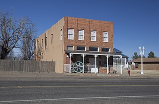
Whiteface is a town in Cochran County, Texas, United States. The population was 449 at the 2010 census.
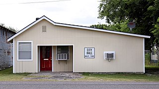
<span class="mw-page-title-main">Anton, Texas</span> City in Texas, United States

Anton is a city in Hockley County, Texas, United States. The population was 1,126 at the 2010 census.

<span class="mw-page-title-main">Levelland, Texas</span> City in Texas, United States

Levelland is a city in Hockley County, Texas, in the United States. As of the 2020 census, the city population was 12,652, down from 13,542 at the 2010 census. It is the county seat of Hockley County. It is located on the Llano Estacado, 30 miles (48 km) west of Lubbock. Major industries include cotton farming and petroleum production. It is the home of South Plains College. Levelland is the principal city of the Levelland micropolitan statistical area, which includes all of Hockley County and part of the larger Lubbock–Levelland combined statistical area. Levelland was so named on account of the flat land at the town site.

<span class="mw-page-title-main">Ropesville, Texas</span> City in Texas, United States

Ropesville is a city in Hockley County, Texas, United States. Its population was 434 at the 2010 census, down from 517 at the 2000 census.

<span class="mw-page-title-main">Smyer, Texas</span> Town in Texas, United States

Smyer is a town in Hockley County, Texas, United States. The nickname it is known for is "The Pit Stop Town" since the town is between two big city areas. The population was 474 at the 2010 census. in 2023, the population declined to 433.

<span class="mw-page-title-main">Sundown, Texas</span> City in Texas, United States

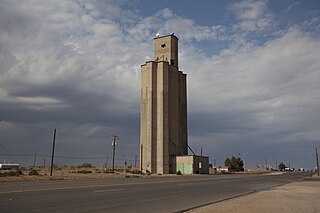
Sundown is a small town in Hockley County, Texas, United States. The community school district is Sundown ISD. The population was 1,397 at the 2010 census, a decrease from 1,505 at the 2000 census.

<span class="mw-page-title-main">Reese Center, Texas</span> Former CDP in Texas, United States

Reese Center is an unincorporated community and former census-designated place (CDP) in Lubbock County, Texas, United States. The population was 42 at the 2000 census. Its population was not recorded separately for the 2010 census. It is part of the Lubbock Metropolitan Statistical Area.
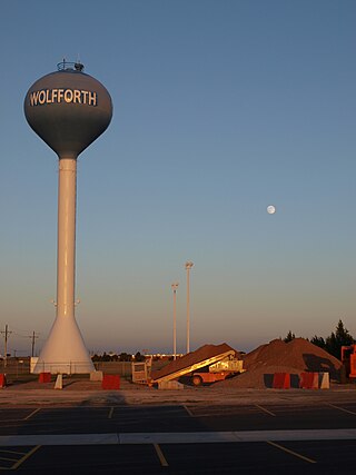
<span class="mw-page-title-main">Wolfforth, Texas</span> City in Texas, United States

Wolfforth is a small town located in Lubbock County. The town was named for 2 brothers, George Wolffarth who was a rancher in the area, and Eastin Wolffarth who was Lubbock County Sherriff around 1900. The population was 3,670 at the 2010 census.

<span class="mw-page-title-main">Stratford, Texas</span> Town in Texas, United States

Stratford is a town in Sherman County, Texas, United States. The population was 2,017 at the 2010 census, up from 1,991 in 2000. It is the county seat of Sherman County.

<span class="mw-page-title-main">Plains, Texas</span> Town in Texas, United States

Plains is a town and the county seat of Yoakum County of western Texas, United States, particularly the south (inner) half of the panhandle's plains. The city's population was 1,481 at the 2010 census. Plains in the Texas High Plains Wine country.

<span class="mw-page-title-main">Bridgewater, Vermont</span> Town in Vermont, United States

Bridgewater is a town in Windsor County, Vermont, United States. The population was 903 at the 2020 census. Bridgewater contains the hamlets of Bridgewater Village, Bridgewater Corners, West Bridgewater, and Bridgewater Center.

<span class="mw-page-title-main">Streetman, Texas</span> Town in Freestone and Navarro counties in Texas, United States

Streetman is a town in Freestone and Navarro counties in Texas, United States. As of the 2010 census the population was 247, up from 203 at the 2000 census.

<span class="mw-page-title-main">Lubbock–Levelland combined statistical area</span>

The Lubbock-Plainview-Levelland Combined Statistical Area is made up of five counties in the South Plains region of west Texas. As of March 2020, the Lubbock-Plainview-Levelland CSA consists of the Lubbock Metropolitan Statistical Area, the Plainview Micropolitan Statistical Area, and the Levelland Micropolitan Statistical Area. In the 2010 census, the CSA had a population of 350,013, though a July 1, 2019 estimate placed the population at 381,664. The CSA's principal city is Lubbock.

References

  1. "2019 U.S. Gazetteer Files". United States Census Bureau. Retrieved August 7, 2020.
  2. 1 2 "Population and Housing Unit Estimates". United States Census Bureau. May 24, 2020. Retrieved May 27, 2020.
  3. 1 2 "U.S. Census website". United States Census Bureau . Retrieved 2008-01-31.
  4. "US Board on Geographic Names". United States Geological Survey. 2007-10-25. Retrieved 2008-01-31.
  5. 1 2 "Geographic Identifiers: 2010 Census Summary File 1 (G001): Opdyke West town, Texas". American Factfinder. U.S. Census Bureau. Archived from the original on February 13, 2020. Retrieved March 13, 2018.
  6. Davis, Charles G. "Opdyke West, TX". Handbook of Texas. Texas State Historical Association. Retrieved 1 August 2021.
  7. Davis, Charles G. "Opdyke, TX". Handbook of Texas. Texas State Historical Association. Retrieved 1 August 2021.
  8. "Opdyke West 1388575". Geographical Names Information System. United States Geological Survey, US Dept of the Interior. Retrieved 1 August 2021.
  9. "Opdyke 1364566". Geographical Names Information System. United States Geological Survey, US Dept of the Interior. Retrieved 1 August 2021.
  10. "US Gazetteer files: 2010, 2000, and 1990". United States Census Bureau. 2011-02-12. Retrieved 2011-04-23.
  11. "Census of Population and Housing". Census.gov. Retrieved June 4, 2015.