Related Research Articles

Boone County is a county in the U.S. state of Iowa. As of the 2020 census, the population was 26,715. Its county seat is Boone.

Carroll County is a county located in the U.S. state of Arkansas. As of the 2020 census, the population was 28,260. The county has two county seats, Berryville and Eureka Springs. Carroll County is Arkansas's 26th county, formed on November 1, 1833, and named after Charles Carroll, the last surviving signer of the United States Declaration of Independence.

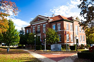
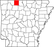
Boone County is a county located in the U.S. state of Arkansas, along the Missouri border. As of the 2020 census, the population was 37,373. The county seat is Harrison. It is Arkansas's 62nd county, formed on April 9, 1869.

U.S. Route 302 is an east–west spur of U.S. Route 2 in northern New England in the United States. It currently runs 171 miles (275 km) from Montpelier, Vermont, beginning at US 2, to Portland, Maine, at U.S. Route 1. It passes through the states of Vermont, New Hampshire and Maine.

The Eleven Point River is a 138-mile-long (222 km) river in southern Missouri and northern Arkansas, United States.
Carrollton is an unincorporated community in Carroll County, Arkansas, United States. Once designated the county seat, it had a population near the 10,000 mark in the 1850s. It has now 30 residents and a historically significant past.
Hopewell is an unincorporated community in Boone County, Arkansas, United States. It lies at an elevation of 1,316 feet.
Bear Creek Springs is an unincorporated community in Boone County, Arkansas, United States. It is the location of Bear Creek Motel, which is located on U.S. 65 and is listed on the National Register of Historic Places.
Self is an unincorporated community in Boone County, Arkansas, United States. It is the location of Cottonwood School No. 45, which is located at Cottonwood and Dubuque Roads and is listed on the National Register of Historic Places.

Eagle Village is an unincorporated community in Eagle Township, Boone County, in the U.S. state of Indiana.
Hughes is a ghost town in Hardin County, in the U.S. state of Iowa.
Cull is an unincorporated community in eastern Howell County, in the U.S. state of Missouri. The community is located on a county road south of U.S. Route 160 and is approximately nine miles east of West Plains, near the eastern border of the county. The community of Rover in Oregon County lies about two miles to the east.
Many Springs is an unincorporated community in Oregon County, in the U.S. state of Missouri.
New Liberty is an extinct town in northeastern Oregon County, in the U.S. state of Missouri. The GNIS classifies it as a populated place.
Riverton is an extinct town in Oregon County, in the U.S. state of Missouri. The GNIS classifies it as a populated place. The site is located on U.S. Route 160 on the west side of the crossing over the Eleven Point River.
Turners Mill is an extinct town in eastern Oregon County, in the U.S. state of Missouri. The GNIS classifies it as a populated place. The mill was adjacent to Turners Spring on the north bank of the Eleven Point River.

Turkey Creek is a stream in the Ozarks of southern Missouri and northern Arkansas. It is a tributary of Lake Taneycomo. The stream source is two-thirds of a mile south of the Missouri - Arkansas border in Boone County north of the village of Crest. The Missouri Pacific Railroad line follows the stream course after exiting the Crest railroad tunnel under Arkansas State Route 14 at Crest. North of the state line in Taney County the stream flows north through west Hollister to its confluence with Lake Taneycomo south of Branson. The stream covers a linear distance of 86 mi (138 km) between the border and its confluence.
Crooked Creek is a stream in Newton, Boone and Marion counties of north Arkansas. It is a tributary of the White River.
Denver is a community in Carroll County in northwest Arkansas, United States. Denver is located on the east bank of Long Creek near the confluence of Dry Creek with Long Creek and approximately one mile west of the Carroll-Boone county line. The community is accessed by county road from Arkansas Highway 396, which passes about 1.5 miles to the north. Farewell is about three miles to the west.
Osage Creek is a stream in Newton, Boone, and Carroll counties of northern Arkansas. It is a tributary of the Kings River.
References
- ↑ U.S. Geological Survey Geographic Names Information System: Oregon (historical)
- ↑ "Boone County". Jim Forte Postal History. Retrieved 6 March 2015.
- ↑ "Towns named after states". Reading Eagle. Jul 2, 1897. p. 3. Retrieved 14 October 2015.
36°18′07″N93°01′16″W / 36.302°N 93.021°W
