Oregon Coast Trail

Last updated
Oregon Coast Trail
OregonCoastTrail.jpg
The Oregon Coast Trail at Floras Lake, looking north to the BLM's New River Area of Critical Environmental Concern (ACEC)
Length425 mi (684 km)
LocationPacific Ocean coast of Oregon, United States
Trailheads Mouth of the Columbia River/California border
UseHiking
Hiking details
Trail difficultyEasy to moderate

The Oregon Coast Trail (OCT) is a long-distance hiking route along the Pacific coast of the U.S. state of Oregon in the United States. It follows the coast of Oregon from the mouth of the Columbia River to the California border south of Brookings. [1]

Contents

The trail was envisioned in 1959 by Samuel N. Dicken, a University of Oregon geography professor, approved in 1971 by the Oregon Recreation Trails Advisory Council and developed and managed by the Oregon Parks and Recreation Department as part of the state park system of Oregon. [1] The official coastal guide gives a length of 382 miles (615 km). About 39 percent of the route is on the beach, 41 percent is on paved road, and 20 percent is on trail and dirt roads. Private ferries can however be arranged at some estuaries to shortcut road segments.

A chief feature of the trail are the public beaches created in 1967 via the Oregon Beach Bill, which formalized the public nature of the coastal beaches since the first such law was passed in 1913. [2] Many of the locations, particularly on the southern portion, are remote and isolated. The Oregon coast is bordered by a temperate rainforest, [3] much of which is now second or third growth.

The difficulty of the trail ranges from easy to moderate, with elevation changes of up to a few hundred feet. [4]

Route

Oregon Coast Trail crossing over a headland in Samuel H. Boardman State Park Coast trail at Boardman SP P4176a.jpeg
Oregon Coast Trail crossing over a headland in Samuel H. Boardman State Park

The northern trailhead is at the base of the south jetty of the Columbia River, approximately 4 miles (6 km) north of the campground of Fort Stevens State Park and about 13 miles (21 km) from the city of Astoria. The trail runs north-south along the entire Oregon Coast, following the shore as closely as practical. For many portions of the route, it is beach walking, mostly on sand. In populated areas it often follows the nearest street to the shore. Many parts of the trail leave the beach and take an inland path, usually where land formations make the shoreline impassable, such as at Cape Kiwanda. Some of the rocky headlands are passable on foot at beach level only at low tide. Other headlands are traversed by state park or forest service trails well above the sea. In many other places, the road is the only feasible route, mostly U.S. Route 101. The southern terminus of the trail is the unmarked Oregon/California border on a stretch of beach about 5 miles (8 km) south of Brookings, and about half a mile south of the Winchuck River.

Besides headlands, there are numerous rivers and creeks which must be crossed. Most creeks are forded by wading, although sometimes the water can be waist deep even at low tide. At high tide, some are hazardous or impossible to cross and require a boat or a detour to a bridge. Rainfall during winter and early spring decreases the number of streams which are safely fordable.

Trail-walking information

A dedicated guidebook for the OCT has not been published. In 2009, the State of Oregon posted a set of downloadable maps with brief route descriptions. Local Oregon hiking guidebooks have good descriptions of portions of the route, particularly for the trail segments. Updated route guides are published on a discussion group. [5] A recently published descriptive trail guide can be accessed in the Links at the bottom of the page. The Oregon Coast Trail is a described route and not a continuous trail. More than 150 miles (240 km) of the route is on pavement. The OCT is signed throughout its length, but in some places signage is not reliable. However it is difficult to become lost since the route is never more than a few miles from a paved road.

The trail is open to hikers, and in some places, to bicycles, and equestrians. As portions of the route lead around headlands or cross river mouths that are only passable at low tide, carrying a current tide table and relevant topographic information can be extremely helpful. Sometimes a hiker must choose between waiting for a lower tide or walking inland to avoid high water.

Seasonal recreation restrictions are in place from March 15 through September 15 in some locations to protect shorebird nesting. These restrictions include complete prohibition of dogs, camping, non-motorized vehicles (including bicycles and fat bikes), motorized vehicles, and kites. Hikers and equestrians must also stay on the wet sand. Shorebird areas are clearly marked on the beach with yellow signs. [6]

Many state campgrounds have areas dedicated for hikers and bicyclists at reduced prices (compared to vehicles). Beach camping is allowed where out of sight of residences, not adjacent to state parks, and not near snowy plover during nesting season. [7] This limits camping on some areas of the trail to developed campgrounds, particularly along the northern beaches. The State of Oregon has stated its intention to create more primitive and free camping areas.

Vehicles are allowed on a few beaches. Dune buggies are used extensively in the Oregon Dunes National Recreation Area, a 40-mile (64 km) stretch of beach from Florence to Coos Bay.

Several portions of the trail are pristine and secluded, such as the segment from Bandon to Port Orford, where several days of relative solitude and free camping exist.

Prevailing winds are from the northwest which makes the trail easier to hike from north to south. Route descriptions are also written assuming a north to south direction of travel.

Cities and towns of various sizes are located along Highway 101 every 20 to 25 miles (32 to 40 km) permitting re-provisioning on a regular basis. Public transportation is extremely limited along the coast.

Points of interest

The sand beach at Oswald West State Park's Smuggler Cove seen from the Oregon Coast Trail Oswald west state park beach from cape falcon P2467.jpeg
The sand beach at Oswald West State Park's Smuggler Cove seen from the Oregon Coast Trail
Headlands visible from Oregon Coast Trail north of Cape Falcon within Oswald West State Park Oregon coast trail north cape falcon P2529.jpeg
Headlands visible from Oregon Coast Trail north of Cape Falcon within Oswald West State Park
Sand dunes in Jessie M. Honeyman Memorial State Park Honeyman Memorial State Park Cleawox Lake.JPG
Sand dunes in Jessie M. Honeyman Memorial State Park
Umpqua River lighthouse Umpqua River lighthouse.jpg
Umpqua River lighthouse
Cape Blanco looking south towards Port Orford Heads State Park, Humbug Mountain in the background, Pinnacle Rock in the frontground. Cape Blanco looking south.JPG
Cape Blanco looking south towards Port Orford Heads State Park, Humbug Mountain in the background, Pinnacle Rock in the frontground.

Places found along the OCT from north to south.

See also

Related Research Articles

Oregon Coast

The Oregon Coast is a coastal region of the U.S. state of Oregon. It is bordered by the Pacific Ocean to its west and the Oregon Coast Range to the east, and stretches approximately 362 miles (583 km) from the California state border in the south to the Columbia River in the north. The region is not a specific geological, environmental, or political entity, and includes the Columbia River Estuary.

Humbug Mountain

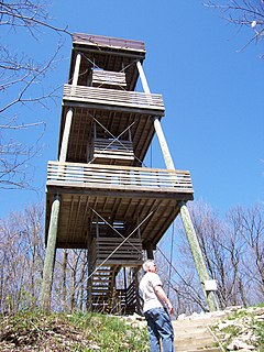
Humbug Mountain is one of the highest mountains in the U.S. state of Oregon to rise directly from the Pacific Ocean. It lies on the state's southern coast, about 6 miles (10 km) south of Port Orford and 21 miles (34 km) north of Gold Beach. The mountain is completely within Humbug Mountain State Park, and U.S. Route 101 passes by its northern base. Its slopes feature an old-growth temperate rainforest. Two trails run from the state park campground to the mountain's summit, one 1.5 miles (2.4 km) long, the other 2 miles (3.2 km) long. Both are part of the much longer Oregon Coast Trail. The area is popular with hikers, campers, cyclists, and whale watchers although biking and camping on the mountain itself are prohibited.

Cape Blanco (Oregon)

Cape Blanco is a prominent headland on the Pacific Ocean coast of southwestern Oregon in the United States, forming the westernmost point in the state. Cape Blanco extends further west than any point of land in the contiguous United States except portions of the Olympic Peninsula in Washington, including Cape Alava, the true westernmost point. The cape is part of Cape Blanco State Park and is the location of the Cape Blanco Light, first lit in 1870.

Cape Meares Headland in Tillamook County, Oregon, U.S.

Cape Meares is a small headland on the Pacific coast in Tillamook County, Oregon, United States. The cape forms a high steep bluff on the south end of Tillamook Bay, approximately five miles (8 km) northwest of the city of Tillamook. Much of the cape is part of the Oregon Parks and Recreation Department-administered Cape Meares State Scenic Viewpoint with three miles of hiking trails, which includes Cape Meares Light and the Octopus Tree. The cape is named after John Meares, a British explorer.

Lewis and Clark National Historical Park

The Lewis and Clark National Historical Park, located in the vicinity of the mouth of the Columbia River, commemorates the Lewis and Clark Expedition. Administration of the park, which includes both federal and state lands, is a cooperative effort of the National Park Service and the states of Oregon and Washington. The National Historical Park was dedicated on November 12, 2004.

Oregon Dunes National Recreation Area

The Oregon Dunes National Recreation Area is located on the Oregon Coast, stretching approximately 40 miles (64 km) north of the Coos River in North Bend to the Siuslaw River in Florence, and adjoining Honeyman State Park on the west. It is part of Siuslaw National Forest and is administered by the United States Forest Service.

Cape Disappointment State Park State park in Washington state, US

Cape Disappointment State Park is a public recreation area on Cape Disappointment, located southwest of Ilwaco, Washington, on the bottom end of Long Beach Peninsula, the northern headlands where the Columbia River meets the Pacific Ocean. The state park's 2,023 acres (819 ha) encompass a diverse landscape of old-growth forest, freshwater lakes, freshwater and saltwater marshes, and oceanside tidelands. Park sites include Fort Canby, the Lewis and Clark Interpretive Center, North Head Lighthouse, and Cape Disappointment Lighthouse. Cape Disappointment is one of several state parks and sites in Washington and Oregon that are included in Lewis and Clark National Historical Park.

Guadalupe-Nipomo Dunes Dune system in California

Guadalupe-Nipomo Dunes is the largest remaining dune system south of San Francisco and the second largest in the U.S. state of California. It encompasses an 18-mile (29 km) stretch of coastline on the Central Coast of California and extends from southern San Luis Obispo County to northern Santa Barbara County.

Kettle Moraine State Forest

The Kettle Moraine State Forest is a state forest in southeastern Wisconsin. The chief feature of the reserve is the Kettle Moraine, a highly glaciated area. The area contains very hilly terrain and glacial landforms, such as kettles, kames and eskers. The 56,000-acre (23,000 ha) forest is divided into two large and three small units, which are spread across a hundred miles.

Tillamook State Forest

The Tillamook State Forest is a 364,000-acre (1,470 km2) publicly owned forest in the U.S. state of Oregon. Managed by the Oregon Department of Forestry, it is located 40 miles (64 km) west of Portland in the Northern Oregon Coast Range, and spans Washington, Tillamook, Yamhill, and Clatsop counties. The forest receives large amounts of precipitation and is dominated by Douglas-fir trees. Activities include commercial logging, recreation, and other commercial resource extraction activities such as mushroom hunting.

Oswald West State Park

Oswald West State Park is part of the state park system of the U.S. state of Oregon. It is located about 10 miles (16 km) south of the city of Cannon Beach, adjacent to Arch Cape, on the Pacific Ocean. The park covers 2,448 acres (9.91 km2), with many miles of hiking trails both inside the park grounds and linking to other parks and landmarks beyond.

Siltcoos River

The Siltcoos River is a 3-mile (4.8 km) stream on the central coast of the U.S. state of Oregon. It begins at Siltcoos Lake, which straddles the border between Douglas and Lane counties. The river meanders generally west to the Pacific Ocean. It is located about 8 miles (13 km) south of Florence and 13 miles (21 km) north of Reedsport. The river, losing little elevation between source and mouth, passes through the Westlake section of Dunes City, under U.S. Route 101, and through a marshy area and sand dunes of Oregon Dunes National Recreation Area, which is within Siuslaw National Forest.

Nehalem Bay State Park

Nehalem Bay State Park is a state park in the United States located on the Oregon Coast, near the communities of Nehalem and Manzanita on the Nehalem Spit, a sand spit west of Nehalem Bay.

The Oregon Coast National Wildlife Refuge Complex consists of six National Wildlife Refuges along the Oregon Coast. It provides wilderness protection to thousands of small islands, rocks, reefs, headlands, marshes, and bays totaling 371 acres spanning 320 miles (515 km) of Oregon's coastline. The areas are all managed by the United States Fish and Wildlife Service.

Cape Perpetua A forested headland projecting into the Pacific Ocean on the central Oregon Coast in Lincoln County

Cape Perpetua is a large forested headland projecting into the Pacific Ocean on the central Oregon Coast in Lincoln County, Oregon. The land is managed by the United States Forest Service as part of the Siuslaw National Forest.

Hug Point State Recreation Site

Hug Point State Recreation Site is a state park on the northern Oregon Coast in the U.S. state of Oregon. Administered by the Oregon Parks and Recreation Department, the park is open to the public and is fee-free. Amenities at the park, which is 5 miles (8.0 km) south of Cannon Beach along U.S. Route 101, include picnicking, fishing, and a Pacific Ocean beach.

Sunset Bay State Park

Sunset Bay State Park is a state park in the U.S. state of Oregon. Administered by the Oregon Parks and Recreation Department, it is about 0.4 miles (0.6 km) south of Cape Arago Lighthouse and 2.5 miles (4.0 km) outside the town of Charleston on Coos Bay. The park offers a crescent shaped beach, tide pools, hiking trails and a year-round campground.

Arch Cape, Oregon Unincorporated community in Oregon, United States

Arch Cape is an unincorporated community in Clatsop County, Oregon, United States. Named for the natural arch in the coastal rocks and the headland (cape) that extends into the Pacific Ocean, it is located along the Pacific coast, approximately four miles south of Cannon Beach, between Hug Point State Recreation Site to the north and Oswald West State Park to the south.

Camp Meriwether (Oregon)

Camp Meriwether is a 790-acre Boy Scout summer camp founded in 1926 and located south of Cape Lookout near Cloverdale, Oregon, along the Oregon Coast. Camp Meriwether is the largest of the Cascade Pacific Council's four resident camps in Oregon. During World War II, the camp was closed for two years and served as a US Army outpost until 1943. Since 2015, there has been controversy over the intended development of a golf course over 200 acres of the coastal land.

Sitka Sedge State Natural Area Natural area in Tillamook County, Oregon, United States

Sitka Sedge State Natural Area is an estuary and beach on the north coast of the U.S. state of Oregon in Tillamook County. Sitka Sedge consists of 357 acres (144 ha) of tidal marsh, mudflats, dunes, forested wetlands, and uplands at the south end of the Sand Lake estuary, north of Tierra Del Mar.

References

  1. 1 2 "Oregon Coast Trail Maps". Oregon Parks and Recreation Department. Retrieved 2009-05-14.
  2. Greg Johnston (June 19, 2003). "The Oregon shore is blessed with beauty". Seattle Post-Intelligencer. Retrieved 2009-03-02.
  3. "The Oregon Coast". Oregon Travel Regions. Go Northwest. Retrieved 2009-03-02.
  4. Nancy Prichard (May 9, 2001). "Oregon Coast Trail". Great Outdoors. Retrieved 2009-03-02.
  5. The route guide is published in the Yahoo! Groups moderated subscription group OregonCoastTrail; look under files for OCT.xlss, a spreadsheet describing segments of the route.
  6. "Oregon Parks and Recreation : Western Snowy Plover : Parks, Campgrounds, Beaches : State of Oregon". www.oregon.gov. Retrieved 2021-06-01.
  7. "Oregon Coast Trail: 8. Bandon to Humbug Mountain State Park" (PDF). State of Oregon, Oregon Parks and Recreation Department. Archived from the original (PDF) on 2012-10-19. Beach camping is restricted within city limits, state park boundaries, and near snowy plover habitat areas (avoid roped and signed areas during nesting). Fires are not allowed upwind or near driftwood piles.

Coordinates: 44°12′N124°00′W / 44.2°N 124.0°W / 44.2; -124.0