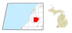
Oronoko Charter Township, Michigan

Last updated
Oronoko Charter Township, Michigan
Oronoko Logo.png
Oronoko Charter Township, MI location.png
Location within Berrien County (red) and the administered village of Berrien Springs (pink)
USA Michigan location map.svg
Red pog.svg
Oronoko Township
Location within the state of Michigan
Coordinates: 41°57′00″N86°22′00″W / 41.95000°N 86.36667°W / 41.95000; -86.36667
Country United States
State Michigan
County Berrien
Organized1837
Government
  SupervisorMike Hildebrand
Area
  Total33.2 sq mi (86.1 km2)
  Land32.3 sq mi (83.7 km2)
  Water0.9 sq mi (2.4 km2)
Elevation
689 ft (210 m)
Population
 (2020)
  Total9,226
Time zone UTC-5 (Eastern (EST))
  Summer (DST) UTC-4 (EDT)
ZIP code(s)
49101, 49103, 49104, 49107
Area code 269
FIPS code 26-61180 [1]
GNIS feature ID1626861 [2]
Website Official website

Oronoko Charter Township is a charter township of Berrien County in the U.S. state of Michigan. The population was 9,226 at the 2020 census. [3]

Contents

Communities

The village of Berrien Springs is the only incorporated municipality within the township.

History

The township was organized on March 11, 1837, from a portion of Berrien Township. Part of the area was known as Feather Settlement starting in the 1830s. [4]

Oronoko initially included what is now Lake Township, which was organized in 1846. Originally, portions of both Oronoko and Berrien townships were on either side of the St. Joseph River, and at the time a large portion of the village of Berrien Springs was in Berrien Township, even though it was on the other side of the river from most of the township. In 1847, the river was made the dividing line between the townships. [5]

There are several accounts given for the name of the township. One is that it was named by Governor Stevens T. Mason after the Indian chief named "Oronoko". However, apart from this story, there is no record that there ever was such a chief. Another is that it is a variant spelling of Orinoco, the name of a South American river that was adopted with various spellings in other states besides Michigan: Oronoco, Minnesota, and Oronoque, Kansas. Others believe the township was named after the literary character Oroonoko, which was also derived from the South American river. A final possibility suggested by Vogel is that the name was taken from a variety of tobacco known as oronoco, orinoko, or oronooka. [6] [7]

Geography

The St. Joseph River forms the eastern boundary of the township. Berrien Township lies across the river directly to the east, and Sodus Township is to the north and northeast. Buchanan Township is to the south, Weesaw Township to the southwest, Baroda Township to the west, and Royalton Township to the north.

US 31 passes through the eastern corner of the township.

According to the United States Census Bureau, the township has a total area of 33.2 square miles (86.1 km2), of which 32.3 square miles (83.7 km2) is land and 0.93 square miles (2.4 km2), or 2.77%, is water. [8]

Demographics

As of the census [1] of 2000, there were 9,843 people, 3,295 households, and 2,303 families residing in the township. The population density was 302.5 inhabitants per square mile (116.8/km2). There were 3,545 housing units at an average density of 109.0 per square mile (42.1/km2). The racial makeup of the township was 66.54% White, 17.48% African American, 0.40% Native American, 7.03% Asian, 0.27% Pacific Islander, 4.38% from other races, and 3.89% from two or more races. Hispanic or Latino of any race were 8.53% of the population.

There were 3,295 households, out of which 31.8% had children under the age of 18 living with them, 57.4% were married couples living together, 10.0% had a female householder with no husband present, and 30.1% were non-families. 23.7% of all households were made up of individuals, and 8.5% had someone living alone who was 65 years of age or older. The average household size was 2.62 and the average family size was 3.11.

In the township the population was spread out, with 22.0% under the age of 18, 18.9% from 18 to 24, 26.9% from 25 to 44, 20.3% from 45 to 64, and 11.9% who were 65 years of age or older. The median age was 31 years. For every 100 females, there were 91.8 males. For every 100 females age 18 and over, there were 87.0 males.

The median income for a household in the township was $35,980, and the median income for a family was $45,998. Males had a median income of $36,341 versus $26,330 for females. The per capita income for the township was $16,904. About 9.9% of families and 18.3% of the population were below the poverty line, including 20.4% of those under age 18 and 10.0% of those age 65 or over.

Education

The Seventh-day Adventist Andrews University is located in the township.

Related Research Articles

<span class="mw-page-title-main">Berrien County, Michigan</span> County in Michigan, United States

Berrien County is a county in the U.S. state of Michigan. It is located at the southwest corner of the state's Lower Peninsula, located on the shore of Lake Michigan and sharing a land border with Indiana. As of the 2020 Census, the population was 154,316. The county seat is St. Joseph.

<span class="mw-page-title-main">Bainbridge Township, Michigan</span> Civil township in Michigan, United States

Bainbridge Township is a civil township of Berrien County in the U.S. state of Michigan. As of the 2020 census, the township population was 2,682. It was organized in 1837. The name is a transfer from Bainbridge, New York.

<span class="mw-page-title-main">Baroda Township, Michigan</span> Civil township in Michigan, United States

Baroda Township is a civil township of Berrien County in the U.S. state of Michigan. As of the 2020 census, the township population was 2,835.

<span class="mw-page-title-main">Benton Charter Township, Michigan</span> Charter township in Michigan, United States

Benton Charter Township is a charter township of Berrien County in the U.S. state of Michigan. As of the 2020 census, the population was 14,374.

<span class="mw-page-title-main">Berrien Township, Michigan</span> Civil township in Michigan, United States

Berrien Township is a civil township of Berrien County in the U.S. state of Michigan. As of the 2010 census, the township population was 5,084.

<span class="mw-page-title-main">Berrien Springs, Michigan</span> Village in Michigan, United States

Berrien Springs is a village in Berrien County in the U.S. state of Michigan. The population was 1,910 at the time of the 2020 census. The village is located within Oronoko Charter Township.

<span class="mw-page-title-main">Buchanan Township, Michigan</span> Civil township in Michigan, United States

Buchanan Township is a civil township of Berrien County in the U.S. state of Michigan. As of the 2010 census, the township population was 3,523. The city of Buchanan is located in the southeast portion of the township.

<span class="mw-page-title-main">Chikaming Township, Michigan</span> Civil township in Michigan, United States

Chikaming Township is a civil township of Berrien County in the U.S. state of Michigan. As of the 2010 census, the township population was 3,100. The township is located in the west central portion of the county. Lake Michigan lies to the northwest, Lake Township is to the north and northeast, Weesaw Township is to the east, Three Oaks Township is to the south, and New Buffalo Township is to the southwest.

<span class="mw-page-title-main">Coloma Charter Township, Michigan</span> Charter township in Michigan, United States

Coloma Charter Township is a charter township of Berrien County in the U.S. state of Michigan. The population was 5,051 at the 2020 census. The city of Coloma lies within the township.

<span class="mw-page-title-main">Eau Claire, Michigan</span> Village in Michigan, United States

Eau Claire is a village located in east central Berrien County in the U.S. state of Michigan. The population was 552 at the 2020 census.

<span class="mw-page-title-main">Hagar Township, Michigan</span> Civil township in Michigan, United States

Hagar Township is a civil township of Berrien County in the U.S. state of Michigan. As of the 2010 census, the township population was 3,671.

<span class="mw-page-title-main">Lake Charter Township, Michigan</span> Charter township in Michigan, United States

Lake Charter Township is a charter township of Berrien County in the U.S. state of Michigan. The population was 3,316 at the 2020 census. The township is located in the west central portion of the county. Lake Michigan and the city of Bridgman are to the west, Lincoln Township to the north, Baroda Township to the east, Weesaw Township to the south, and Chikaming Township to the southwest.

<span class="mw-page-title-main">Lincoln Charter Township, Michigan</span> Charter township in Michigan, United States

Lincoln Charter Township is a charter township of Berrien County in the U.S. state of Michigan. The population was 14,929 at the 2020 census.

<span class="mw-page-title-main">Niles Charter Township, Michigan</span> Charter township in Michigan, United States

Niles Charter Township is a charter township of Berrien County in the U.S. state of Michigan. The population was 14,417 at the 2020 census.

<span class="mw-page-title-main">Pipestone Township, Michigan</span> Civil township in Michigan, United States

Pipestone Township is a civil township of Berrien County in the U.S. state of Michigan. The population was 2,312 at the 2010 census. The township was organized on February 16, 1842.

<span class="mw-page-title-main">Royalton Township, Michigan</span> Civil township in Michigan, United States

Royalton Township is a civil township of Berrien County in the U.S. state of Michigan, a few miles southeast of the city of St. Joseph. The population was 4,766 at the 2010 census, up from 3,888 at the 2000 census. There are no incorporated municipalities in the township, but portions are considered to be part of the Benton Harbor/St. Joseph urban area. The unincorporated communities of Hollywood, Scottdale, Arden, and Buckhorn are within the township.

<span class="mw-page-title-main">Sodus Township, Michigan</span> Civil township in Michigan, United States

Sodus Township is a civil township of Berrien County in the U.S. state of Michigan. The population was 1,932 at the 2010 census. There are no incorporated municipalities in the township. The unincorporated community of Sodus in the northwest of the township is its main settlement; the portion of the township just to the west is part of the Benton Harbor/St. Joseph urban area.

<span class="mw-page-title-main">St. Joseph Charter Township, Michigan</span> Charter township in Michigan, United States

St. Joseph Charter Township is a charter township of Berrien County in the U.S. state of Michigan. The population was 9,993 at the 2020 census. The township is on the shores of Lake Michigan in the west central portion of the county, south of and adjacent to the city of St. Joseph.

<span class="mw-page-title-main">Three Oaks Township, Michigan</span> Civil township in Michigan, United States

Three Oaks Township is a civil township of Berrien County in the U.S. state of Michigan on the border with the state of Indiana. The population was 2,574 at the 2010 census.

<span class="mw-page-title-main">Watervliet Township, Michigan</span> Charter township in Michigan, United States

Watervliet Charter Township is a charter township of Berrien County in the U.S. state of Michigan. The population was 3,036 at the 2020 census.

References

  1. 1 2 "U.S. Census website". United States Census Bureau . Retrieved 2008-01-31.
  2. U.S. Geological Survey Geographic Names Information System: Oronoko Charter Township, Michigan
  3. "Oronoko charter township, Berrien County, Michigan - Census Bureau Profile". United States Census Bureau. Retrieved 11 March 2024.
  4. Walter Romig, Michigan Place Names, p. 193
  5. Ellis, Franklin (2005) [1880]. "Township of Oronoko". History of Berrien and Van Buren counties, Michigan. Ann Arbor, Mich.: University of Michigan Library. p. 287. Retrieved 2006-06-28.
  6. Vogel, Virgil J. (1986). Indian Names in Michigan. Ann Arbor, Michigan: The University of Michigan Press. ISBN   0-472-10069-6. Vogel also mentions Oronogo, Missouri, but popular accounts indicate that that name does not derive from the South American river.
  7. Arent, Jennifer (June 2005). "Community Profile of Oronoko Charter Township" (PDF). Berrien County Economic Development Department. p. 4. Archived from the original (PDF) on 2006-07-11. Retrieved 2006-06-28.
  8. "Geographic Identifiers: 2010 Demographic Profile Data (G001): Oronoko charter township, Berrien County, Michigan". U.S. Census Bureau, American Factfinder. Archived from the original on February 12, 2020. Retrieved January 8, 2014.