Palmas, Arroyo, Puerto Rico

Last updated
Palmas
Barrio
Street in Palmas, Arroyo, Puerto Rico.jpg
Street in Palmas
Palmas, Arroyo, Puerto Rico locator map.png
Location of Palmas within the municipality of Arroyo shown in red
Caribbean location map.svg
Red pog.svg
Palmas
Location of Puerto Rico
Coordinates: 17°58′19″N66°02′31″W / 17.97206°N 66.041945°W / 17.97206; -66.041945 [1]
Commonwealth Flag of Puerto Rico.svg  Puerto Rico
Municipality Flag official of Arroyo.svg Arroyo
Area
[1]
  Total4.74 sq mi (12.3 km2)
  Land3.86 sq mi (10.0 km2)
  Water0.88 sq mi (2.3 km2)
Elevation
[2]
10 ft (3 m)
Population
 (2010)
  Total3,789
  Density471.2/sq mi (181.9/km2)
 Source: 2010 Census
Time zone UTC−4 (AST)

Palmas is a barrio in the municipality of Arroyo, Puerto Rico. Its population in 2010 was 3,789. [3] [4] [5]

Contents

History

The barrio was in Spain's gazetteers [6] until Puerto Rico was ceded by Spain in the aftermath of the Spanish–American War under the terms of the Treaty of Paris of 1898 and became an unincorporated territory of the United States. In 1899, the United States Department of War conducted a census of Puerto Rico finding that combined the population of Palmas, Ancones and Guásimas barrios was 596. [7]

Historical population
CensusPop.Note
1910 481
1920 58020.6%
1930 65613.1%
1940 1,24790.1%
1950 1,39812.1%
1960 1,78027.3%
1980 2,361
1990 3,16734.1%
2000 4,09029.1%
2010 3,789−7.4%
U.S. Decennial Census
1900 (N/A) [8] 1910-1930 [9]
1930-1950 [10] 1980-2000 [11] 2010 [12]

Special Community

Since 2001 when law 1-2001 was passed, [13] measures have been taken to identify and address the high levels of poverty and the lack of resources and opportunities affecting specific communities in Puerto Rico. [14] By 2008, there were 742 places on the list of Comunidades especiales de Puerto Rico of barrios, communities, sectors, or neighborhoods and in 2004, Palmas barrio made the list. [15] [16]

See also

Related Research Articles

<span class="mw-page-title-main">Guayo, Adjuntas, Puerto Rico</span> Barrio in Puerto Rico

Guayo is a rural barrio in the municipality of Adjuntas, Puerto Rico.

<span class="mw-page-title-main">Bayamoncito, Aguas Buenas, Puerto Rico</span> Barrio of Puerto Rico

Bayamoncito Barrio is a barrio in the municipality of Aguas Buenas, Puerto Rico. Its population in 2010 was 1,738.

<span class="mw-page-title-main">Cagüitas, Aguas Buenas, Puerto Rico</span> Barrio of Puerto Rico

Cagüitas is a barrio in the municipality of Aguas Buenas, Puerto Rico. Its population in 2010 was 2,664.

<span class="mw-page-title-main">Sumidero, Aguas Buenas, Puerto Rico</span> Barrio of Puerto Rico

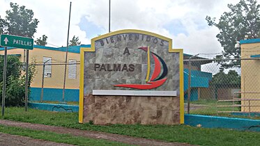
Sumidero is a barrio in the municipality of Aguas Buenas, Puerto Rico. Its population in 2010 was 8,008. In Sumidero barrio is part of the Aguas Buenas urban zone and the Santa Clara community.

<span class="mw-page-title-main">Barrero, Rincón, Puerto Rico</span> Barrio of Puerto Rico

Barrero Barrio is a barrio in the municipality of Rincón, Puerto Rico. Its population in 2010 was 1,084.

<span class="mw-page-title-main">Ensenada, Rincón, Puerto Rico</span> Barrio of Puerto Rico

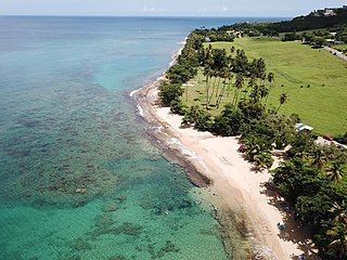
Ensenada is a barrio in the municipality of Rincón, Puerto Rico. Its population in 2010 was 1,328. Ensenada is on the western coast and is made up of about two dozen sectors. Steps Beach, popular with surfers, is located in The Tres Palmas Reserve, which is an area between Ensenada and Puntas in Rincón.

<span class="mw-page-title-main">Quebrada Grande, Barranquitas, Puerto Rico</span> Barrio of Puerto Rico

Quebrada Grande is a barrio in the municipality of Barranquitas, Puerto Rico. Its population in 2010 was 3,217.

<span class="mw-page-title-main">Quebrada Infierno, Gurabo, Puerto Rico</span> Barrio of Puerto Rico

Quebrada Infierno is a barrio in the municipality of Gurabo, Puerto Rico. Its population in 2010 was 773.

<span class="mw-page-title-main">Jaguar, Gurabo, Puerto Rico</span> Barrio of Puerto Rico

Jaguar is a barrio in the municipality of Gurabo, Puerto Rico. Its population in 2010 was 735.

<span class="mw-page-title-main">Caimital Alto, Aguadilla, Puerto Rico</span> Barrio of Puerto Rico

Caimital Alto is a barrio in the municipality of Aguadilla, Puerto Rico. Its population in 2010 was 3,989.

<span class="mw-page-title-main">Maleza Alta, Aguadilla, Puerto Rico</span> Barrio of Puerto Rico

Maleza Alta is a rural barrio in the municipality of Aguadilla, Puerto Rico. Its population in 2010 was 1,800.

<span class="mw-page-title-main">Maleza Baja, Aguadilla, Puerto Rico</span> Barrio of Puerto Rico

Maleza Baja is a rural barrio in the municipality of Aguadilla, Puerto Rico. Its population in 2010 was 1,887.

<span class="mw-page-title-main">Guajataca, Quebradillas, Puerto Rico</span> Barrio of Puerto Rico

Guajataca is a barrio in the municipality of Quebradillas, Puerto Rico. Its population in 2010 was 1,611.

<span class="mw-page-title-main">Mariana, Naguabo, Puerto Rico</span> Barrio of Puerto Rico

Mariana is a barrio in the municipality of Naguabo, Puerto Rico. Its population in 2010 was 2,074.

<span class="mw-page-title-main">Piedras Blancas, San Sebastián, Puerto Rico</span> Barrio of Puerto Rico

Piedras Blancas is a barrio in the municipality of San Sebastián, Puerto Rico. Its population in 2010 was 2,563.

<span class="mw-page-title-main">Sonadora, Aguas Buenas, Puerto Rico</span> Barrio of Puerto Rico

Sonadora is a barrio in the municipality of Aguas Buenas, Puerto Rico. Its population in 2010 was 3,191. In Sonadora barrio is part of the Aguas Buenas urban zone.

<span class="mw-page-title-main">Charcas, Quebradillas, Puerto Rico</span> Barrio of Puerto Rico

Charcas is a barrio in the municipality of Quebradillas, Puerto Rico. Its population in 2010 was 401. Charcas is the location of a nostalgic reenactment event Fiesta de Los Jibaros in December which depicts country life before the 1950s.

<span class="mw-page-title-main">Yaurel, Arroyo, Puerto Rico</span> Barrio of Puerto Rico

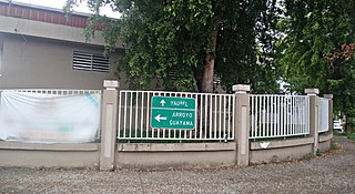
Yaurel is a barrio in the municipality of Arroyo, Puerto Rico. Its population in 2010 was 1,589.

<span class="mw-page-title-main">Bermejales</span> Barrio of Orocovis, Puerto Rico

Bermejales is a barrio in the municipality of Orocovis, Puerto Rico. Its population in 2010 was 500.

<span class="mw-page-title-main">Damián Abajo</span> Barrio in Orocovis, Puerto Rico

Damián Abajo is a barrio in the municipality of Orocovis, Puerto Rico. Its population in 2010 was 754.

References

  1. 1 2 "US Gazetteer 2019". US Census. US Government.
  2. U.S. Geological Survey Geographic Names Information System: Palmas barrio
  3. Picó, Rafael; Buitrago de Santiago, Zayda; Berrios, Hector H. Nueva geografía de Puerto Rico: física, económica, y social, por Rafael Picó. Con la colaboración de Zayda Buitrago de Santiago y Héctor H. Berrios. San Juan Editorial Universitaria, Universidad de Puerto Rico,1969.
  4. Gwillim Law (20 May 2015). Administrative Subdivisions of Countries: A Comprehensive World Reference, 1900 through 1998. McFarland. p. 300. ISBN   978-1-4766-0447-3 . Retrieved 25 December 2018.
  5. Puerto Rico: 2010 Population and Housing Unit Counts.pdf (PDF). U.S. Dept. of Commerce, Economics and Statistics Administration, U.S. Census Bureau. 2010.
  6. "Anuario del comercio, de la industria, de la magistratura y de la administración. 1881". Biblioteca Nacional de España (in Spanish). p. 1614. Retrieved 4 April 2023.
  7. Joseph Prentiss Sanger; Henry Gannett; Walter Francis Willcox (1900). Informe sobre el censo de Puerto Rico, 1899, United States. War Dept. Porto Rico Census Office (in Spanish). Imprenta del gobierno. p.  165.
  8. "Report of the Census of Porto Rico 1899". War Department Office Director Census of Porto Rico. Archived from the original on July 16, 2017. Retrieved September 21, 2017.
  9. "Table 3-Population of Municipalities: 1930 1920 and 1910" (PDF). United States Census Bureau. Archived (PDF) from the original on August 17, 2017. Retrieved September 21, 2017.
  10. "Table 4-Area and Population of Municipalities Urban and Rural: 1930 to 1950" (PDF). United States Census Bureau. Archived (PDF) from the original on August 30, 2015. Retrieved September 21, 2014.
  11. "Table 2 Population and Housing Units: 1960 to 2000" (PDF). United States Census Bureau. Archived (PDF) from the original on July 24, 2017. Retrieved September 21, 2017.
  12. Puerto Rico: 2010 Population and Housing Unit Counts.pdf (PDF). U.S. Dept. of Commerce Economics and Statistics Administration U.S. Census Bureau. 2010. Archived (PDF) from the original on 2017-02-20. Retrieved 2019-08-02.
  13. "Leyes del 2001". Lex Juris Puerto Rico (in Spanish). Retrieved 24 June 2019.
  14. "Comunidades Especiales de Puerto Rico" (in Spanish). 8 August 2011. Retrieved 24 June 2019.
  15. "Evoluciona el proyecto de Comunidades Especiales". El Nuevo Dia (in Spanish). 24 February 2017. Retrieved 24 June 2019.
  16. "Ya es ley Oficina para el Desarrollo Socioeconómico y Comunitario". El Vocero de Puerto Rico (in Spanish). Retrieved 24 June 2019.