
Aranmula is a temple town in the state of Kerala, India. It is known as the cultural capital of Pathanamthitta district, located at a distance of around 116 km from Trivandrum, the capital of Kerala, it is situated on the banks of the river Pampa. A centre of pilgrimage from time immemorial and a trade post of eminence, when the river was the chief means of transport, it is near Kozhencherry in Pathanamthitta District. It is easily accessible from Chengannur railway station (10km). It is one of the Fastest Growing Village.
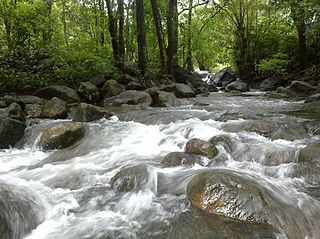
Adyanpara Falls is a cascading waterfall in the Kurmbalangodu village of Nilambur taluk in Kerala, India. It is 14 kilometres (8.7 mi) from Nilambur town, and attracts tourists from various parts of Kerala. This is a seasonal waterfall. During Summer, water flow is low. This waterfall is of a natural cascading style as the waterfall descends over the rock. Adyanpara Weir is situated near to this falls.
Punnala is a small village situated in Kollam district of Kerala, India. Punnala is located at a distance of 8 kilometers from both Pathanapuram and Punalur and 1 km from Chachipunna. It is in the Pathanapuram Taluk, Pathanapuram Assembly Constituency and Mavelikkara Parliament Constituency. Punnala is a part of Piravanthoor Grama Panchayth, Pathanapuram Block Panchayat and Kollam district Panchayat.
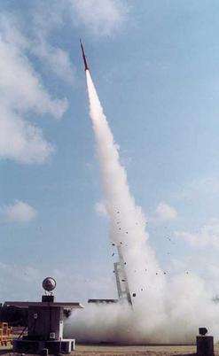
Thumba Equatorial Rocket Launching Station (TERLS),Thiruvananthapuram is an Indian spaceport established on 21 November 1963. Operated by the Indian Space Research Organisation (ISRO), it is located in Thumba, Thiruvananthapuram, Kerala, which is near the southwestern tip of mainland India, very close to Earth's magnetic equator. It is currently used by ISRO for launching sounding rockets.
Kizhaparayar is a small village in Kerala state, India. It is part of the Meenachil Panchayat in Kottayam district. The village situated on the banks of the Meenachil River. There is no traces when the first settlement came to this village. It is a sparsely populated place. Kizhaparayar borders with Edamattom in the South, Palakkadu in North, Pala in the west. The other side of the river is Bharananganam.
Ummathoor is a village near Civil Station in the state of Kerala, India.
Perumpilly, also Perumpally, is a village in Kanayannur taluk of Ernakulam district in Kerala state, south India. It is 22 km (14 mi) south-east of Ernakulam city. Perumpilly is famous for historic Christian churches and Hindu temples. The village lies 14 km (8.7 mi) from Piravom. The nearest town is Mulanthuruthy.
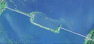
Thanneermukkom is a village in Alappuzha district of Kerala, India.
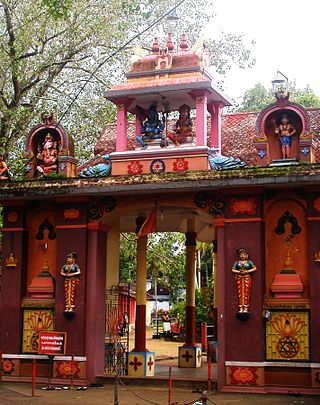
Thrippara Shiva Kshetram is a famous Shiva temple in Vallicode village, Pathanamthitta District, Kerala, India. This temple is located on the banks of the Achankovil river. The main sanctum sanctorum here is situated in the open directly above the temple ghats. This makes it a bit different from other temples in this area. The temple has a history dating back to 800 years.
Peruvanthanam is a village in Idukki district in the state of Kerala in southwestern India.
Piravanthoor is a village in Kollam district in the state of Kerala, India. Piravanthoor is a part of Pathanapuram Block Panchayat and Kollam district Panchayat.
Punnayur is a Panchayath in Thrissur district in the state of Kerala, India.This village has coastal area, Mannalamkunnu Beach is one of tourist destination in Trissur District. The office, co-op bank and Punnayur Village are located in Edakkara. Edakkara is one of the small area of Punnnayur Panchayth, Edakkazhiyur, Agalad, Kuzhingara, Aviyur Mannalamkunnu and Punnayur are the other places. Punnayur is located 35 km from Thrissur railway station, 12 km from Guruvayoor railway station, and 90 km from Kochi International Airport. Edakkara is very close to NH 17,.

Vellikulangara is a small village in Thrissur district in the state of Kerala, India.
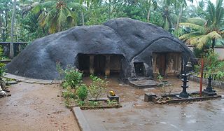
Kottukkal Cave Temple, also known as Kaltrikkovil in Malayalam, is an existing example of rock cut architecture, built between 6th and 8th centuries CE. It is situated in the village of Kottukkal, near Anchal, Kollam district, Kerala in India. The name Kottukkal is a reference to rock cut shrine. There are two caves of unequal size, both facing the east with the sculpture of the main deity Ganapathy in between. The smaller cave has an idol of Hanuman and the larger one has a monolithic Nandi (bull) in it. Lord Shiva is also a deity in the temple in the form of a Shiva Ling.
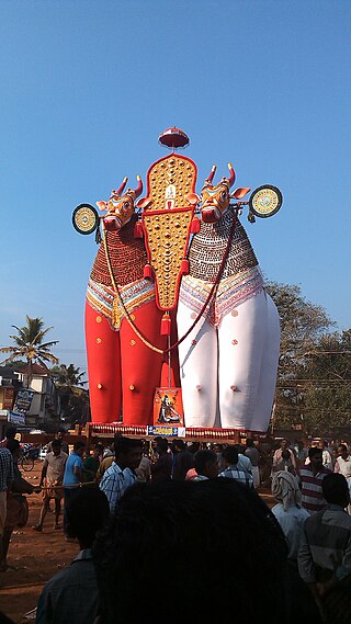
Kadamankulam is a village in Peruvanthanam village Panchayath, of Perumedu taluk, Idukki District of Kerala, India.

St Joseph College of Communication, Changanassery (SJCC), is the first university affiliated media college in South India and was founded in August 2004. It is a Christian minority self-financing education institution affiliated to Mahatma Gandhi University, Kottayam, Kerala, India. The college is first of its kind in South India hosting more than 1000 students in 8 undergraduate and 5 postgraduate career oriented programs in Media Studies and Mass Communication. The college offers Bachelor and Master of Arts university degrees in Multimedia, Animation, Graphic Design, Cinema & Television, Print and Electronic journalism, Visual Arts, Visual Effects, and Audiography & Digital Editing and more.
Pallikkal is a village in Adoor taluk, Pathanamthitta district in the state of Kerala, India.

Kannadi is a gram panchayat in the Palakkad district, state of Kerala, India. It is a local government organisation that serves the villages of Kannadi-I and Kannadi-II.

Meppadi is a village in the Indian state of Kerala. It is an extremely scenic hill station on the State Highway between Kozhikode and Ooty. The nearest city is Kalpetta, which is the headquarters of the Wayanad revenue district.

Aranmula State assembly constituency is one of the 140 state legislative assembly constituencies in Kerala state in southern India. It is also one of the 7 state legislative assembly constituencies included in the Pathanamthitta Lok Sabha constituency. As of the 2021 assembly elections, the current MLA is Veena George of CPI(M).


 India
India 
