
El Paso is an unincorporated community and census-designated place (CDP) in southwestern White County, Arkansas, United States. It was first listed as a CDP in the 2020 census with a population of 267. Its name is Spanish for "the pass", referring to a small gap in the hills on the community's northern edge. Once known as Peach Orchard Gap in its early settlement, the origin of El Paso's Spanish name is unknown.
Magnet Cove is a census-designated place (CDP) and former town in Hot Spring County, Arkansas, United States. It is located in the Ouachita Mountains southeast of Hot Springs, on Arkansas Highway 51 north of U.S. Highway 270. As of the 2020 census, the town of Magnet Cove had a population of 692.

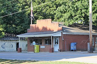
New Blaine is an unincorporated community and census-designated place (CDP) in Logan County, Arkansas, United States. Per the 2020 census, the population was 173.
Salado is an Incorporated community and census-designated place (CDP) in Independence County, Arkansas, United States. It was first listed as a CDP in the 2020 census with a population of 472.
Midway is a census-designated place in Baxter County, Arkansas, United States. Midway is 5.5 miles (8.9 km) northwest of Mountain Home. Per the 2020 census, the population was 1,036. Midway has a post office with ZIP code 72651. Long home to a rural trading post, Midway became a boomtown during the construction of the Bull Shoals Dam, and later evolved to serve tourists and retirees attracted to the lake.

Kingston is an unincorporated community and census-designated place (CDP) in northeast Madison County, Arkansas, United States. It was first listed as a CDP in the 2020 census with a population of 97.
Vanndale is an unincorporated community and census-designated place (CDP) in Searcy Township, Cross County, Arkansas, United States. It was first listed as a CDP in the 2020 census with a population of 339. Vanndale was the county seat of Cross County from 1886 until 1903, when it was moved to the booming railroad town of Wynne. The community was named for John W. Vann, postmaster. Vanndale was formerly on Highway 1, but has now been bypassed and is on Highway 1B.
Buffalo City is an unincorporated community and census-designated place (CDP) in Baxter County, Arkansas, United States. It was first listed as a CDP in the 2020 census with a population of 26.

Yarborough Landing is a census-designated place in Little River County, Arkansas, United States. Per the 2020 census, the population was 457.
Centerville is an unincorporated community and census-designated place (CDP) in Yell County, Arkansas, United States. Centerville is located at the junction of Arkansas Highways 7 and 154, 6.5 miles (10.5 km) north-northeast of Ola. It was first listed as a CDP in the 2020 census with a population of 283.
Newhope is an unincorporated community and census-designated place (CDP) in Pike County, Arkansas, United States. Newhope is located at the junction of U.S. Route 70 and Arkansas Highway 369, 8 miles (13 km) west of Daisy. Newhope has a post office with ZIP code 71959.

Ponca is an unincorporated community and census-designated place (CDP) in Newton County, Arkansas, United States. Ponca is located on Arkansas Highway 43, 10 miles (16 km) west of Jasper. Ponca has a post office with ZIP code 72670.
Mellwood is an unincorporated community and census-designated place (CDP) in Phillips County, Arkansas, United States. Mellwood is located on Arkansas Highway 44, 8.5 miles (13.7 km) southwest of Elaine. Mellwood has a post office with ZIP code 72367. It was first listed as a CDP in the 2020 census with a population of 21.
Hattieville is an unincorporated community and census-designated place (CDP) in Conway County, Arkansas, United States. It was first listed as a CDP in the 2020 census with a population of 132. Hattieville is located on Arkansas Highway 213, 9.5 miles (15.3 km) north-northwest of Morrilton. Hattieville has a post office with ZIP code 72063.
Monroe is an unincorporated community and census-designated place (CDP) in Monroe County, Arkansas, United States. The unincorporated community extends beyond the CDP slightly into Lee County. It was first listed as a CDP in the 2020 census with a population of 51.
Batavia is an unincorporated community and census-designated place (CDP) in Boone County, Arkansas, United States. It was first listed as a CDP in the 2020 census with a population of 328.
Mount Olive is an unincorporated community and census-designated place (CDP) in Izard County, Arkansas, United States. Mount Olive is located on the White River, 11.1 miles (17.9 km) west-southwest of Melbourne.
Lacey is an unincorporated community and census-designated place (CDP) in Drew County, Arkansas, United States. Lacey is located at the junction of U.S. Route 425 and Arkansas Highway 133, 12.4 miles (20.0 km) south-southwest of Monticello. It was first listed as a CDP in the 2020 census with a population of 139.
Bethesda was an unincorporated community and census-designated place (CDP) in western Independence County, Arkansas, United States. It was first listed as a CDP in the 2020 census with a population of 199.
Collins is an unincorporated community and census-designated place (CDP) in Drew County, Arkansas, United States. It is located along Arkansas Highway 35, 7 miles (11 km) west of Dermott and 15 miles (24 km) southeast of Monticello. It was first listed as a CDP in the 2020 census with a population of 149.

