
Vizianagaram is a city and the headquarters of Vizianagaram district in the Indian state of Andhra Pradesh. It is central Eastern Ghats, about 24 km (15 mi) west of the Bay of Bengal and 40 km (25 mi) north-northeast of Visakhapatnam. The city has a population of 2,28,025 and was the headquarters of the rajas of Vizianagaram, who played a notable role in the history of Andhra Pradesh in the 18th century and were patrons of education and the fine arts.

Vizianagaram district is one of the nine districts in the Coastal Andhra region of the Indian state of Andhra Pradesh with its headquarters located at Vizianagaram. The district is bounded on the east by the district of Srikakulam, southwest by the City of Bheemunipatnam, southeast by the Bay of Bengal, and northwest by the state of Odisha. It was formed on 1 June 1979, with some parts carved from the neighbouring districts of Srikakulam and Visakhapatnam. The district is named after the princely state of Vizianagaram. It is the least populous district in Andhra Pradesh.

Srikakulam district is one of the nine districts in the Coastal Andhra region of the Indian state of Andhra Pradesh, with its headquarters located at Srikakulam. It is one of the nine coastal districts, located in the extreme northeastern direction of the state. It was formerly known as Chicacole.

Chintalavalasa is a census town in Vizianagaram district of the Indian state of Andhra Pradesh. It is located in Denkada mandal of Vizianagaram revenue division.

Gajapathinagaram is a census town in Vizianagaram district of the Indian state of Andhra Pradesh. It is located in Gajapathinagaram mandal of Vizianagaram revenue division. It is located on National Highway 26 between Vizianagaram and Ramabhadrapuram.
Jarajapupeta is a census town in Vizianagaram district of the Indian state of Andhra Pradesh. It is located in Nellimarla mandal of Vizianagaram revenue division.

Kothavalasa is a Suburb in Visakhapatnamcity but present in Vizianagaram district of the Indian state of Andhra Pradesh. It is located in Kothavalasa mandal of Vizianagaram revenue division. It is located 30 km from City Visakhapatanam

Parvathipuram is a Municipality.It is located in Vizianagaram district of Indian state of Andhra Pradesh.It is also a revenue division in Vizianagaram district This Revenue Division shares a border with Srikakulam District and various districts in Odisha.
Sriramnagar is a census town in Vizianagaram district of the Indian state of Andhra Pradesh. It is located in Garividi mandal of Vizianagaram revenue division.
Nelli-marla is a census town in Vizianagaram district of the Indian state of Andhra Pradesh. It is in Nellimarla mandal of Vizianagaram revenue division.

Baliji-peta or Baligi-peta is a village in Vizianagaram district of the Indian state of Andhra Pradesh. According to some historians, most of the people of Original Balija caste have migrated from this village.

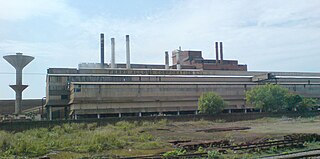
Cheepurupalli is a census town in Vizianagaram district of the Indian state of Andhra Pradesh. The town is located 30 km to the north of Vizianagaram.The town covers an area of 348 hectares with a population of 78,000 according to the 2011 census.
Pusapati-rega is a village in Vizianagaram district of the Indian state of Andhra Pradesh, India.
Naguru is a village and panchayat in Garugubilli mandal in Vizianagaram district of Andhra Pradesh, India. Naguru is a small village with a population of around 5000. Most of the people are employed in cultivation and cattle. Naguru was an assembly constituency in Andhra Pradesh till restructuring in 2009. It is located on the highway connecting Parvathipuram - Srikakulam, just 17 km from Parvathipuram. One who wants to visit Naguru, has to reach Parvathipuram first via train and from there can get a bus to Naguru easily.
Narsipuram is a village located in Vizianagaram district, Andhra Pradesh, 3 km from Parvathipuram. Located on the stretch of NH-43, it is accessible by all modes of transportation and has a railway station for most of the trains from Visakhapatnam to Rayagada.
Salur mandal is one of the 34 mandals in Vizianagaram district of the Indian state of Andhra Pradesh. It is administration under Parvathipuram revenue division and headquartered at Salur. The mandal is bounded by Makkuva, Ramabhadrapuram, Pachipenta and Bobbili mandals. A portion of it also borders the state of Odisha.
Makkuva mandal is one of the 34 mandals in Vizianagaram district of the Indian state of Andhra Pradesh. It is administration under Parvathipuram revenue division and headquartered at Makkuva. The mandal is bounded by Salur mandal on South & West, Parvathipuram mandal on North, Seethanagaram mandal on east and Bobbili mandal on south east. A portion of it also borders the Narayanapatna block of the Koraput district of Odisha on north west.
Pachipenta mandal is one of the 34 mandals in Vizianagaram district of the Indian state of Andhra Pradesh. It is administration under Parvathipuram revenue division and headquartered at Pachipenta. The mandal is bounded by Salur, Ramabhadrapuram and Mentada mandals. A portion of it also borders the state of Odisha.
Mentada mandal is one of the 34 mandals in Vizianagaram district of the Indian state of Andhra Pradesh. It is administration under Parvathipuram revenue division and headquartered at Mentada. The mandal is bounded by Pachipenta, Ramabhadrapuram, Dattirajeru and Gajapathinagaram mandals. A portion of it also borders the state of Odisha.

Parvathipuram revenue division is an administrative division in the Vizianagaram district of the Indian state of Andhra Pradesh. It is one of the two revenue divisions in the district with fifteen mandals under its administration. The divisional headquarters are located at Parvathipuram.

