
North Cornwall is an area of Cornwall, England, United Kingdom. It is also the name of a former local government district, which was administered from Bodmin and Wadebridge 50.516°N 4.835°W. Other towns in the area are Launceston, Bude, Padstow, and Camelford.
St Teath is a civil parish and village in north Cornwall, England, in the United Kingdom.
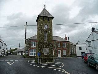
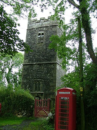
Delabole is a large village and civil parish in north Cornwall, England, United Kingdom, which lies approximately two miles (3 km) west of Camelford.

St Enoder is a civil parish and hamlet in Cornwall, England, United Kingdom. The hamlet is situated five miles (8 km) southeast of Newquay. There is an electoral ward bearing this name which includes St Columb Road. The population at the 2011 census was 4,563.

St Michael Caerhays is a civil parish and village in Cornwall, England, United Kingdom. The village is about seven miles (11 km) south-southwest of St Austell. The population as of the 2011 census was 96
Philleigh is a civil parish and village in Cornwall, England, one of the four civil parishes in the Roseland Peninsula. The civil parish includes the hamlets of Treworlas, Treworthal and a number of smaller settlements.

St Veep is a civil parish in Cornwall, England, United Kingdom, situated above the east bank of the River Fowey about three miles (5 km) south-east of Lostwithiel. It is bordered by the parishes of St Winnow to the north-west, Boconnoc to the north, Lanreath to the east Polperro to the south-east and Lanteglos to the south. The River Fowey forms its western boundary. The parish is named after Saint Veep of whom little is known.

St Anthony-in-Meneage is a coastal civil parish and village in Cornwall, England, United Kingdom. The parish is in the Meneage district of the Lizard peninsula. In the 2001 census the parish had a population of 171, decreasing to 168 at the 2011 census.
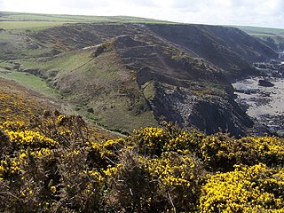
Tregardock is a coastal hamlet and beach in the civil parish of Delabole in north Cornwall, England, United Kingdom. It is situated between Trebarwith Strand and Port Gaverne. The small beach is accessed by climbing down the cliffs near the settlement of Tregardock.
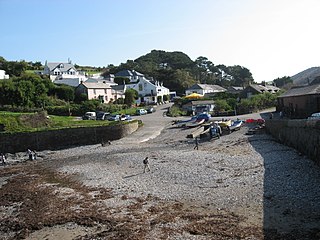
Port Gaverne is a hamlet on the north coast of Cornwall, England, UK, about 0.5 miles (0.80 km) east of Port Isaac and part of St Endellion parish.

St Breward is a civil parish and village in Cornwall, England, United Kingdom. It is on the western side of Bodmin Moor, about 6 miles (10 km) north of Bodmin. At the 2011 census the parish population including Cooksland and Fentonadle was 919.

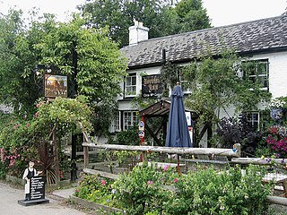
Pendoggett is a village in the civil parish of St Kew, Cornwall, England, United Kingdom. It is a linear village stradling the B3314 Wadebridge to Delabole road about five miles (8 km) northwest of Wadebridge, four miles (6.5 km) southeast of Delabole, and two miles (3 km) southeast of Port Isaac.
Otterham is a village and a civil parish in north Cornwall, England, United Kingdom. The village is situated approximately ten miles (16 km) south of Bude and six miles (9.7 km) north of Camelford.

Slaughterbridge, Treague and Camelford Station are three adjoining settlements in north Cornwall, England. They straddle the boundary of Forrabury and Minster and Lanteglos by Camelford civil parishes just over a mile (2 km) north-west of the market town of Camelford.

Warleggan or Warleggon is a hamlet and civil parish on the southern edge of Bodmin Moor in Cornwall, England.

Lanteglos is a coastal civil parish in south Cornwall, England, United Kingdom. It is on the east side of the tidal estuary of the River Fowey which separates it from the town and civil parish of Fowey. The South West Coast Path runs along the southern coasts of the parish and much of the southern part of the parish lies in the Polruan to Polperro Site of Special Scientific Interest managed by the National Trust.

Carland Cross is a location in Cornwall, England, United Kingdom, about six miles north of Truro at OS grid reference OS grid ref SW846539. At Carland Cross there are a hamlet, a road junction and a large wind farm. The road junction is in the civil parish of St Erme, very close to the boundary with St Newlyn East.

Rosenannon is a hamlet in Cornwall, England, United Kingdom. It is within the civil parish of St Wenn, 4 miles (6.4 km) south-west of the town of Wadebridge.

Tregorrick is a hamlet south of St Austell in Pentewan Valley civil parish, mid Cornwall, England, United Kingdom.

Delabole railway station was a railway station that served a quarry, rural district, and village of Delabole, situated approximately two miles (3 km) west of Camelford in north Cornwall, England, UK. It was located on the North Cornwall Railway and named after Delabole Quarry. There were three hamlets in the vicinity, Pengelly, Meadrose, and Rockhead, while the hamlet of Delabole was south of the quarry.
