Pepperwood Grove, California

Last updated
Pepperwood Grove
Unincorporated community
California Locator Map with US.PNG
Red pog.svg
Pepperwood Grove
Location in California
Usa edcp location map.svg
Red pog.svg
Pepperwood Grove
Pepperwood Grove (the US)
Coordinates: 39°03′29″N122°46′53″W / 39.05806°N 122.78139°W / 39.05806; -122.78139 Coordinates: 39°03′29″N122°46′53″W / 39.05806°N 122.78139°W / 39.05806; -122.78139
Country United States
State California
County Lake County
Elevation [1] 1,329 ft (405 m)

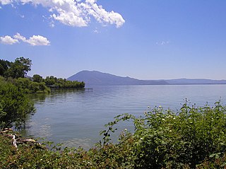
Pepperwood Grove is an unincorporated community in Lake County, California. [1] It is located on Clear Lake 7.5 miles (12 km) east of Lakeport, [2] at an elevation of 1329 feet (405 m). [1]

Unincorporated area Region of land not governed by own local government

In law, an unincorporated area is a region of land that is not governed by a local municipal corporation; similarly an unincorporated community is a settlement that is not governed by its own local municipal corporation, but rather is administered as part of larger administrative divisions, such as a township, parish, borough, county, city, canton, state, province or country. Occasionally, municipalities dissolve or disincorporate, which may happen if they become fiscally insolvent, and services become the responsibility of a higher administration. Widespread unincorporated communities and areas are a distinguishing feature of the United States and Canada. In most other countries of the world, there are either no unincorporated areas at all, or these are very rare; typically remote, outlying, sparsely populated or uninhabited areas.
Lake County, California County in California, United States

Lake County is a county located in the north central portion of the U.S. state of California. As of the 2010 census, the population was 64,665. The county seat is Lakeport. The county takes its name from Clear Lake, the dominant geographic feature in the county and the largest natural lake wholly within California.

California State of the United States of America

California is a state in the Pacific Region of the United States. With 39.6 million residents, California is the most populous U.S. state and the third-largest by area. The state capital is Sacramento. The Greater Los Angeles Area and the San Francisco Bay Area are the nation's second- and fifth-most populous urban regions, with 18.7 million and 9.7 million residents respectively. Los Angeles is California's most populous city, and the country's second-most populous, after New York City. California also has the nation's most populous county, Los Angeles County, and its largest county by area, San Bernardino County. The City and County of San Francisco is both the country's second-most densely populated major city after New York City and the fifth-most densely populated county, behind only four of the five New York City boroughs.

Related Research Articles

Pepperwood may refer to:

Sigmund Stern Recreation Grove

Sigmund Stern Recreation Grove, locally called Stern Grove, is a 33-acre (130,000 m2) recreational site in the Sunset District, San Francisco, California. It is administered by the city's Recreation and Parks Department, and is the concert setting for the 80-year-old Stern Grove Festival.

Pepperwood, California Unincorporated community in California, United States

Pepperwood is an unincorporated community in Humboldt County, California. It is located 3.5 miles (5.6 km) northwest of Redcrest, at an elevation of 115 feet. Pepperwood is the northernmost community along the Avenue of the Giants. The ZIP Code is 95569. The community is inside area code 707.

Oak Grove, Yuba County, California Former settlement in California, United States

Oak Grove is a former settlement in Yuba County, California. It was located on Dry Creek, 2.5 miles (4.0 km) west-southwest of Oregon House, at an elevation of 1158 feet. The site is covered by the Virginia Ranch Reservoir.

Oak Grove, Butte County, California Unincorporated community in California, United States

Oak Grove is an unincorporated community in Butte County, California. It lies at an elevation of 128 feet.

Irishtown, California Former settlement in California, United States

Irishtown is a former settlement in Amador County, California. It was located 1.5 miles (2.4 km) south-southwest of Pine Grove, at an elevation of 1972 feet. The townsite lies within the boundaries of Pine Grove. Irishtown is a former Miwok settlement.

Oak Grove, Calaveras County, California Unincorporated community in California, United States

Oak Grove is an unincorporated community in Calaveras County, California. It lies at an elevation of 292 feet.

Cedar Grove, Fresno County, California Unincorporated community in California, United States

Cedar Grove is an unincorporated community and the location of the visitor center in Kings Canyon National Park. Situated near the South Fork of the Kings River, in Fresno County, California, Cedar Grove and Grant Grove Village are the only commercially developed areas in the park. Facilities include the Cedar Grove Visitor Center, the Cedar Grove Lodge, a market and four campgrounds. The road into the canyon closes mid-November to mid-April.

Elk Grove, Humboldt County, California Former settlement in California, United States

Elk Grove is a former settlement in Humboldt County, California. It was located 6 miles (9.7 km) north-northeast of Orick, at an elevation of 151 feet. It still appeared on maps as of 1947.

Pine Grove, Lake County, California Unincorporated community in California, United States

Pine Grove is an unincorporated community in Lake County, California. It is located 1.5 miles (2.4 km) northwest of Whispering Pines, at an elevation of 2,520 feet.

Cypress Grove, Marin County, California Unincorporated community in California, United States

Cypress Grove is an unincorporated community in Marin County, California. It is located on the northeast shore of Tomales Bay 5.5 miles (8.9 km) south of Tomales, at an elevation of 13 feet.

Grove, California Unincorporated community in California, United States

Grove is an unincorporated community in Mendocino County, California. It is located on the California Western Railroad 12.5 miles (20 km) north-northwest of Comptche, at an elevation of 404 feet.

Hales Grove, California Unincorporated community in California, United States

Hales Grove is an unincorporated community in Mendocino County, California. It is located on California State Route 1 adjacent to the South Fork of Mule Creek 11 miles (18 km) south of Piercy, at an elevation of 1138 feet.

Hendy Grove, California Unincorporated community in California, United States

Hendy Grove is an unincorporated community in Mendocino County, California. It lies at an elevation of 190 feet.

Pine Grove, Mendocino County, California Unincorporated community in California, United States

Pine Grove is an unincorporated community in Mendocino County, California. It is located 3 miles (4.8 km) north-northwest of Mendocino, at an elevation of 167 feet. On the ocean just west of the community is the Point Cabrillo Light station.

The Grove, California Unincorporated community in California, United States

The Grove is an unincorporated community in Merced County, California. It is located 3.5 miles (5.6 km) north of Atwater, at an elevation of 197 feet.

Pacific Grove Acres, California Unincorporated community in California, United States

Pacific Grove Acres is an unincorporated community in Monterey County, California. It is located northwest of Pacific Grove, at an elevation of 125 feet.

Pepperwood Preserve is a 3,117 acre plot of land owned by the Pepperwood Foundation, located in the Mayacamas Mountains in the coast ranges of California near the towns of Santa Rosa and Healdsburg in Sonoma County. The preserve includes the headwaters of Mark West Creek, Franz Creek, and Brooks Creek all of which feed into the Russian River. The highest point on the preserve is 1,560 feet.

Cisco Grove, California Unincorporated community in California, United States

Cisco Grove is an unincorporated community in Placer County, California. Cisco Grove is located 7 miles (11.3 km) east of Emigrant Gap. It lies at an elevation of 5643 feet.

Cockatoo Grove was a populated place in San Diego County, California, in the United States. As of 2015, former location of Cockatoo Grove is within the Otay Lakes neighborhood of Chula Vista, California.

References

  1. 1 2 3 U.S. Geological Survey Geographic Names Information System: Pepperwood Grove, California
  2. Durham, David L. (1998). California's Geographic Names: A Gazetteer of Historic and Modern Names of the State. Clovis, Calif.: Word Dancer Press. p. 120. ISBN   1-884995-14-4.