Rose Place, California

Last updated
Rose Place
Unincorporated community
California Locator Map with US.PNG
Red pog.svg
Rose Place
Location in California
Usa edcp location map.svg
Red pog.svg
Rose Place
Rose Place (the US)
Coordinates: 39°09′57″N122°49′04″W / 39.16583°N 122.81778°W / 39.16583; -122.81778 Coordinates: 39°09′57″N122°49′04″W / 39.16583°N 122.81778°W / 39.16583; -122.81778
Country United States
State California
County Lake County
Elevation [1] 3,113 ft (949 m)

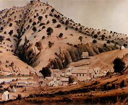
Rose Place is an unincorporated community in Lake County, California. [1] It is located 5 miles (8 km) east of Upper Lake, [2] at an elevation of 3113 feet (949 m). [1]

Unincorporated area Region of land not governed by own local government

In law, an unincorporated area is a region of land that is not governed by a local municipal corporation; similarly an unincorporated community is a settlement that is not governed by its own local municipal corporation, but rather is administered as part of larger administrative divisions, such as a township, parish, borough, county, city, canton, state, province or country. Occasionally, municipalities dissolve or disincorporate, which may happen if they become fiscally insolvent, and services become the responsibility of a higher administration. Widespread unincorporated communities and areas are a distinguishing feature of the United States and Canada. In most other countries of the world, there are either no unincorporated areas at all, or these are very rare; typically remote, outlying, sparsely populated or uninhabited areas.
Lake County, California County in California, United States

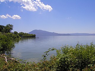
Lake County is a county located in the north central portion of the U.S. state of California. As of the 2010 census, the population was 64,665. The county seat is Lakeport. The county takes its name from Clear Lake, the dominant geographic feature in the county and the largest natural lake wholly within California.

California State of the United States of America

California is a state in the Pacific Region of the United States. With 39.6 million residents, California is the most populous U.S. state and the third-largest by area. The state capital is Sacramento. The Greater Los Angeles Area and the San Francisco Bay Area are the nation's second- and fifth-most populous urban regions, with 18.7 million and 8.8 million residents respectively. Los Angeles is California's most populous city, and the country's second-most populous, after New York City. California also has the nation's most populous county, Los Angeles County, and its largest county by area, San Bernardino County. The City and County of San Francisco is both the country's second-most densely populated major city after New York City and the fifth-most densely populated county, behind only four of the five New York City boroughs.

Related Research Articles

Ward Creek (Lake Tahoe)

Ward Creek is a 6.1-mile (9.8 km) eastward-flowing stream in Placer County, California, USA. The creek flows into Lake Tahoe 2.7 miles (4.3 km) south of Tahoe City, California, and has undergone extensive restoration to reduce sediment and surface run-off to maintain the purity of Lake Tahoe.

Bidwells Bar, California Former settlement in California, United States

Bidwell's Bar was a gold mining camp in Butte County, California, United States, which lay at the end of the California Trail. It was located 6.5 miles (10.5 km) east-northeast of Oroville, at an elevation of 902 feet.

Smoke Creek Desert desert in northwestern Nevada

The Smoke Creek Desert is an arid region of northwestern Nevada, USA that lies about 60 miles (97 km) to the north of Pyramid Lake, west of the Fox Range and east of the Smoke Creek Mountains. The southern end of the desert lies on the Pyramid Lake Indian Reservation, and a rail line lies at the eastern edge. The Smoke Creek Desert is southwest of the Black Rock Desert's South Playa and is between the Granite Range and the Fox Range.

Arrowbear Lake, California Unincorporated community in California, United States

Arrowbear Lake is an unincorporated community in San Bernardino County, California, United States. Its altitude is 6,086 feet (1,855 m), in the San Bernardino Mountains.

Salmon Falls, California Former settlement in California, United States

Salmon Falls is a former settlement in El Dorado County, California. It was located on the South Fork of the American River 5.5 miles (9 km) south-southwest of Pilot Hill, at an elevation of 469 feet. It was flooded by Folsom Lake. Nearby were waterfalls from which the place got its name. The site is now registered as California Historical Landmark #571.

Norden, California Unincorporated community in California, United States

Norden is a small unincorporated community in Nevada County, California, United States, about 9 miles (14 km) west of Truckee. The community is located on a former portion of U.S. Route 40 near Interstate 80 and lies along the historical First Transcontinental Railroad, 1.5 miles (2.4 km) west of Donner Pass.

South Lake, Kern County, California Unincorporated community in California, United States

South Lake is an unincorporated community in the Kern River Valley, in Kern County, California. It is located 4.5 miles (7.2 km) west-southwest of Weldon, at an elevation of 2,887 feet (880 m).

Land, California Former settlement in California, United States

Land is a former settlement in Butte County, California, United States. It was located 1.5 miles (2.4 km) west-southwest of Bidwell's Bar on the Western Pacific Railroad, at an elevation of 902 feet. Land is now covered by Lake Oroville. The place was named for A.H. Land, a lumber company president.

Lake Valley, California Unincorporated community in California, United States

Lake Valley is an unincorporated community in El Dorado County, California. It extends for 8 miles (13 km) along the Upper Truckee River from Lake Tahoe to Meyers, at an elevation of 6207 feet.

Meeks Bay, California Unincorporated community in California, United States

Meeks Bay is an unincorporated community in El Dorado County, California. It lies on Lake Tahoe at the mouth of Meeks Creek, at an elevation of 6240 feet. The place is named for John Meeks, who owned the land. The Meeks brothers baled 25 tons of wild hay in the meadows at the mouth of Meeks Creek in 1862.

China Lake, Kern County, California Unincorporated community in California, United States

China Lake is an unincorporated community in Kern County, California. It is located 2.5 miles (4 km) north-northeast of Ridgecrest, at an elevation of 2264 feet. The place is on China Lake, a dry lake on the Naval Air Weapons Station China Lake.

Desert Lake, California Unincorporated community in California, United States

Desert Lake is an unincorporated community in Kern County, California.

Brockway, California Unincorporated community in California, United States

Brockway is an unincorporated community in Placer County, California. Brockway is located on the north shore of Lake Tahoe on State Line Point, adjacent to the Nevada state border. It lies at an elevation of 6266 feet.

Cuddy Canyon, California Unincorporated community in California, United States

Cuddy Canyon is a canyon, and a narrow valley known as Cuddy Valley, running along the boundary line between Kern County and Ventura County, California. It lies inside the Los Padres National Forest and southern San Emigdio Mountains.

Donner, California Former community in California, United States

Donner is a former settlement in Placer County, California. Donner was located on the Southern Pacific Railroad, 2 miles (3.2 km) east-southeast of Donner Pass. Its site lies at an elevation of 7021 feet.

Idlewild, Placer County, California Unincorporated community in California, United States

Idlewild is an unincorporated community in Placer County, California. Idlewild is located on Lake Tahoe, 1.5 miles (2.4 km) north of Homewood. It lies at an elevation of 6234 feet.

Lake Forest, Placer County, California Unincorporated community in California, United States

Lake Forest is an unincorporated community in Placer County, California. Lake Forest is located on Lake Tahoe, 6.25 miles (10.1 km) southwest of Kings Beach. It lies at an elevation of 6260 feet.

Sunnyside, Placer County, California Unincorporated community in California, United States

Sunnyside is an unincorporated community in Placer County, California. Sunnyside is located on Lake Tahoe, 2 miles (3.2 km) south-southwest of Tahoe City. It lies at an elevation of 6260 feet.

Crucero, California Ghost town in California, United States

Crucero, California is a ghost town in San Bernardino County, California. It was located at the junction of the Union Pacific Railroad and the Tonopah and Tidewater Railroad. Originally named Epsom, it was renamed in 1910 for the Spanish word for crossing. A post office existed at Crucero from 1911 to 1917 and from 1922 to 1943. Following the abandonment of the T&T, the settlement was also abandoned.

References

  1. 1 2 3 U.S. Geological Survey Geographic Names Information System: Rose Place, California
  2. Durham, David L. (1998). California's Geographic Names: A Gazetteer of Historic and Modern Names of the State. Clovis, Calif.: Word Dancer Press. p. 134. ISBN   1-884995-14-4.