Perigi Lama

Last updated
Perigi Lama roundabout next to Global Jaya School Perigi Lama roundabout.jpg
Perigi Lama roundabout next to Global Jaya School

Perigi Lama, Parigi Lama, or simply Perigi is a kelurahan (village) at Pondok Aren district, South Tangerang, Banten. Perigi Lama in Indonesian means "Old Perigi" because the neighboring kelurahan/village is called Perigi Baru which in opposite means "New Perigi".

History

The area of this village is about 450 hectares with land, river, lake and paddy fields. The population of this village is about 15 thousand people consisting of the indigenous people which are the Betawi people, also with other ethnic groups such as some Chinese, Javanese, Sundanese, Batak, Minangkabau, Madurenesse and others. In this village there is a lake which is called Setu Perigi. This kelurahan was once a model village when still part of the province of West Java.

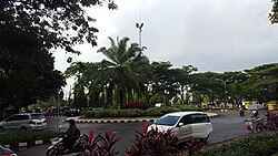
Due to the current era of globalization and modernization, this village now has become an area with the presence of many international facilities and a number of modern housings.

Geography

Parigi Lama is located close and partially part of Bintaro Jaya. Parigi Lama contains many international and national schools such as the British International School, Jakarta Japanese School (ジャカルタ日本人学校), Aulia Islamic School, Pembangunan Jaya High School, Tunas Indonesia Elementary School, Global Jaya School, and Mentari International School.[ citation needed ] There are also a number of modern housings and clusters in this area such as Discovery Serenity, Permata Bintaro, Emerald Bintaro and Graha Raya Bintaro.

There is a National Heroes cemetery in Parigi Lama, which is called "Taman Makam Bahagia ABRI" located to the south of Global Jaya International School.

Coordinates: 6°15′56″S106°41′49″E / 6.26556°S 106.69694°E / -6.26556; 106.69694

Related Research Articles

Papua (province) Province of Indonesia

Papua is the largest and easternmost province of Indonesia, comprising most of Western New Guinea. It is bordered by the state of Papua New Guinea to the east, the province of West Papua to the west, the Pacific Ocean to the north, and the Arafura Sea to the south. According to the 2010 census by Statistics Indonesia, Papua had a population of 2,833,381, the majority of whom are Christians. The 2015 Intermediate Census revealed a population of 3,143,088, while the latest official estimate is 3,347,100. The province is divided into twenty-eight regencies and one city. Its capital and largest city is Jayapura.

Cilandak is a district of South Jakarta, Indonesia. The Krukut River flows through the eastern edge of Cilandak, while the Pesanggrahan and Grogol Rivers flow through the western edge.

Tanah Abang district in Jakarta Pusat Administrative City, Indonesia

Tanah Abang is a district of Central Jakarta, Indonesia. The district hosts the biggest textile market in Southeast Asia, Tanah Abang Market. Tanah Abang District is also the location of Bung Karno Stadium and the western half of the Sudirman Central Business District.

Tanjung Priok district in Jakarta Utara Administrative City, Indonesia

Tanjung Priok is a district of North Jakarta, Indonesia. It hosts the western part of the city's main harbor, the Port of Tanjung Priok. The district of Tanjung Priok is bounded by Laksamana Yos Sudarso Tollway and Sunter River canal to the east, by Kali Japat, Kali Ancol, and the former Kemayoran Airport to the southwest, by Sunter Jaya Road and Sunter Kemayoran Road to the south, and by Jakarta Bay to the north.

Semarang City in Central Java, Indonesia

Semarang is the capital and largest city of Central Java province in Indonesia. A major port during the Dutch colonial era, and still an important regional centre and port today. The city has been named as the cleanest tourist destination in Southeast Asia by the ASEAN Clean Tourist City Standard (ACTCS) for the year of 2020 to 2022.

Tangerang City in Banten, Indonesia

Tangerang is a city in the province of Banten, Indonesia. Located on the western border of Jakarta, it is the third largest urban centre in the Greater Jakarta metropolitan area after Jakarta and Bekasi; the sixth largest city proper in the nation; and the largest city in Banten province. It has an area of 164.54 square kilometres and an official 2010 Census population of 1,798,601, which had risen to 2,043,213 at the 2015 Intermediate Census. The latest official estimate as at mid 2019 is 2,237,006 – making it the eighth most populated suburb in the world at the latter date.

Masai, Johor Town in Malaysia

Masai is an area in Pasir Gudang, Johor Bahru District, Johor, Malaysia, and is the oldest neighbourhood of Johor Bahru town. It is located 25 kilometres from the Johor Bahru city centre. Masai is located on route J10 which leads to Kong Kong, a fishing village along Johor River. The main access roads to Masai are Jalan Masai Lama(J10) and Pasir Gudang Highway(Federal Route 17).

Subdivisions of Indonesia

Indonesia is divided into provinces. Provinces are made up of regencies and cities. Provinces, regencies and cities have their own local governments and parliamentary bodies.

Duren Sawit district of Indonesia

Duren Sawit is a district (kecamatan) of East Jakarta, Indonesia. The rough boundaries of Duren Sawit are I. Gusti Ngurah Rai road to the north, Kali Sunter to the west, and Kali Malang to the south. The district borders the districts of Jatinegara to the west, Cakung and Pulo Gadung to the north, and Makasar to the south, and Bekasi to the east.

Cempaka Putih district in Jakarta Pusat Administrative City, Indonesia

Cempaka Putih is a subdistrict of Central Jakarta, Indonesia. Cempaka Putih is roughly bounded by Jenderal Ahmad Yani bypass highway to the east, Pramuka boulevard to the south, Letjend Suprapto boulevard to the north, and a railway line to the west. The name "Cempaka Putih" derived from flowering plant white champaca.

Pondok Indah is an upscale residential area in Kebayoran Lama, South Jakarta, Indonesia. Dubbed the 'Beverly Hills' of Indonesia, this is a much sought-after suburb by expatriates due to the proximity to the Jakarta Intercultural School. Ciputra & Brasali, Indonesia's pioneer real estate developers and the Murdaya family built Pondok Indah in the 70s into the most prestigious and luxurious residential complex and commercial area in Indonesia. It is now controlled by the Murdaya family's Central Cipta Murdaya Group as well as descendents of Ciputra and Brasali through the listed PT Metropolitan Kentjana Tbk.

Pesanggrahan is a subdistrict of South Jakarta, one of the administrative city which forms the capital territory of Jakarta, Indonesia. The Pesanggrahan River flows along the eastern edge of Pesanggrahan Subdistrict. To the west of Pesanggrahan Subdistrict is Tangerang Regency, Banten Province.

British School Jakarta Private international baccalaureate world school in Indonesia

The British School of Jakarta (BSJ) is an independent school in Pondok Aren, South Tangerang in Greater Jakarta, Indonesia. The British School of Jakarta is an international member of the Headmasters' and Headmistresses' Conference. It was established in Jakarta in 1973 under the auspices of the British Embassy. The main campus was relocated to Bintaro in 1994 to accommodate increasing numbers of students, and an early years centre was opened in Pondok Indah in 1999. The school offers classes for students from pre-school to year 13 based on a British curriculum, with the final two years covered by the International Baccalaureate diploma program.

Pondok Aren Town and district in Banten, Indonesia

Pondok Aren is a district in South Tangerang, Banten, Indonesia. It is located on the south-western outskirts of Jakarta. The population during the 2010 Census was 303,093. Pondok Aren district mainly covers the area of Bintaro Jaya and borders South Jakarta to the east. Pondok Aren district office is located at Jl. Graha Raya Bintaro, Perigi Baru behind the Pondok Aren Sectoral Police office.

South Tangerang City in Banten, Indonesia

South Tangerang is a city in the province of Banten, Indonesia. Located 30 km on the southwestern border of Jakarta, the city forms part of the Greater Jakarta metropolitan area. It was administratively separated from Tangerang Regency on 29 October 2008. According to the 2010 Census, its population was 1,290,322 and at the Intermediate 2015 Census this had risen to 1,538,970, while the latest official estimate in mid 2019 is 1,755,112. The total area is 147.19 km².

1987 Bintaro train crash

The 1987 Bintaro train accident occurred in Pondok Betung urban village, Bintaro, Tangerang, Indonesia on Monday 19 October 1987. Two passenger trains collided, causing 156 fatalities, making it the worst railway crash in Indonesia to date.

Global Jaya International School Private international baccalaureate world school in Indonesia

The Global Jaya School (GJS) is an International School in Indonesia, located in the outskirts of Jakarta in Pondok Aren district, South Tangerang in the Sector 9 Bintaro Jaya area. The school was established in 1995. It is accredited by the Western Association of Schools and Colleges and is an International Baccalaureate (IB) World School. The school was also previously known as "Sekolah Global Jaya" (SGJ) and "Global Jaya International School" (GJIS). Since the presidency of Joko Widodo in Indonesia, the school is now known as "Global Jaya School".

South Bekasi District in West Java, Indonesia

South Bekasi is one of the twelve districts (kecamatan) within the municipality of Bekasi, in Jakarta's greater metro area on the island of Java, Indonesia. The district covers an area of 1,605.40 hectares, and as of December 2012 had a population of 196,231. Administratively it is divided into five administrative villages (kelurahan): Jaka Mulya (Jakamulya), Jaka Setia (Jakasetia), Kayuringin Jaya, Marga Jaya (Margajaya), and Pekayon Jaya. Public schools were started in the district in 1994. As of 2013 all of the villages had health centres except for Jaka Setia.

Bintaro Jaya is a planned township developed by PT. Jaya Real Property. The development of the township began in 1979 and continues to grow to this day. This independent city was first within South Jakarta, then extended to South Tangerang within Greater Jakarta. The total land area of this satellite city is about 1000 hectares. The name Bintaro is derived from the Bintaro Village, which also takes the name of Bintaro plant, whereas Jaya came from the name of the developer.

Sunter is a neighborhood in North Jakarta, Indonesia. The neighborhood corresponds roughly with the Sunter Agung and Sunter Jaya administrative village of Tanjung Priok subdistrict of North Jakarta. Zip code of the area is 14350. The area is adjacent to Plumpang Semper in the north, Kemayoran in the west, Kelapa Gading in the east and Cempaka Mas in the south. The area probably named after Sunter River, which flows through the neighborhood. The area is a low terrain and prone to flooding during heavy rain.