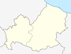
Montemitro is a small town and comune in the province of Campobasso in the Molise region of Italy, near the Trigno river.

Monte di Procida is a comune (municipality) in the Metropolitan City of Naples in the Italian region of Campania, located about 15 kilometres (9.3 mi) west of Naples, facing the island of Procida. Monte di Procida includes the small island of San Martino, which was occupied by the Germans during World War II. Its territory is included in the Campi Flegrei Regional Park.
Duronia is a comune (municipality) in the Province of Campobasso in the Italian region Molise, located about 20 kilometres (12 mi) northwest of Campobasso. As of 31 December 2004, it had a population of 473 and an area of 22.2 square kilometres (8.6 sq mi).
Mafalda is a comune (municipality) in the Province of Campobasso in the Italian region Molise, located about 45 kilometres (28 mi) north of Campobasso.
Molise is a comune (municipality) in the Province of Campobasso in the Italian region Molise, located about 15 kilometres (9 mi) northwest of Campobasso. As of 31 December 2004, it had a population of 179 and an area of 5.2 square kilometres (2.0 sq mi).
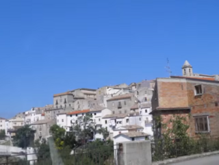
Montefalcone nel Sannio is a comune (municipality) in the Province of Campobasso in the Italian region Molise, located about 35 kilometres (22 mi) north of Campobasso.
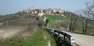
Montelongo is a comune (municipality) in the Province of Campobasso in the Italian region Molise, located about 30 kilometres (19 mi) northeast of Campobasso.
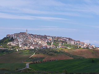
Montenero di Bisaccia is a small hill top town and comune (municipality). It is in the Province of Campobasso, which is in the region of Molise, in Italy. It is about 10 kilometres (6 mi) inland from the coast, and about 45 kilometres (28 mi) north of Campobasso. The nearest large town and airport is Pescara. Montenero di Bisaccia borders the following municipalities: Cupello, Guglionesi, Lentella, Mafalda, Montecilfone, Palata, Petacciato, San Felice del Molise, San Salvo, Tavenna.
Oratino is a comune (municipality) in the Province of Campobasso in the Italian region Molise, located about 7 kilometres (4 mi) west of Campobasso. As of 31 December 2004, it had a population of 1,326 and an area of 18.0 square kilometres (6.9 sq mi).

Palata is a comune (municipality) in the Province of Campobasso, located in the Italian region of Molise. It is situated about 35 kilometres (22 mi) northeast of Campobasso.

San Giacomo degli Schiavoni is a comune (municipality) in the Province of Campobasso in the Italian region Molise, located about 50 kilometres (31 mi) northeast of Campobasso.The settlement was formerly inhabited by an Arbëreshë community, who have since assimilated.
Sant'Angelo Limosano is a comune (municipality) in the Province of Campobasso in the Italian region Molise, located about 15 kilometres (9 mi) northwest of Campobasso. As of 31 December 2004, it had a population of 380 and an area of 16.8 square kilometres (6.5 sq mi).
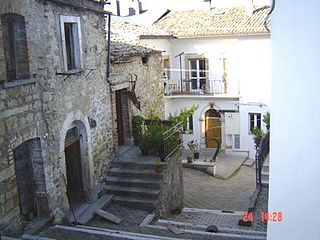
Tavenna is a comune (municipality) in the Province of Campobasso in the Italian region Molise, located about 40 kilometres (25 mi) north of Campobasso.
Carpinone is a comune (municipality) in the Province of Isernia in the Italian region Molise, located about 30 kilometres (19 mi) west of Campobasso and about 7 kilometres (4 mi) east of Isernia. As of 31 December 2004, it had a population of 1,273 and an area of 32.5 square kilometres (12.5 sq mi).
Castelpetroso is a comune (municipality) in the Province of Isernia in the Italian region Molise, located about 25 kilometres (16 mi) west of Campobasso and about 10 kilometres (6 mi) southeast of Isernia. As of 31 December 2004, it had a population of 1,708 and an area of 22.6 square kilometres (8.7 sq mi).
Castelpizzuto is a comune (municipality) in the Province of Isernia in the Italian region Molise, located about 30 kilometres (19 mi) west of Campobasso and about 11 kilometres (7 mi) southeast of Isernia. As of 31 December 2004, it had a population of 156 and an area of 15.2 square kilometres (5.9 sq mi).

Miranda is a comune (municipality) in the Province of Isernia in the Italian region Molise, located about 35 kilometres (22 mi) northwest of Campobasso and about 6 kilometres (4 mi) north of Isernia. As of 31 December 2004, it had a population of 1,065 and an area of 22.3 square kilometres (8.6 sq mi).
Pettoranello del Molise is a comune (municipality) in the Province of Isernia in the Italian region Molise, located about 30 kilometres (19 mi) west of Campobasso and about 6 kilometres (4 mi) southeast of Isernia.
Sessano del Molise is a comune (municipality) in the Province of Isernia in the Italian region Molise, located about 30 kilometres (19 mi) northwest of Campobasso and about 9 kilometres (6 mi) northeast of Isernia. As of 31 December 2004, it had a population of 871 and an area of 24.7 square kilometres (9.5 sq mi).
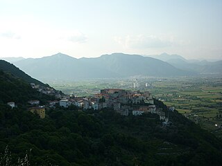
Sesto Campano is a comune (municipality) in the Province of Isernia in the Italian region Molise, located about 50 kilometres (31 mi) southwest of Campobasso and about 25 kilometres (16 mi) southwest of Isernia.


