Macchia Valfortore

Last updated
Macchia Valfortore
Comune di Macchia Valfortore
Apulia Molise Campania (2009) 07 (RaBoe).jpg
Panorama of Macchia Valfortore
MacchiaValfortore-Stemma.gif
Location of Macchia Valfortore
Macchia Valfortore
Italy provincial location map 2016.svg
Red pog.svg
Macchia Valfortore
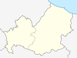
Location of Macchia Valfortore in Italy
Italy Molise location map.svg
Red pog.svg
Macchia Valfortore
Macchia Valfortore (Molise)
Coordinates: 41°36′N14°55′E / 41.600°N 14.917°E / 41.600; 14.917
Country Italy
Region Molise
Province Campobasso (CB)
Government
  MayorGianfranco Paolucci (since 2023) [1]
Area
[2]
  Total
26.77 km2 (10.34 sq mi)
Elevation
477 m (1,565 ft)
Population
 (April 2024) [3]
  Total
470
  Density18/km2 (45/sq mi)
Demonym Macchiaroli
Time zone UTC+1 (CET)
  Summer (DST) UTC+2 (CEST)
Postal code
86040
Dialing code 0874
Patron saint St. Nicholas
Saint dayDecember 6
Website Official website

Macchia Valfortore is a town and comune in the Province of Campobasso, Molise, southern Italy. With a population of 470 inhabitants. The town overlooks Lake Occhito. Neighbouring comuni are Sant'Elia a Pianisi and Pietracatella.

Contents

History

In 216 BC, a Roman army under consul Varro camped in the town called Maccla, thought to be this town, prior to marching to the defeat against Hannibal at the Battle of Cannae. [4] In 476 AD with the Western Roman Empire weakening, Maccla was occupied by the Visigoths. In the early Middle Ages it was a possession of the Lombards, who held it until 982, when they were defeated by the Byzantines.

On September 21, 1701, Gaetano Giacomo Gambacorta, styled the Prince of Macchia, started a conspiracy (Macchia Conspiracy), against the Spanish viceroy in Naples. The revolt was quickly put down and Gaetano fled to Vienna, Austria where he died on January 27, 1703. In 1800 Joseph Bonaparte, King of Naples and Napoleon's brother, divided Naples into new administrative orders. This created the Province of Campobasso which Macchia is located to this day. The suffix Valfortore was added in the 19th century.

Symbols

The municipal coat of arms depicts a tower and a cow in the upper part, symbol of the agricultural nature of the community; in the lower part are reproduced the three ancient gates of access to the town. The gonfalon is a blue cloth.

Main sights

References

  1. "Anagrafe degli Amministratori Locali e Regionali". amministratori.interno.gov.it. Retrieved 2 May 2024.
  2. "Superficie di Comuni Province e Regioni italiane al 9 ottobre 2011". Italian National Institute of Statistics. Retrieved 16 March 2019.
  3. "Bilancio demografico mensile". demo.istat.it. Retrieved 2 May 2024.
  4. "Comune di Macchia Valfortore - Prov. CB". www.comune.macchiavalfortore.cb.it. Retrieved 2 May 2024.
  5. "Chiesa di San Nicola Vescovo di Mira Istituto Diocesano Sostentamen". catalogo.beniculturali.it. Retrieved 2 May 2024.