
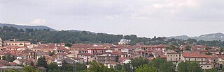
Campobasso is a city and comune in southern Italy, the capital of the region of Molise and of the province of Campobasso. It is located in the high basin of the Biferno river, surrounded by Sannio and Matese mountains.

Forenza is a town and comune in the province of Potenza, Basilicata, southern Italy. It is bounded by the comuni of Acerenza, Avigliano, Filiano, Ginestra, Maschito, Palazzo San Gervasio, Pietragalla, Ripacandida.

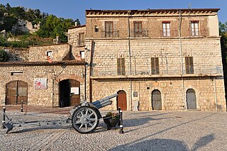
Bojano or Boiano is a town and comune in the province of Campobasso, Molise, south-central Italy.

Mirabello Sannitico is a small town in the province of Campobasso, Molise, southern Italy. The population is about 2,100 inhabitants. It has an agrarian-based culture and history, dating back to at least the 12th century. Nearby towns include Campobasso to the northwest and Vinchiaturo to the southwest. The Tappino River flows on either side of the town on the north and south.

Pagani is a town and comune in Campania, Italy, administratively part of the Province of Salerno, in the region known as the Agro nocerino-sarnese. Pagani has a population of 35,834, as of 2016.

Ferrazzano is a town and comune in the province of Campobasso, in the Italian region Molise. It is located 5 km (3 mi) south of Campobasso.
Lioni is a town and comune in the province of Avellino, Campania, southern Italy.
Taurano is a village and comune in the province of Avellino, in the Campania region of southern Italy.
Taurasi is a town and municipality in the province of Avellino, Campania, southern Italy. In antiquity it was a town in Samnium. The town's name probably derives from the Latin Taurus. Over time it changed from Taurasos to Taurasia before changing to its current form. Taurasi is best known for its increasingly famous red wine also named Taurasi, made of Aglianico grapes along with Piedirosso and Barbera grapes.

Alfedena is a comune in the province of L'Aquila of the Abruzzo region of central Italy. It is located in the Abruzzo, Lazio and Molise National Park in the upper Sangro valley, near the Monti della Meta mountain chain.
Barrea is a comune in the province of L'Aquila in the Abruzzo region of Italy.

Montesarchio is a comune in the Province of Benevento, Campania, Southern Italy. It is located 18 kilometres southwest of Benevento in the Valle Caudina at the foot of Monte Taburno. The commune was granted the official status of city (città) by a presidential decree of 31 July 1977. In 2020, it had a population of 13,226. It is one of I Borghi più belli d'Italia.

San Donato Val di Comino is a comune (municipality) in the Province of Frosinone in the Italian region Lazio, located in the Comino Valley about 110 kilometres (68 mi) east of Rome and about 40 kilometres (25 mi) east of Frosinone.
San Pietro Infine is a comune (municipality) in the Province of Caserta in the Italian region Campania, located about 70 kilometres (43 mi) northwest of Naples and about 50 kilometres (31 mi) northwest of Caserta. San Pietro Infine borders the following municipalities: Mignano Monte Lungo, San Vittore del Lazio, Venafro.

Morcone is a comune (municipality) in the Province of Benevento in the Italian region Campania, located about 70 km northeast of Naples and about 25 km northwest of Benevento. The villages (Contrade) of Morcone include: Canepino, Cuffiano, Coste, Torre, Fuschi, Piana.
Pietraroja is a mountain comune (municipality) in the province of Benevento in Campania, southern Italy. It is approximately 50 km by car from Benevento, in direction north-west, 83 km from Naples in direction north-east and approximately 223 km from Rome in direction south-east.
San Massimo is a comune (municipality) in the Province of Campobasso in the Italian region Molise, located about 25 kilometres (16 mi) southwest of Campobasso, comprising 27.6 square kilometres (10.7 sq mi).
Vinchiaturo is a comune (municipality) in the Province of Campobasso in the Italian region Molise, located about 10 kilometres (6 mi) southwest of Campobasso with a population of 3368 people (31-12-2022).

Cerro al Volturno is a comune (municipality) in the Province of Isernia, in the Italian region of Molise. It is located about 45 kilometres (28 mi) west of Campobasso, and about 10 kilometres (6 mi) northwest of Isernia.
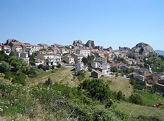
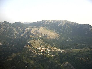
Pietrabbondante is a comune (municipality) in the Province of Isernia in the Italian region Molise, located about 30 kilometres (19 mi) northwest of Campobasso and about 20 kilometres (12 mi) northeast of Isernia.


