
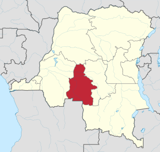
Bandundu is one of eleven former provinces of the Democratic Republic of the Congo. It bordered the provinces of Kinshasa and Bas-Congo to the west, Équateur to the north, and Kasai-Occidental to the east. The provincial capital is also called Bandundu.

Équateur was a province in the northwest of the Belgian Congo and the successor Republic of the Congo, now known as Democratic Republic of the Congo. It had its origins in the Équateur District of the Congo Free State, the private property of King Leopold II of Belgium. It was upgraded to the status of a province in 1917. Between 1933 and 1947 it was named Coquilhatville. In 1962 it was divided into three smaller provinces, but there were recombined in 1966. Équateur was one of the eleven provinces of the Democratic Republic of the Congo until 2015, when it was split into the new, smaller Équateur province, as well as the Tshuapa, Mongala, Nord-Ubangi and Sud-Ubangi provinces.
Kasaï-Occidental was one of the eleven provinces of the Democratic Republic of the Congo between 1966 and 2015, when it was split into the Kasaï-Central and the Kasaï provinces.
Mai-Ndombe is one of the 21 new provinces of the Democratic Republic of the Congo created in the 2015 repartitioning. Mai-Ndombe, Kwango, and Kwilu provinces are the result of the dismemberment of the former Bandundu province. Mai-Ndombe was formed from the Plateaux and Mai-Ndombe districts. The town of Inongo was elevated to capital city of the new province.
Yumbi is a town and territory of Mai-Ndombe in the Democratic Republic of the Congo. It lies on the eastern bank of the Congo River between Bolobo and Lukolela. The town of Yumbi is the headquarters of Yumbi Territory and has a population of approximately 30,000.

The provinces of the Democratic Republic of the Congo were divided into 26 districts. Those in turn were divided into territories or communes.
Kasongo Lunda is a town and seat of Kasongo Lunda Territory, in the Kwango Province of the Democratic Republic of the Congo. The town lies near the border with Angola to the east, here defined by the Kwango River. As of 2012 the town was estimated to have a population of 23,820.
Dungu is a territory in the Haut-Uele Province of the Democratic Republic of the Congo. The administrative center is the town of Dungu, which lies on both sides of the Uele River. The territory is divided into the Ndoromo, Maringindo and Wandu chiefdoms.
Opala is a town in the Tshopo Province of the Democratic Republic of the Congo. It is the administrative center of the Opala Sector and of the Opala Territory. The town lies on the left bank of the Lomami River.

Bas-Uélé is one of the 21 new provinces of the Democratic Republic of the Congo created in the 2015 repartitioning. Bas-Uélé, Haut-Uélé, Ituri, and Tshopo provinces are the result of the dismemberment of the former Orientale Province. Bas-Uélé was formed from the Bas-Uele District whose town of Buta was elevated to capital city of the new province.

Haut-Uélé is one of the 21 new provinces of the Democratic Republic of the Congo created in the 2015 repartitioning. Haut-Uélé, Bas-Uélé, Ituri, and Tshopo provinces are the result of the dismemberment of the former Orientale province. Haut-Uélé was formed from the Haut-Uélé district whose town of Isiro was elevated to capital city of the new province.

Tshopo is one of the 21 new provinces of the Democratic Republic of the Congo created in the 2015 repartitioning. It is situated in the north central part of the country on the Tshopo River, for which it is named.

Équateur District was a former district of the Congo Free State, Belgian Congo and Democratic Republic of the Congo. In 1914 it became part of former Équateur Province. The district went through various changes of extent and name over the years. The original district roughly corresponds to the current provinces of Équateur and Tshuapa.

Bas-Fleuve District was a district located in the Kongo Central province, in the Democratic Republic of the Congo. It included the Tshela, Lukula and Seke-Banza territories.

Mai-Ndombe District was a district of pre-2015 Bandundu Province in the Democratic Republic of the Congo. It covered roughly the same area as the colonial-era Lac Léopold II District. In 2015, it was merged with Plateaux District, all in pre-2015 Bandundu Province, to form the new Mai-Ndombe Province.
Bolobo Territory is an administrative region of Mai-Ndombe Province of the Democratic Republic of the Congo. The headquarters is the town of Bolobo. The territory lies on the east side of the Congo River, opposite the Republic of the Congo.
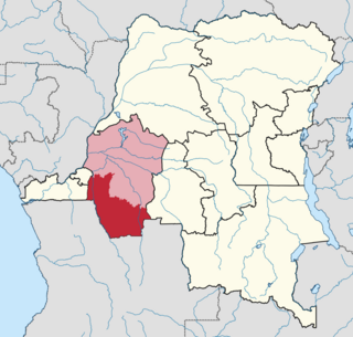
Idiofa Territory is an administrative area in the Kwilu Province of the Democratic Republic of the Congo. The capital is the town of Idiofa.
Bagata Territory is an administrative region in the Kwilu Province of the Democratic Republic of the Congo. The headquarters are in the town of Bagata. The territory is divided into five sectors: Kidzweme, Kwango-Kasai, Kwilu-Ntobere, Manzasay and Wamba-Fatunda.

Masi-Manimba is a town in Kwilu Province, Democratic Republic of the Congo, the headquarters of the Masi-Manimba Territory. As of 2012 the population was estimated to be 31,802.
Kwango District was a district of the Congo Free State, Belgian Congo and the Democratic Republic of the Congo. It went through various changes in extent. It roughly corresponded to the present provinces of Kwilu and Kwango.
