Playa, Guayanilla, Puerto Rico

Last updated
Playa
Barrio
Playa, Guayanilla, Puerto Rico locator map.png
Location of Playa within the municipality of Guayanilla shown in red
Caribbean location map.svg
Red pog.svg
Playa
Location of Puerto Rico
Coordinates: 18°00′22″N66°46′08″W / 18.006193°N 66.768995°W / 18.006193; -66.768995 [1]
Commonwealth Flag of Puerto Rico.svg  Puerto Rico
Municipality Flag of Guayanilla.svg Guayanilla
Area
[1]
  Total1.14 sq mi (3.0 km2)
  Land0.52 sq mi (1.3 km2)
  Water0.62 sq mi (1.6 km2)
Elevation
[2]
0 ft (0 m)
Population
 (2010)
  Total1,186
  Density2,280.8/sq mi (880.6/km2)
 Source: 2010 Census
Time zone UTC−4 (AST)

Playa Barrio is a rural barrio in the municipality of Guayanilla, Puerto Rico. Its population in 2010 was 1,186. [3] [4]

Contents

Features and demographics

Playa has .52 square miles (1.3 km2) of land area and .62 square miles (1.6 km2) of water area. In 2010, its population was 1,186 with a population density of 2,280.8 inhabitants per square mile (880.6/km2). [5]

Historical population
CensusPop.Note
1910 467
1920 427−8.6%
1930 56632.6%
1940 90960.6%
1950 1,28741.6%
1960 1,63527.0%
1980 1,471
1990 1,326−9.9%
2000 1,317−0.7%
2010 1,186−9.9%
U.S. Decennial Census
1900 (N/A) [6] 1910-1930 [7]
1930-1950 [8] 1980-2000 [9] 2010 [10]

History

The barrio was in Spain's gazetteers [11] until Puerto Rico was ceded by Spain in the aftermath of the Spanish–American War under the terms of the Treaty of Paris of 1898 and became an unincorporated territory of the United States. In 1899, the United States Department of War conducted a census of Puerto Rico finding that the combined population of Magas and Playa barrios was 962. [12]

See also

Related Research Articles

<span class="mw-page-title-main">Aceitunas</span> Barrio of Moca, Puerto Rico

Aceitunas is a barrio in the municipality of Moca, Puerto Rico with a population of 3,098 in 2010. The land area of this subdivision is 5.36 square miles (13.9 km2).

<span class="mw-page-title-main">Bajura, Isabela, Puerto Rico</span> Barrio of Puerto Rico

Bajura is a barrio in the municipality of Isabela, Puerto Rico. Its population in 2010 was 663.

<span class="mw-page-title-main">Barrero, Guayanilla, Puerto Rico</span> Barrio of Puerto Rico

Barrero is a rural barrio in the municipality of Guayanilla, Puerto Rico. Its population in 2010 was 839.

<span class="mw-page-title-main">Consejo, Guayanilla, Puerto Rico</span> Barrio of Puerto Rico

Consejo is a rural barrio in the municipality of Guayanilla, Puerto Rico. Its population in 2010 was 886.

<span class="mw-page-title-main">Jaguas, Guayanilla, Puerto Rico</span> Barrio of Puerto Rico

Jaguas is a rural barrio in the municipality of Guayanilla, Puerto Rico. Its population in 2010 was 1413.

<span class="mw-page-title-main">Playa, Añasco, Puerto Rico</span> Barrio of Puerto Rico

Playa is a barrio in the municipality of Añasco, Puerto Rico. Its population in 2010 was 1,498.

<span class="mw-page-title-main">Playa, Santa Isabel, Puerto Rico</span> Barrio of Puerto Rico

Playa Barrio is a barrio in the municipality of Santa Isabel, Puerto Rico. Its population in 2010 was 807.

<span class="mw-page-title-main">Tierras Nuevas Poniente</span> Barrio of Manatí, Puerto Rico

Tierras Nuevas Poniente is a rural barrio in the municipality of Manatí, Puerto Rico. Its population in 2010 was 3,614.

<span class="mw-page-title-main">Encarnación, Peñuelas, Puerto Rico</span> Barrio of Puerto Rico

Encarnación is a barrio in the municipality of Peñuelas, Puerto Rico. Its population in 2010 was 1,378.

<span class="mw-page-title-main">Viví Arriba</span> Barrio of Utuado, Puerto Rico

Viví Arriba is a barrio in the municipality of Utuado, Puerto Rico. Its population in 2010 was 748.

<span class="mw-page-title-main">Santa Isabel, Utuado, Puerto Rico</span> Barrio of Puerto Rico

Santa Isabel is a barrio in the municipality of Utuado, Puerto Rico. Its population in 2010 was 660.

<span class="mw-page-title-main">Boca, Guayanilla, Puerto Rico</span> Barrio of Puerto Rico

Boca is a rural barrio in the municipality of Guayanilla, Puerto Rico. Its population in 2010 was 1,089.

<span class="mw-page-title-main">Indios, Guayanilla, Puerto Rico</span> Barrio of Puerto Rico

Indios is a rural barrio in the municipality of Guayanilla, Puerto Rico. Its population in 2010 was 2,647.

<span class="mw-page-title-main">Llano, Guayanilla, Puerto Rico</span> Barrio of Puerto Rico

Llano is a rural barrio in the municipality of Guayanilla, Puerto Rico. Its population in 2010 was 773.

<span class="mw-page-title-main">Magas, Guayanilla, Puerto Rico</span> Barrio of Puerto Rico

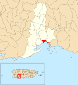
Magas is a rural barrio with an urban area in the municipality of Guayanilla, Puerto Rico. Its population in 2010 was 3,436.

<span class="mw-page-title-main">Carrizales, Hatillo, Puerto Rico</span> Barrio of Puerto Rico

Carrizales is a rural, coastal barrio in the municipality of Hatillo, Puerto Rico. Its population in 2010 was 8,066.

<span class="mw-page-title-main">Playa Sardinas I</span> Barrio of Culebra, Puerto Rico

Playa Sardinas I is a barrio in the municipality of Culebra, Puerto Rico. Its population in 2010 was 186.

<span class="mw-page-title-main">Quebradas, Guayanilla, Puerto Rico</span> Barrio of Puerto Rico

Quebradas is a rural barrio in the municipality of Guayanilla, Puerto Rico. Its population in 2010 was 2,425.

<span class="mw-page-title-main">Jobos, Guayama, Puerto Rico</span> Barrio of Puerto Rico

Jobos is a barrio in the municipality of Guayama, Puerto Rico. Its population in 2010 was 8,286.

<span class="mw-page-title-main">Tomás de Castro, Caguas, Puerto Rico</span> Barrio of Puerto Rico

Tomás de Castro is a barrio in the municipality of Caguas, Puerto Rico. Its population in 2010 was 19,414.

References

  1. 1 2 "US Gazetteer 2019". US Census. US Government.
  2. U.S. Geological Survey Geographic Names Information System: Playa barrio
  3. Picó, Rafael; Buitrago de Santiago, Zayda; Berrios, Hector H. Nueva geografía de Puerto Rico: física, económica, y social, por Rafael Picó. Con la colaboración de Zayda Buitrago de Santiago y Héctor H. Berrios. San Juan Editorial Universitaria, Universidad de Puerto Rico,1969.
  4. Gwillim Law (20 May 2015). Administrative Subdivisions of Countries: A Comprehensive World Reference, 1900 through 1998. McFarland. p. 300. ISBN   978-1-4766-0447-3 . Retrieved 25 December 2018.
  5. Puerto Rico: 2010 population and housing unit counts.pdf (PDF). U.S. Dept. of Commerce, Economics and Statistics Administration, U.S. Census Bureau. 2010.
  6. "Report of the Census of Porto Rico 1899". War Department Office Director Census of Porto Rico. Archived from the original on July 16, 2017. Retrieved September 21, 2017.
  7. "Table 3-Population of Municipalities: 1930 1920 and 1910" (PDF). United States Census Bureau. Archived (PDF) from the original on August 17, 2017. Retrieved September 21, 2017.
  8. "Table 4-Area and Population of Municipalities Urban and Rural: 1930 to 1950" (PDF). United States Census Bureau. Archived (PDF) from the original on August 30, 2015. Retrieved September 21, 2014.
  9. "Table 2 Population and Housing Units: 1960 to 2000" (PDF). United States Census Bureau. Archived (PDF) from the original on July 24, 2017. Retrieved September 21, 2017.
  10. Puerto Rico: 2010 Population and Housing Unit Counts.pdf (PDF). U.S. Dept. of Commerce Economics and Statistics Administration U.S. Census Bureau. 2010. Archived (PDF) from the original on 2017-02-20. Retrieved 2019-08-02.
  11. "Anuario del comercio, de la industria, de la magistratura y de la administración. 1881". Biblioteca Nacional de España (in Spanish). p. 1614. Retrieved 4 April 2023.
  12. Joseph Prentiss Sanger; Henry Gannett; Walter Francis Willcox (1900). Informe sobre el censo de Puerto Rico, 1899, United States. War Dept. Porto Rico Census Office (in Spanish). Imprenta del gobierno. p.  165.