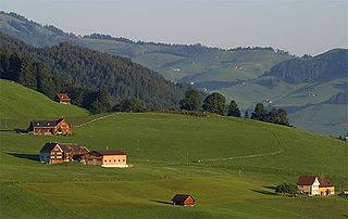
Zabukovje is a dispersed settlement below Sveti Jošt in the City Municipality of Kranj in the Upper Carniola region of Slovenia.
Podgorje pri Pišecah is a settlement in the hills west of Bizeljsko in the Municipality of Brežice in eastern Slovenia. The area was traditionally part of Styria. It is now included with the rest of the municipality in the Lower Sava Statistical Region.
Zabukovje pri Raki is a settlement in the hills west of Raka in the Municipality of Krško in eastern Slovenia. The area was traditionally part of Lower Carniola. It is now included with the rest of the municipality in the Lower Sava Statistical Region.
Podgorje pod Čerinom is a settlement in the Municipality of Vojnik in eastern Slovenia. It lies in the hills east of Frankolovo. The area was part of the traditional region of Styria. It is now included with the rest of the municipality in the Savinja Statistical Region.
Zabukovje is a small settlement in the Municipality of Vojnik in eastern Slovenia. It lies in the hills north of Nova Cerkev. It is part of the traditional region of Styria. It is now included with the rest of the municipality in the Savinja Statistical Region.
Dolenje Zabukovje is a small settlement in the hills south of Mokronog in the Municipality of Mokronog-Trebelno in southeastern Slovenia. The area is part of the historical region of Lower Carniola. The municipality is now included in the Southeast Slovenia Statistical Region.
Gorenje Zabukovje is a small settlement in the Municipality of Mokronog-Trebelno in southeastern Slovenia. It lies in the hills west of Trebelno in the historical region of Lower Carniola. The municipality is now included in the Southeast Slovenia Statistical Region.

Zabukovje is a dispersed settlement in the Municipality of Šentrupert in southeastern Slovenia. It lies in the hills west of Šentrupert and north of Mirna. The area is part of the historical region of Lower Carniola. The municipality is now included in the Southeast Slovenia Statistical Region.
Drožanje is a settlement just north of Sevnica in east-central Slovenia. The area is part of the historical region of Styria. The Municipality of Sevnica is now included in the Lower Sava Statistical Region.
Čanje is a settlement in the hills above Blanca in the Municipality of Sevnica in central Slovenia. The area is part of the historical region of Styria. The municipality is now included in the Lower Sava Statistical Region.
Kamenica is a small village northeast of Krmelj in the Municipality of Sevnica in central Slovenia. The area is part of the historical region of Lower Carniola. The municipality is now included in the Lower Sava Statistical Region. Until 2001, the settlement included the area of now autonomous settlement of Kamenško.
Metni Vrh is a dispersed settlement in the hills north of Sevnica in east-central Slovenia. The area is part of the historical region of Lower Styria. The Municipality of Sevnica is now included in the Lower Sava Statistical Region.
Mrzla Planina is a dispersed settlement in the hills northeast of Sevnica in east-central Slovenia. The area is part of the historical region of Styria. The municipality is now included in the Lower Sava Statistical Region.
Žigrski Vrh is a settlement in the Municipality of Sevnica in central Slovenia. It lies in the hills above the left bank of the Sava River east of Sevnica in the historical region of Styria. The municipality is now included in the Lower Sava Statistical Region.
Zabukovje nad Sevnico is a dispersed settlement in the hills north of Sevnica in central Slovenia. The area is part of the historical region of Styria. The Municipality of Sevnica is now included in the Lower Sava Statistical Region.
Vrh pri Boštanju is a settlement in the hills southwest of Boštanj in the Municipality of Sevnica in east-central Slovenia. The area is part of the historical region of Lower Carniola. The municipality is now included in the Lower Sava Statistical Region. The settlement includes the hamlets of Dule, Pleček, Gabrnik, Ravne, Topolovec, Grič, Hrib, Dobje, Reviše, Volčje Jame, Drče, Okič, Sleme, Drenovec, Straški Hrib, and Lipoglav.
Vranje is a settlement in the Municipality of Sevnica in central Slovenia. It lies in the hills northeast of Sevnica in the historical region of Styria. The municipality is now included in the Lower Sava Statistical Region.

The Municipality of Škocjan, established in October 1994, is a municipality in the traditional region of Lower Carniola in southeastern Slovenia. The seat of the municipality is Škocjan. The Municipality of Škocjan is now included in the Southeast Slovenia Statistical Region. The majority of the municipality is part of the Novo Mesto Administrative Unit, except for the northeastern part, which belongs to the Sevnica Administrative Unit.

Križišče is a small village in the Municipality of Sevnica in southeastern Slovenia. It lies in the valley of Kamenica Creek, northwest of the road linking Sevnica and Mokronog and east of the road linking Krmelj and Šentjanž. The village became an autonomous settlement in 2008, and was formed from parts of the settlements of Gabrje and Goveji Dol. It is part of the traditional region of Lower Carniola and is included in the Lower Sava Statistical Region. One of the two roads from Krmelj to the main road linking Mokronog and Sevnica runs through the settlement. The rail line from Sevnica to Trebnje runs past the southeastern border of the settlement.
Kamenško is a small village in the Municipality of Sevnica in southeastern Slovenia. It lies on a small rise northeast of Krmelj, east of the road connecting Krmelj and Šentjanž, above and to the north of the villages of Brezje and Kamenica. Until 2001, the area was part of the settlement of Kamenica. The village is part of the traditional region of Lower Carniola and is included in the Lower Sava Statistical Region.