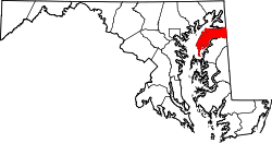
Pomona is an unincorporated community in Kent County, Maryland, United States. [1] It is located at the intersection of MD-289 (Quaker Neck Road) and Pomona Road, 4.5 miles southwest of Chestertown. Pomona is home to the last remaining country store in Kent County.
Clark's Conveniency was listed on the National Register of Historic Places in 1975. [2]
Wells Township is a township in Fulton County, Pennsylvania, United States. The population was 477 at the 2010 census. Wells Township was initially settled in 1760. It was originally known as Aughwick Township when it was incorporated in 1849. The name was changed to Wells Township on April 2, 1850.
Shawboro is an unincorporated community located in Currituck County, North Carolina, United States.
Churchville is an unincorporated community in Harford County, Maryland, United States, situated between the county seat, Bel Air, and Aberdeen, where the Aberdeen Proving Ground is located.
Conowingo is a community in western Cecil County, Maryland, United States.
New Kent is a census-designated place (CDP) in and the county seat of New Kent County, Virginia, United States. The population as of the 2010 Census was 239.
Deer Creek is a 52.9-mile-long (85.1 km) river in Maryland and Pennsylvania that flows through the scenic areas of Harford County and empties into the Susquehanna River, roughly halfway between the Interstate 95 bridge and Conowingo Dam. Its watershed area is 171 square miles (440 km2). Its watershed area in MD is 145 square miles (380 km2), with 3% impervious surface in 1994. It serves as a divider between the agricultural and urban/suburban areas of Harford County.
Lineboro is an unincorporated community located in northeastern Carroll County, Maryland, United States. The community was named for its founder, Jonathan Line. Coincidentally, its name refers to its location near the Mason–Dixon line.
Lower Marlboro, is a small, waterfront unincorporated community located at the crossroads of MD 262 and Chaneyville Road in Calvert County, Maryland, United States, along the east bank of the Patuxent River.
Jackson Township is one of thirteen townships in Parke County, Indiana, United States. As of the 2010 census, its population was 737 and it contained 475 housing units.
Forest Hill is an unincorporated community in Harford County, Maryland, United States, located north of the county seat of Bel Air. The main part of town is located at the intersection of Maryland Route 24 and Jarrettsville Road. Until 1958, this community was served by the Maryland and Pennsylvania Railroad at milepost 30.3.
Hague is an unincorporated community in Westmoreland County, in the U. S. state of Virginia.
Tucker Hill is an unincorporated community in Westmoreland County, in the U. S. state of Virginia.
Chesterville is an unincorporated community in Kent County, Maryland, United States. It is located at the intersection of Maryland routes 290 and Maryland Route 447|447.
Sassafras is an unincorporated community in Kent County, Maryland, United States. The Lanthim House, built in the 1720s, served as a general store.
Berkley is an unincorporated community in Harford County, Maryland, United States. Rigbie House was listed on the National Register of Historic Places in 1973.
Creswell is an unincorporated community in Harford County, Maryland, United States. Fair Meadows was listed on the National Register of Historic Places in 1980.
Emmorton is an unincorporated community in Harford County, Maryland, United States. St. Mary's Church was listed on the National Register of Historic Places in 1973.
Whiteford is an unincorporated community in Harford County, Maryland, United States. The community has historically had a strong Welsh heritage, which is reflected in the local architecture.
Little Heaven is an unincorporated community in Kent County, Delaware. Its elevation is 26 ft (7.9 m) and its position 39°02′30″N75°27′24″W. It is north of Frederica at the interchange between Delaware Route 1 and Bowers Beach Road/Clapham Road.
Colonias, New Mexico is a community, and somewhat of a ghost town, in Guadalupe County, New Mexico. It is located within the Anton Chico Land Grant, on New Mexico State Road 379 about 14 miles (23 km) northwest of Santa Rosa, New Mexico. Online maps point to a current community, which is in the same location as the ghost town.
Coordinates: 39°9′44″N76°6′35″W / 39.16222°N 76.10972°W