Butlertown, Maryland | |
|---|---|
 Butlertown  Butlertown | |
| Coordinates: 39°16′57″N76°06′16″W / 39.28250°N 76.10444°W | |
| Country | |
| State | |
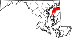
| County | |
| Area | |
• Total | 0.82 sq mi (2.14 km2) |
| • Land | 0.82 sq mi (2.12 km2) |
| • Water | 0.01 sq mi (0.02 km2) |
| Elevation | 82 ft (25 m) |
| Population (2020) | |
• Total | 520 |
| • Density | 635.70/sq mi (245.33/km2) |
| Time zone | UTC−5 (Eastern (EST)) |
| • Summer (DST) | UTC−4 (EDT) |
| ZIP code | 21678 [2] |
| Area codes | 410 & 443 |
| FIPS code | 24-11900 |
| GNIS feature ID | 589868 [3] |
Butlertown is an unincorporated community and census-designated place in Kent County, Maryland, United States. [3] Per the 2020 census, the population was 520. [4]