Chesapeake Landing, Maryland

Last updated
Chesapeake Landing
USA Maryland location map.svg
Red pog.svg
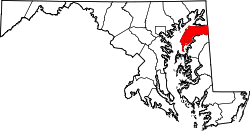
Chesapeake Landing
Location within the state of Maryland
Usa edcp location map.svg
Red pog.svg
Chesapeake Landing
Chesapeake Landing (the United States)
Coordinates: Coordinates: 39°16′12″N76°09′29″W / 39.270°N 76.158°W / 39.270; -76.158
Country Flag of the United States.svg  United States of America
State Flag of Maryland.svg  Maryland
County Kent
Area
[1]
  Total1.13 sq mi (2.92 km2)
  Land1.00 sq mi (2.59 km2)
  Water0.13 sq mi (0.33 km2)
Population
 (2020)
  Total472
  Density471.53/sq mi (182.01/km2)
Time zone UTC-5 (Eastern (EST))
  Summer (DST) UTC-4 (EDT)
FIPS code 24-16025

Chesapeake Landing is a census designated place in Kent County, Maryland, United States. [2] [3] Per the 2020 Census, the population was 472. [4]

Contents

Demographics

Historical population
CensusPop.
2020 472
U.S. Decennial Census [5]
2020 [6]

2020 census

Chesapeake Landing CDP, Maryland - Demographic Profile
(NH = Non-Hispanic)
Race / EthnicityPop 2020 [6] % 2020
White alone (NH)38781.99%
Black or African American alone (NH)469.75%
Native American or Alaska Native alone (NH)10.21%
Asian alone (NH)20.42%
Pacific Islander alone (NH)00.00%
Some Other Race alone (NH)10.21%
Mixed Race/Multi-Racial (NH)265.51%
Hispanic or Latino (any race)91.91%
Total472100.00%

Note: the US Census treats Hispanic/Latino as an ethnic category. This table excludes Latinos from the racial categories and assigns them to a separate category. Hispanics/Latinos can be of any race.

Related Research Articles

Lisbon, Maryland Census-designated place in Maryland

Lisbon is a census-designated place located in western Howard County in the state of Maryland, United States, located roughly between Baltimore and Frederick and north of Washington, D.C. It is contained in an area of roughly one square mile. Lisbon is located along Interstate 70 and Maryland Route 144 and is home to the first roundabout in Maryland. It first appeared as a CDP in the 2020 Census with a population of 282.

Romancoke is a census-designated place on Queen Anne's in Maryland, United States, located at the southern terminus of Maryland Route 8. Romancoke was changed from an unincorporated community to a census-designated place for the 2020 Census listing a population of 1,855. The name "Romancoke" comes from the Algonquian word for "circling of the water." William Claiborne, who founded Kent Island, also had a plantation in Virginia named Romancoke.

Silver Hill is an unincorporated community and census-designated place (CDP) in Prince George's County, Maryland, United States, approximately 1 mile (1.6 km) southeast of Washington, D.C. Per the 2020 census, the population was 6,381. Prior to 2010, Silver Hill was part of the Suitland-Silver Hill census-designated place.

Still Pond is a census-designated place in Kent County, Maryland, United States. Still Pond is located at the intersection of Maryland routes 292 and 566 on Still Pond Neck, south-southeast of Betterton and north of Chestertown. Much of the community is included in the Still Pond Historic District and it is notable as the first place in Maryland in which women gained the right to vote.

Cedar Heights is an census designated place in Prince George's County, Maryland, United States. Per the 2020 Census, the population was 1,597.

Callaway is a census designated place in St. Mary's County, Maryland, United States. The elevation is 105 feet (32 m). Per the 2020 Census, the population was 1,779.

Graceham, Maryland Unincorporated community in Maryland, United States

Graceham is an unincorporated community and a census designated place since 2020 in Frederick County, Maryland, United States. Graceham is home to Graceham Moravian Church and Parsonage. Per the 2020 Census, the population was 243.

Crumpton is a census-designated place in Queen Anne's County, Maryland, United States. Crumpton is located along the Chester River, 5 miles (8.0 km) west-southwest of Millington. Crumpton has a post office with the ZIP code 21628.

Cedarville is an unincorporated community and census-designated place in southern Prince George's County, Maryland, United States. As of the 2020 census the population was 639.

Fairwood is an unincorporated area and census-designated place (CDP) in Prince George's County, Maryland, United States. The population was 7,983 at the 2020 census.

Marlboro Meadows, Maryland Census-designated place in Maryland

Marlboro Meadows is an unincorporated community and census-designated place (CDP) in Prince George's County, Maryland, United States. Per the 2020 census, the population was 3,655. It was newly delineated for the 2010 census prior to which the area was part of the Greater Upper Marlboro census-designated place.

Marlboro Village is an unincorporated community and census-designated place (CDP) in Prince George's County, Maryland, United States. Per the 2020 census, the population was 9,221. It was newly delineated for the 2010 census prior to which the area was part of the Greater Upper Marlboro census-designated place.

Melwood is an unincorporated community and census-designated place (CDP) in Prince George's County, Maryland, United States. It was newly delineated for the 2010 census, at which time its population was 3,051. Per the 2020 census, the population was 3,977.

Queensland is a census-designated place near Upper Marlboro in Prince George's County, Maryland, United States. The population of the CDP was 2,191 at the 2020 census. It was formerly known as Queenland until 2014 when its name was changed to Queensland and a small portion of its geography was transferred to Upper Marlboro.

Maryland Park is an census designated place in Prince George's County, Maryland, United States. It first appeared as a CDP in the 2020 Census with a population of 965.

Brown Station is an census designated place in Prince George's County, Maryland, United States. Per the 2020 Census, the population was 3,298.

Ten Mile Creek is a census designated place in Montgomery County, Maryland, United States. It first appeared as a CDP prior to the 2020 Census with a population was 1,012.

Flower Hill is an census designated place in Montgomery County, Maryland, United States. It has a population of 14,108 as of its first recording in the 2020 census.

Honeygo is a census designated place in Baltimore County, Maryland, United States. It first appeared as a CDP in the 2020 Census with a population of 12,927.

Wildewood is a planned community and census-designated place (CDP) in St. Mary's County, Maryland, United States. It is in east-central St. Mary's County, 7 miles (11 km) east of Leonardtown, the county seat, and 58 miles (93 km) southeast of Washington, D.C. It is bordered to the east by the unincorporated community of California.

References

  1. "2020 U.S. Gazetteer Files". United States Census Bureau. Retrieved April 26, 2022.
  2. "Chesapeake Landing Census Designated Place". Geographic Names Information System . United States Geological Survey . Retrieved 15 March 2021.
  3. "TIGERweb v18.0". Decennial IT Division for Geography Division, U.S. Census Bureau. Retrieved 26 February 2021.
  4. "Chesapeake Landing CDP, Maryland". United States Census Bureau . Retrieved March 13, 2022.
  5. "Decennial Census of Population and Housing by Decades". US Census Bureau.
  6. 1 2 "P2 HISPANIC OR LATINO, AND NOT HISPANIC OR LATINO BY RACE - 2020: DEC Redistricting Data (PL 94-171) - Chesapeake Landing CDP, Maryland". United States Census Bureau .