

Sassafras is an unincorporated community in Kent County, Maryland, United States. [2] The Lanthim House, built in the 1720s, served as a general store. [3]
Contents
Nearby Rich Hill was listed on the National Register of Historic Places in 1972. [4]
Sassafras is an unincorporated community in Kent County, Maryland, United States. [2] The Lanthim House, built in the 1720s, served as a general store. [3]
Nearby Rich Hill was listed on the National Register of Historic Places in 1972. [4]
It is in the Kent County Public Schools. Kent County Middle School is in Chestertown, and Kent County High School is in an unincorporated area, in the Butlertown CDP with a Worton postal address.
The community was formerly assigned to Millington Elementary School. [5] In 2017 the school board voted to close Millington Elementary School. [6]
Municipalities and communities of Kent County, Maryland, United States | ||
|---|---|---|
| Towns | 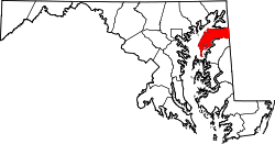 | |
| CDPs | ||
| Unincorporated communities | ||
| Footnotes | ‡This populated place also has portions in an adjacent county or counties | |
39°22′22″N75°48′7.2″W / 39.37278°N 75.802000°W