Darjeeling Sadar subdivision is a subdivision of the Darjeeling district in the state of West Bengal, India.
Jorebungalow is a village in the Jorebunglow Sukhiapokhri CD block in the Darjeeling Sadar subdivision of the Darjeeling district in the Indian state of West Bengal.
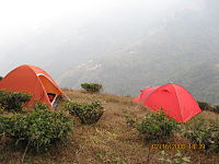
Maney Bhanjyang is a small transit-town in the Darjeeling Sadar subdivision, Darjeeling district in the state of West Bengal in India. It is located at the gateway of the Singalila National Park, 28 km away from Darjeeling town. The income of the local residents is geared towards tourism, especially foreign trekkers. Maney Bhanjyang is the start of the trailhead for the trek to Sandakphu on the Singalila Ridge, the highest point in West Bengal. Conveyance for Sandakphu is also available mainly from Maney Bhanjyang in the form of Land Rovers of 1960 model. The 4-hour ride can be quite 'jumpy' as drivers maneuver their prized possessions along snaky curves and uphill roads.

Sukhiapokhri is a census town in the Jorebunglow Sukhiapokhri CD block in the Darjeeling Sadar subdivision of the Darjeeling district in the indian state of West Bengal. It is located 11 km from Ghum on the way to Mirik.
Phansidewa is a community development block that forms an administrative division in the Siliguri subdivision of the Darjeeling district in the Indian state of West Bengal.

Soureni is a village in the Mirik CD block in the Mirik subdivision of the Darjeeling district, in West Bengal, India.
Matigara is a community development block that forms an administrative division in the Siliguri subdivision of the Darjeeling district in the Indian state of West Bengal.

Sonada is a census town in the Jorebunglow Sukhiapokhri CD block in the Darjeeling Sadar subdivision of the Darjeeling District in West Bengal, India.
Kharibari is a community development block that forms an administrative division in the Siliguri subdivision of the Darjeeling district in the Indian state of West Bengal.
Darjeeling Pulbazar is a community development block that forms an administrative division in the Darjeeling Sadar subdivision of the Darjeeling district in the Indian state of West Bengal.
Jorebunglow Sukhiapokhri is a community development block that forms an administrative division in the Darjeeling Sadar subdivision of the Darjeeling district in the Indian state of West Bengal.
Rangli Rangliot is a community development block that forms an administrative division in the Darjeeling Sadar subdivision of the Darjeeling district in the Indian state of West Bengal.
Kalimpong I is a community development block that forms an administrative division in the Kalimpong subdivision of the Kalimpong district in the Indian state of West Bengal.
Kalimpong II is a community development block that forms an administrative division in the Kalimpong subdivision of the Kalimpong district in the Indian state of West Bengal.
Gorubathan is a community development block that forms an administrative division in the Kalimpong subdivision of the Kalimpong district in the Indian state of West Bengal.
Mirik is a community development block that forms an administrative division in the Mirik subdivision of the Darjeeling district in the Indian state of West Bengal.
Kurseong is a community development block that forms an administrative division in the Kurseong subdivision of the Darjeeling district in the Indian state of West Bengal.
Naxalbari is a community development block that forms an administrative division in the Siliguri subdivision of the Darjeeling district in the Indian state of West Bengal.
Rongmook Ceder Tea Garden is a census town in the Jorebunglow Sukhiapokhri CD block in the Darjeeling Sadar subdivision of the Darjeeling district in the state of West Bengal, India.
Mangarjung Tea Garden (Nagri) is a census town in the Jorebunglow Sukhiapokhri CD block in the Darjeeling Sadar subdivision of the Darjeeling district in the state of West Bengal, India.