Porac, Pampanga

Last updated
Porac
Municipality of Porac
Porac road-sign.jpg
Welcome Arch
Porac.png
Seal
Ph locator pampanga porac.png
Map of Pampanga with Porac highlighted
OpenStreetMap
Porac, Pampanga
Philippines location map (square).svg
Red pog.svg
Porac
Location within the Philippines
Coordinates: 15°04′19″N120°32′31″E / 15.0719°N 120.5419°E / 15.0719; 120.5419 Coordinates: 15°04′19″N120°32′31″E / 15.0719°N 120.5419°E / 15.0719; 120.5419
Country Flag of the Philippines.svg  Philippines
Region Central Luzon (Region III)
Province Pampanga
District 2nd District
Founded October 31, 1594 [1]
Barangays 29 (see Barangays)
Government
[2]
  Type Sangguniang Bayan
   Mayor Jaime "Jing" V. Capil
   Vice Mayor Charlie O. Santos
   Congressman Juan Miguel M. Arroyo
   Electorate 66,579 voters (2019)
Area
[3]
  Total314.00 km2 (121.24 sq mi)
Population
 (2015 census) [4]
  Total124,381
  Density400/km2 (1,000/sq mi)
   Households
27,156
Economy
   Income class 1st municipal income class
   Poverty incidence 11.1% (2015) [5]
   Revenue ₱297,776,423.37 (2016)
Time zone UTC+8 (PST)
ZIP code
2008
PSGC
IDD : area code +63(0)45
Climate type tropical monsoon climate
Native languages Kapampangan
Mag-indi language
Tagalog
Website www.poracpampanga.gov.ph

Porac, officially the Municipality of Porac (Kapampangan : Balen ning Porac; Filipino : Bayan ng Porac), is a 1st class municipality in the province of Pampanga, Philippines. According to the 2015 census, it has a population of 124,381 people. [4]

Contents

The Subic-Clark-Tarlac Expressway (SCTEx) traverses this town, the exit of which is located in Barangay Manuali.

With an area of 31,400 hectares (78,000 acres), Porac is the largest town in Pampanga. It was once among the largest municipalities in the archipelago before it was divided into separate municipalities.

History

Porac was founded on October 31, 1594, upon acceptance by Fray Mateo Peralta in the Friar's Intermediate Chapter (recorded by Fray Gaspar de San Agustin, by saying Porac has its First Minister and Friar, Fray Mateo de Mendoza.

The General Headquarters and Military Camp Base of the Philippine Commonwealth Army and Philippine Constabulary was stationed in Porac from 1942 to 1946 and the local military operates against the Imperial Japanese military and local collaborators from 1942 to 1945. The Mexican Expeditionary Air Force were given a base around Porac to help liberate the country from the Japanese Empire in World War II. (Marker: October 31, 2008, 412th Anniversary of Porac). [6]

Geography

Porac is 26 kilometres (16 mi) west from the provincial capital San Fernando, south of Angeles and north of Floridablanca. A portion of Mount Pinatubo is in the municipality.

Porac has a hilly to mountainous terrain in the majority of its plains. Most rivers, if not all, are heavily silted by mudflow due to the eruption of Mount Pinatubo and succeeding lahar flows. Tourist spots include Darabulbul Falls (nicknamed Dara Falls) in Jalung, Miyamit Falls in Sapang Uwak, and the hot springs of Sitio Puning, accessed through Sapang Bato in Angeles. Babo Pangulo offers a view of Porac and Mount Negron.

Barangays

Porac is politically subdivided into 29 barangays.

  • Babo Pangulo
  • Babo Sacan (Guanson)
  • Balubad
  • Calzadang Bayu
  • Camias
  • Cangatba
  • Diaz
  • Dolores (Hacienda Dolores)
  • Inararo (Aetas)
  • Jalung
  • Mancatian
  • Manibaug Libutad
  • Manibaug Paralaya
  • Manibaug Pasig
  • Manuali
  • Mitla Proper
  • Palat
  • Pias
  • Pio
  • Planas
  • Poblacion
  • Pulung Santol
  • Salu
  • San Jose Mitla
  • Santa Cruz
  • Sapang Uwak (Aetas)
  • Sepung Bulaun (Baidbid)
  • Siñura (Seniora)
  • Villa Maria (Aetas)

Climate

The town of Porac has two distinct climates, rainy and dry. The rainy or wet season normally begins in May and runs through October, while the rest of the year is the dry season. The warmest period of the year occurs between March and April, while the coolest period is from December through February.

Climate data for Porac, Pampanga
MonthJanFebMarAprMayJunJulAugSepOctNovDecYear
Average high °C (°F)30
(86)
31
(88)
33
(91)
34
(93)
33
(91)
31
(88)
29
(84)
29
(84)
29
(84)
30
(86)
31
(88)
30
(86)
31
(87)
Average low °C (°F)19
(66)
20
(68)
21
(70)
23
(73)
25
(77)
25
(77)
25
(77)
25
(77)
24
(75)
23
(73)
22
(72)
20
(68)
23
(73)
Average precipitation mm (inches)8
(0.3)
9
(0.4)
15
(0.6)
34
(1.3)
138
(5.4)
203
(8.0)
242
(9.5)
233
(9.2)
201
(7.9)
126
(5.0)
50
(2.0)
21
(0.8)
1,280
(50.4)
Average rainy days3.74.16.511.221.224.927.726.525.521.812.65.6191.3
Source: Meteoblue [7]

Demographics

Population census of Porac
YearPop.±% p.a.
1903 8,487    
1918 10,243+1.26%
1939 16,169+2.20%
1948 14,685−1.06%
1960 23,449+3.98%
1970 36,232+4.44%
1975 44,462+4.19%
YearPop.±% p.a.
1980 50,906+2.74%
1990 68,215+2.97%
1995 75,408+1.90%
2000 80,757+1.48%
2007 102,962+3.41%
2015 124,381+2.39%
Source: Philippine Statistics Authority [4] [8] [9] [10]

In the 2015 census, the population of Porac, Pampanga, was 124,381 people, [4] with a density of 400 inhabitants per square kilometre or 1,000 inhabitants per square mile.

Economy

Porac is an important source of granite and a tamping ground of minerals. [11]

Porac is home to the Mekeni Food Corporation, an "AAA" Meat Processing Plant accredited with the National Meat Inspection Service (NMIS). Being classified under the "AAA" category, it is qualified to market its products, not just in the local, but in the international market as well. This means that it is compliant to all government regulatory requirements to assure food quality and safety in its operations (Sun Star, 2006).

In 2014, Ayala Land and Leonio Land embarked on developing a mixed-used estate in Porac known as Alviera. The development project combines business, residential, recreational, leisure, and institutional. The local government dubbed Alviera as the regional growth center of Central Luzon. Now, it is a premiere tourist destination in the north. [12]

Local government

Town hall Poractownhalljf.JPG
Town hall

The municipal government is divided into three branches: executive, legislative and judiciary. The judicial branch is administered solely by the Supreme Court of the Philippines. The executive branch is composed of the mayor and the barangay captains for the barangays. The legislative branch is composed of the Sangguniang Bayan (town assembly), Sangguniang Barangay (barangay council), and the Sangguniang Kabataan for the youth sector.

Spanish-era Roman Catholic churches

Facade of Santa Catalina de Alejandria Parish Church Poracpampangajfa.JPG
Façade of Santa Catalina de Alejandria Parish Church

Since the founding of the town of Porac in 1867, [13] various Roman Catholic structures have been built in the area to aid in the religious practices of the devout Kapampangans. As of writing, three notable Spanish-era religious structures are extant within the municipality. The largest of the three, the Santa Catalina de Alejandria Church is located at Barangay Poblacion and still functions as one of Porac’s main parochial structures. The other two are currently utilized as barangay chapels.

Santa Catalina de Alejandria Church

The Santa Catalina de Alejandria parish church is under the jurisdiction of the Roman Catholic Archdiocese of San Fernando. Its original structure, built in 1872, is largely intact but slight revisions have been made to the inside. It underwent restoration in the 1980s. The church is 52 metres (171 ft) long, 12 metres (39 ft) wide and 9 metres (30 ft) high. [14]

Pio Chapel

The 1861 Pio Chapel is a circular chapel built by Don Felino Gil, founder of the Escuela de Artes y Oficios (now the Don Honorio Ventura Technical State University). [15]

Hacienda Dolores Chapel

Another vintage chapel is located at Barangay Dolores, north of the Porac town proper. The Our Lady of Sorrows Chapel was said to be built by the Dolores family within the old Hacienda Dolores in 1856. [16] The chapel, like the Pio chapel, is currently utilized as a community chapel. The chapel boasts of a slender octagonal belfry and Doric columns adorning the two-level façade. Notable features of the chapel are finials found on both levels of the façade.

Archaeology

The area in and around Babo Balukbuk in Porac has strong indications of human habitation, according to investigations published on the University of the Philippines Archaeological Studies Program website. Later test excavations confirmed this conclusion through the presence of materials dated around 12th century to 17th century C.E. [17]

Images

Related Research Articles

Pampanga Province in Central Luzon, Philippines

Pampanga is a province in the Central Luzon region of the Philippines. Lying on the northern shore of Manila Bay, Pampanga is bordered by Tarlac to the north, Nueva Ecija to the northeast, Bulacan to the east, the Manila Bay to the central-south, Bataan to the southwest and Zambales to the west. Its capital is the City of San Fernando. Angeles, while geographically within Pampanga, is classified as a first-class, highly urbanized city and is governed independently of the province.

Lubao Municipality in Central Luzon, Philippines

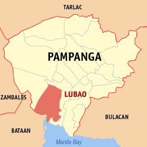
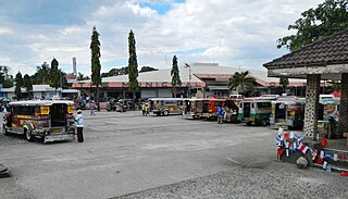
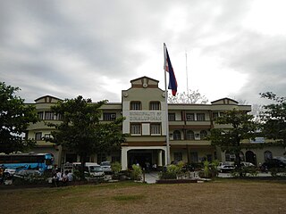
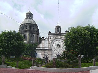
Lubao, officially the Municipality of Lubao, is a 1st class municipality in the province of Pampanga, Philippines. According to the 2015 census, it has a population of 160,838 people.

Mabalacat Component city in Central Luzon, Philippines

Mabalacat, officially the City of Mabalacat, is a 3rd class component city in the province of Pampanga, Philippines. According to the 2015 census, it has a population of 250,799 people.

Floridablanca, Pampanga Municipality in Central Luzon, Philippines

Floridablanca, officially the Municipality of Floridablanca is a 1st class municipality in the province of Pampanga, Philippines. According to the 2015 census, it has a population of 125,163 people. Floridablanca is a part of the province of the Pampanga located in Central Luzon lying north of Dinalupihan, Bataan and south-southwest of San Fernando, Pampanga.

Botolan Municipality in Central Luzon, Philippines

Botolan, officially the Municipality of Botolan, is a 1st class municipality in the province of Zambales, Philippines. According to the 2015 census, it has a population of 57,707 people.

Dinalupihan Municipality in Central Luzon, Philippines

Dinalupihan, officially the Municipality of Dinalupihan, is a 1st class municipality in the province of Bataan, Philippines. According to the 2015 census, it has a population of 106,371 people.

Pilar, Bataan Municipality in Central Luzon, Philippines

Pilar, officially the Municipality of Pilar, is a 3rd class municipality in the province of Bataan, Philippines. According to the 2015 census, it has a population of 41,823 people.

Bacolor, Pampanga Municipality in Central Luzon, Philippines

Bacolor, officially the Municipality of Bacolor, is a 3rd class municipality in the province of Pampanga, Philippines. According to the 2015 census, it has a population of 39,460 people.

Macabebe Municipality in Central Luzon, Philippines

Macabebe, officially the Municipality of Macabebe, is a 1st class municipality in the province of Pampanga, Philippines. According to the 2015 census, it has a population of 75,850 people.

Minalin Municipality in Central Luzon, Philippines

Minalin, officially the Municipality of Minalin, is a 4th class municipality in the province of Pampanga, Philippines. According to the 2015 census, it has a population of 47,713 people.

San Luis, Pampanga Municipality in Central Luzon, Philippines

San Luis, officially the Municipality of San Luis, is a 3rd class municipality in the province of Pampanga, Philippines. According to the 2015 census, it had a population of 54,106 people.

Santa Ana, Pampanga Municipality in Central Luzon, Philippines

Santa Ana, officially the Municipality of Santa Ana, is a 3rd class municipality in the province of Pampanga, Philippines. According to the 2015 census, it has a population of 55,178 people.

San Simon, Pampanga Municipality in Central Luzon, Philippines

San Simon, officially the Municipality of San Simon, is a 3rd class municipality in the province of Pampanga, Philippines. According to the 2015 census, it has a population of 53,198 people.

Santa Rita, Pampanga Municipality in Central Luzon, Philippines

Santa Rita, officially the Municipality of Santa Rita, is a 4th class municipality in the province of Pampanga, Philippines. According to the 2015 census, it has a population of 40,979 people.

Doña Remedios Trinidad Municipality in Central Luzon, Philippines

Doña Remedios Trinidad, officially the Municipality of Doña Remedios Trinidad, is a 1st class municipality in the province of Bulacan, Philippines. According to the 2015 census, it has a population of 22,663 people.

Norzagaray Municipality in Central Luzon, Philippines

Norzagaray, officially the Municipality of Norzagaray, is a 1st class municipality in the province of Bulacan, Philippines. According to the 2015 census, it has a population of 111,348 people.

Capas Municipality in Central Luzon, Philippines

Capas, officially the Municipality of Capas, is a 1st class municipality in the province of Tarlac, Philippines, and one of the richest towns in the province. The town also consists of numerous subdivisions and exclusive villages.

Tarlac City Component city in Central Luzon, Philippines

Tarlac City, officially the City of Tarlac, is a 1st class component city and capital of the province of Tarlac, Philippines. According to the 2015 census, it has a population of 342,493 people.

Victoria, Tarlac Municipality in Central Luzon, Philippines

Victoria, officially the Municipality of Victoria, is a 2nd class municipality in the province of Tarlac, Philippines. According to the 2015 census, it has a population of 63,715 people.

General Mamerto Natividad Municipality in Central Luzon, Philippines

General Mamerto Natividad, officially the Municipality of General Mamerto Natividad, also known as Gen. M. Natividad, is a 4th class municipality in the province of Nueva Ecija, Philippines. According to the 2015 census, it has a population of 41,656 people.

References

  1. https://www.sunstar.com.ph/article/1772002
  2. "Municipality". Quezon City, Philippines: Department of the Interior and Local Government. Retrieved 31 May 2013.
  3. "Province: Pampanga". PSGC Interactive. Quezon City, Philippines: Philippine Statistics Authority . Retrieved 12 November 2016.
  4. 1 2 3 4 Census of Population (2015). "Region III (Central Luzon)". Total Population by Province, City, Municipality and Barangay. PSA . Retrieved 20 June 2016.
  5. "PSA releases the 2015 Municipal and City Level Poverty Estimates". Quezon City, Philippines. Retrieved 1 January 2020.
  6. "Archived copy". Archived from the original on 2013-04-25. Retrieved 2012-11-05.CS1 maint: archived copy as title (link)
  7. "Porac: Average Temperatures and Rainfall". Meteoblue. Retrieved 5 May 2020.
  8. Census of Population and Housing (2010). "Region III (Central Luzon)". Total Population by Province, City, Municipality and Barangay. NSO . Retrieved 29 June 2016.
  9. Censuses of Population (1903–2007). "Region III (Central Luzon)". Table 1. Population Enumerated in Various Censuses by Province/Highly Urbanized City: 1903 to 2007. NSO.
  10. "Province of Pampanga". Municipality Population Data. Local Water Utilities Administration Research Division. Retrieved 17 December 2016.
  11. "Porac". electronic Kabalen. Retrieved 14 December 2012.
  12. Ladaw, D. "Risen from the ashes", Inquirer, 2014
  13. "History of Porac, Pampanga". www.poracpampanga.gov.ph. Retrieved 9 November 2014.
  14. http://pampanga.islandsphilippines.com/natural.php
  15. Henares, Ivan. "Pampanga: Pio Chapel and the ethics of transferring heritage structures". www.ivanhenares.com. Retrieved 9 November 2014.
  16. "Dolores chapel". www.flickr.com. Retrieved 9 November 2014.
  17. UPD ASP Website, Archaeological Sites & Introduction >