Sainte-Anne is a city in the southern part of Grande-Terre, Guadeloupe in the French West Indies It is one of the most popular tourist destinations of the island, along with Le Gosier and Saint-François).

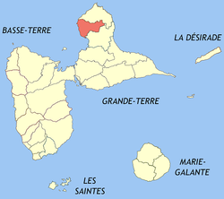
Anse-Bertrand is a commune in Guadeloupe, an overseas region and department of France in the Lesser Antilles.
Baie-Mahault is a commune in the overseas department and region of Guadeloupe, France. It is the second most populated commune of Guadeloupe, after Les Abymes. The extensive industrial zone of Jarry in Baie-Mahault is by far the most industrialized commune in the islands and the largest industrial park in the Lesser Antilles. It is part of the urban area of Pointe-à-Pitre, the largest metropolitan area in Guadeloupe, located in the northwest.

Bouillante is a commune in the French overseas region and department of Guadeloupe, in the Lesser Antilles.

Capesterre-Belle-Eau is a commune in the French overseas region and department of Guadeloupe, in the Lesser Antilles. It is located in the south-east of Basse-Terre Island. Capesterre-Belle-Eau covers an area of 103.3 km2. The 1999 population was 19,568. The population density is 189 persons per km2. The inhabitants are called Capesterriens.

Pointe-à-Pitre is the second largest city of Guadeloupe after Les Abymes. Guadeloupe is an overseas region and department of France located in the Lesser Antilles, of which it is a sous-préfecture, being the seat of the Arrondissement of Pointe-à-Pitre.

Le Gosier is a commune in the French overseas region and department of Guadeloupe, in the Lesser Antilles. It is located on the south side of the island of Grande-Terre and part of the urban unit of Pointe-à-Pitre-Les Abymes, the largest conurbation in Guadeloupe.

Petit-Bourg is the seventh-largest commune in the French overseas department of Guadeloupe. It is located on the east side of the island of Basse-Terre, and is part of the metropolitan area of Pointe-à-Pitre, the largest metropolitan area in Guadeloupe.

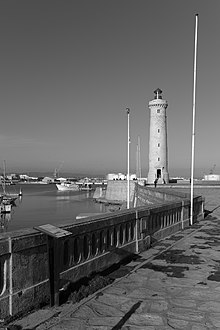
Le Moule is the sixth-largest commune in the French overseas department of Guadeloupe. It is located on the northeast side of the island of Grande-Terre.

Gourbeyre is a commune in the French overseas region and department of Guadeloupe, in the Lesser Antilles. It is a suburb of the city of Basse-Terre.

Pointe-Noire is a commune on Guadeloupe, a French overseas department in the Caribbean. It is located on the northwest coast of the island of Basse-Terre.

Vieux-Habitants is a commune on Guadeloupe, a French overseas department in the Caribbean. It is located on the southwest coast of the island of Basse-Terre.

Goyave is a commune in the French overseas region and department of Guadeloupe, Lesser Antilles. It is part of the urban area of Pointe-à-Pitre, the largest metropolitan area in Guadeloupe.
Lamentin is a commune in the French overseas department and region of Guadeloupe. It is part of the agglomeration of Pointe-à-Pitre, in the north part of Basse-Terre. Three islets are included in the commune: Christopher, Fajou, Caret.

Saint-Claude is a commune in the French overseas department of Guadeloupe. It lies in the interior of southern Basse-Terre Island, just northeast of the capital city of Basse-Terre.

Morne-à-l'Eau is a commune located in the department of Guadeloupe.

Petit-Canal is a commune in the department of Guadeloupe. Petit-Canal is a coastal commune on Grande-Terre.

Sainte-Rose is a commune in the department of Guadeloupe. It is the second largest commune of Guadeloupe, in terms of area, after Petit-Bourg. Sainte-Rose lies on the coast of the island of Basse-Terre.

Saint-Louis is a commune in the overseas department of Guadeloupe. Saint-Louis lies on the north of the island of Marie-Galante, and is the island's largest commune. Many beaches lie on the west coast of the commune.

Trois-Rivières is a commune in the overseas department of Guadeloupe, and the chef-lieu of the Canton of Trois-Rivières. It is on the south coast of the island of Basse-Terre. It is surrounded with the towns of Capesterre-Belle-Eau, Vieux-Fort and Gourbeyre.