
Basse-Terre is a commune in the French overseas department of Guadeloupe, in the Lesser Antilles. It is also the prefecture of Guadeloupe. The city of Basse-Terre is located on Basse-Terre Island, the western half of Guadeloupe.
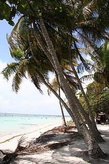
Sainte-Anne is a city in the southern part of Grande-Terre, Guadeloupe in the French West Indies It is one of the most popular tourist destinations of the island, along with Le Gosier and Saint-François).
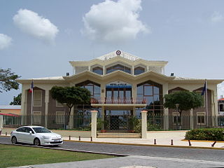
Baie-Mahault is a commune in the overseas department and region of Guadeloupe, France. It is the second most populated commune of Guadeloupe, after Les Abymes. The extensive industrial zone of Jarry in Baie-Mahault is by far the most industrialized commune in the islands and the largest industrial park in the Lesser Antilles. It is part of the urban area of Pointe-à-Pitre, the largest metropolitan area in Guadeloupe, located in the northwest.

Bouillante is a commune in the French overseas region and department of Guadeloupe, in the Lesser Antilles.

Baillif is a commune of Guadeloupe, an overseas region and department of France located in the Lesser Antilles. Baillif is a suburb of Basse-Terre, the prefecture and second-largest urban area of Guadeloupe located on Basse-Terre Island.

Capesterre-Belle-Eau is a commune in the French overseas region and department of Guadeloupe, in the Lesser Antilles. It is located in the south-east of Basse-Terre Island. Capesterre-Belle-Eau covers an area of 103.3 km2. The 1999 population was 19,568. The population density is 189 persons per km2. The inhabitants are called Capesterriens.

Pointe-à-Pitre is the second largest city of Guadeloupe after Les Abymes. Guadeloupe is an overseas region and department of France located in the Lesser Antilles, of which it is a sous-préfecture, being the seat of the Arrondissement of Pointe-à-Pitre.

Le Gosier is a commune in the French overseas region and department of Guadeloupe, in the Lesser Antilles. It is located on the south side of the island of Grande-Terre and part of the urban unit of Pointe-à-Pitre-Les Abymes, the largest conurbation in Guadeloupe.

Petit-Bourg is the seventh-largest commune in the French overseas department of Guadeloupe. It is located on the east side of the island of Basse-Terre, and is part of the metropolitan area of Pointe-à-Pitre, the largest metropolitan area in Guadeloupe.

Le Moule is the sixth-largest commune in the French overseas department of Guadeloupe. It is located on the northeast side of the island of Grande-Terre.

Pointe-Noire is a commune on Guadeloupe, a French overseas department in the Caribbean. It is located on the northwest coast of the island of Basse-Terre.

Vieux-Habitants is a commune on Guadeloupe, a French overseas department in the Caribbean. It is located on the southwest coast of the island of Basse-Terre.

Goyave is a commune in the French overseas region and department of Guadeloupe, Lesser Antilles. It is part of the urban area of Pointe-à-Pitre, the largest metropolitan area in Guadeloupe.
Lamentin is a commune in the French overseas department and region of Guadeloupe. It is part of the agglomeration of Pointe-à-Pitre, in the north part of Basse-Terre. Three islets are included in the commune: Christopher, Fajou, Caret.

Saint-Claude is a commune in the French overseas department of Guadeloupe. It lies in the interior of southern Basse-Terre Island, just northeast of the capital city of Basse-Terre.

Morne-à-l'Eau is a commune located in the department of Guadeloupe.
Petit-Canal is a commune in the department of Guadeloupe. Petit-Canal is a coastal commune on Grande-Terre.

Sainte-Rose is a commune in the department of Guadeloupe. It is the second largest commune of Guadeloupe, in terms of area, after Petit-Bourg. Sainte-Rose lies on the coast of the island of Basse-Terre.

Trois-Rivières is a commune in the overseas department of Guadeloupe, and the chef-lieu of the Canton of Trois-Rivières. It is on the south coast of the island of Basse-Terre. It is surrounded with the towns of Capesterre-Belle-Eau, Vieux-Fort and Gourbeyre.

La Désirade is a commune in the French overseas region and department of Guadeloupe, in the Lesser Antilles. The commune of La Désirade is made up of the island of La Désirade and the uninhabited Petite Terre Islands located about 10 kilometres (6 mi) south of it.


