Private town

Last updated

Private towns [lower-alpha 1] in Polish-Lithuanian Commonwealth were privately owned towns within the lands owned by magnates, bishops, knights, princes, etc.

Contents

Zamosc in the 17th century Braun and Hogenberg Zamosc.jpg
Zamość in the 17th century

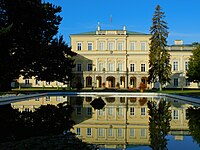
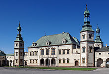
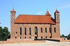
Amongst the most well-known former private magnate towns are Białystok, Zamość, Rzeszów, Puławy, Tarnów, Siedlce, Biała Podlaska, Ivano-Frankivsk, Ternopil and Uman. Magnate palaces and castles can be often found in former private magnate towns. Examples include the Branicki Palace in Białystok, the Czartoryski Palace in Puławy, the Zamoyski Palace in Zamość, the Lubomirski Castle in Rzeszów, the Radziwiłł Palace in Biała Podlaska, the Ogiński Palace in Siedlce, the Potocki Palaces in Międzyrzec Podlaski, Tulchyn and Vysokaye, the Wiśniowiecki Palace in Vyshnivets, the Zbaraski Castle in Zbarazh.

Also various other landmarks were often founded by the owners, including town halls, churches, monasteries, schools, theatres, etc., some rather unique, like the Mannerist Kalwaria Zebrzydowska Park and Baroque fortified Berdychiv Carmelite Monastery.

Some of the most known former private bishop towns include Łódź, Kielce, Łowicz, Pabianice and Skierniewice.

List of private towns

CityPopulation
(2015) [1] [2]
Former ownersCountryAdministrative division
1. Białystok 295,282 House of Branicki (Gryf) Flag of Poland.svg  Poland Podlaskie Voivodeship
2. Poltava (Połtawa)294,962 House of Wiśniowiecki,
House of Koniecpolski
Flag of Ukraine.svg  Ukraine Poltava Oblast
3. Rivne (Równe)249,639 House of Ostrogski,
House of Lubomirski
Flag of Ukraine.svg  Ukraine Rivne Oblast
4. Ivano-Frankivsk (Stanisławów)228,575 House of Potocki Flag of Ukraine.svg  Ukraine Ivano-Frankivsk Oblast
5. Ternopil (Tarnopol)217,773 House of Tarnowski,
House of Ostrogski,
House of Zamoyski
Flag of Ukraine.svg  Ukraine Ternopil Oblast
6. Rzeszów 183,108House of LubomirskiFlag of Poland.svg  Poland Podkarpackie Voivodeship
7. Tarnów 112,120House of TarnowskiFlag of Poland.svg  Poland Lesser Poland Voivodeship
8. Maladzyechna (Mołodeczno)94,686 House of Sapieha,
House of Gosiewski,
House of Ogiński
Flag of Belarus.svg  Belarus Minsk Region
9. Uman (Humań)86,451House of PotockiFlag of Ukraine.svg  Ukraine Cherkasy Oblast
10. Berdychiv (Berdyczów)77,788 House of Tyszkiewicz,
House of Zawisza,
House of Radziwiłł
Flag of Ukraine.svg  Ukraine Zhytomyr Oblast
11. Siedlce 76,347House of OgińskiFlag of Poland.svg  Poland Masovian Voivodeship
12. Zhlobin (Żłobin)75,700 House of Chodkiewicz

Bona Sforza

Flag of Belarus.svg  Belarus Gomel Region
13. Ostrów Wielkopolski 72,890House of PrzebendowskiFlag of Poland.svg  Poland Greater Poland Voivodeship
14. Ostrowiec Świętokrzyski 72,277House of TarnowskiFlag of Poland.svg  Poland Świętokrzyskie Voivodeship
15. Smila (Smiła)68,618House of LubomirskiFlag of Ukraine.svg  Ukraine Cherkasy Oblast
16. Chervonohrad (Krystynopol)67,863House of PotockiFlag of Ukraine.svg  Ukraine Lviv Oblast
17. Kalush (Kałusz)67,631 House of Sieniawski Flag of Ukraine.svg  Ukraine Ivano-Frankivsk Oblast
18. Zamość 65,255House of ZamoyskiFlag of Poland.svg  Poland Lublin Voivodeship
19. Leszno 64,589 House of Leszczyński, [3]
House of Sułkowski
Flag of Poland.svg  Poland Greater Poland Voivodeship
20. Zhodzina (Żodzino)63,722 House of Radziwiłł Flag of Belarus.svg  Belarus Minsk Region

Private clergy towns

Former private clergy towns by population as of 2015:

CityPopulation
(2015)
Former ownersCountry
(2023)
Administrative division (2023)
1. Łódź 711,332 Diocese of Kujawy [4] Flag of Poland.svg  Poland Łódź Voivodeship
2. Kielce 199,870 Diocese of Kraków Flag of Poland.svg  Poland Świętokrzyskie Voivodeship
3. Olsztyn 174,675 Diocese of Warmia Flag of Poland.svg  Poland Warmian-Masurian Voivodeship
4. Włocławek 114,885Diocese of KujawyFlag of Poland.svg  Poland Kuyavian-Pomeranian Voivodeship
5. Suwałki 69,317 Camaldolese Flag of Poland.svg  Poland Podlaskie Voivodeship
6. Pabianice 67,688Diocese of Kraków [5] Flag of Poland.svg  Poland Łódź Voivodeship
7. Skierniewice 48,634 Archdiocese of Gniezno Flag of Poland.svg  Poland Łódź Voivodeship
8. Fastiv (Fastów)47,869 Diocese of Kyiv Flag of Ukraine.svg  Ukraine Kyiv Oblast
9. Marijampolė (Mariampol)38,345 Marians Flag of Lithuania.svg  Lithuania Marijampolė County
10. Czeladź 32,940Diocese of KrakówFlag of Poland.svg  Poland Silesian Voivodeship

See also

Notes

  1. Belarusian: прыватныя гарады, Lithuanian: privatūs miestai, Polish: prywatne miasta, Ukrainian: приватні міста.

Related Research Articles

<span class="mw-page-title-main">Poddębice</span> Place in Łódź Voivodeship, Poland

Poddębice is a town in central Poland, in Łódź Voivodeship, about 40 km northwest of Łódź. It is the capital of Poddębice County. Population is 7,245 (2020). It is located within the historic Łęczyca Land.

<span class="mw-page-title-main">Koniecpol</span> Place in Silesian Voivodeship, Poland

Koniecpol is a town in Częstochowa County, Silesian Voivodeship, Poland, with 5,910 inhabitants (2019). It is located in the historic Sieradz Land.

<span class="mw-page-title-main">Grabów nad Prosną</span> Place in Greater Poland Voivodeship, Poland

Grabów nad Prosną is a town in Ostrzeszów County, Greater Poland Voivodeship, Poland, with about 1,900 inhabitants.

<span class="mw-page-title-main">Rzgów</span> Place in Łódź Voivodeship, Poland

Rzgów is a town in Łódź East County, Łódź Voivodeship, in central Poland, with 3,382 inhabitants (2020). It is situated on the Ner River within the Sieradz Land. The town is a member of Cittaslow.
<span class="mw-page-title-main">Dąbrowice, Kutno County</span> Town in Łódź Voivodeship, Poland

Dąbrowice is a town in Kutno County, Łódź Voivodeship, in central Poland. It is the seat of the gmina called Gmina Dąbrowice. It lies approximately 22 kilometres (14 mi) north-west of Kutno and 65 km (40 mi) north-west of the regional capital Łódź. It is located within the historic Łęczyca Land.
<span class="mw-page-title-main">Oporów, Łódź Voivodeship</span> Village in Łódź Voivodeship, Poland

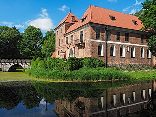
Oporów is a village in Kutno County, Łódź Voivodeship, in central Poland. It is the seat of the gmina called Gmina Oporów. It's 14 kilometres (9 mi) east of Kutno and 53 km (33 mi) north of the regional capital Łódź.

<span class="mw-page-title-main">Grabów, Łęczyca County</span> Town in Łódź Voivodeship, Poland

Grabów is a town in Łęczyca County, Łódź Voivodeship, in central Poland. It is the seat of the gmina called Gmina Grabów. It lies approximately 16 kilometres (10 mi) north-west of Łęczyca and 50 km (31 mi) north-west of the regional capital Łódź. It is located within the historic Łęczyca Land.

Bielawska Wieś is a village in the administrative district of Gmina Bielawy, within Łowicz County, Łódź Voivodeship, in central Poland. It lies approximately 20 kilometres (12 mi) west of Łowicz and 36 km (22 mi) north of the regional capital Łódź.

<span class="mw-page-title-main">Bielawy, Łowicz County</span> Village in Łódź Voivodeship, Poland

Bielawy is a village in Łowicz County, Łódź Voivodeship, in central Poland. It is the seat of the gmina called Gmina Bielawy. It lies approximately 20 kilometres (12 mi) west of Łowicz and 34 km (21 mi) north of the regional capital Łódź. It is located in Łęczyca Land.

Gosławice is a village in the administrative district of Gmina Bielawy, within Łowicz County, Łódź Voivodeship, in central Poland. It lies approximately 3 kilometres (2 mi) south-west of Bielawy, 22 km (14 mi) west of Łowicz, and 32 km (20 mi) north of the regional capital Łódź.

<span class="mw-page-title-main">Psary, Łowicz County</span> Village in Łódź Voivodeship, Poland

Psary is a village in the administrative district of Gmina Bielawy, within Łowicz County, Łódź Voivodeship, in central Poland. It lies approximately 4 kilometres (2 mi) south of Bielawy, 21 km (13 mi) west of Łowicz, and 31 km (19 mi) north-east of the regional capital Łódź. It is located in Łęczyca Land.

Wola Gosławska is a village in the administrative district of Gmina Bielawy, within Łowicz County, Łódź Voivodeship, in central Poland. It lies approximately 24 kilometres (15 mi) west of Łowicz and 31 km (19 mi) north of the regional capital Łódź.

Szczukocice is a village in the administrative district of Gmina Gorzkowice, within Piotrków County, Łódź Voivodeship, in central Poland. It lies approximately 3 kilometres (2 mi) south-west of Gorzkowice, 24 km (15 mi) south of Piotrków Trybunalski, and 66 km (41 mi) south of the regional capital Łódź.
<span class="mw-page-title-main">Żytno</span> Village in Łódź Voivodeship, Poland

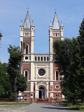
Żytno is a village in Radomsko County, Łódź Voivodeship, in central Poland. It is the seat of the Gmina called Gmina Żytno. It lies approximately 20 kilometres (12 mi) south-east of Radomsko and 96 km (60 mi) south of the regional capital Łódź. It is located in the historic Sieradz Land.

<span class="mw-page-title-main">Toporów, Łódź Voivodeship</span> Village in Łódź Voivodeship, Poland

Toporów is a village in the administrative district of Gmina Wierzchlas, within Wieluń County, Łódź Voivodeship, in south-central Poland. It lies approximately 8 kilometres (5 mi) south-east of Wierzchlas, 14 km (9 mi) south-east of Wieluń, and 87 km (54 mi) south-west of the regional capital Łódź.

<span class="mw-page-title-main">Bratoszewice</span> Village in Łódź Voivodeship, Poland

Bratoszewice is a village in the administrative district of Gmina Stryków, within Zgierz County, Łódź Voivodeship, in central Poland. It lies approximately 6 kilometres (4 mi) north-east of Stryków, 20 km (12 mi) north-east of Zgierz, and 22 km (14 mi) north-east of the regional capital Łódź. It is located in Łęczyca Land.
<span class="mw-page-title-main">Koźle, Łódź Voivodeship</span> Village in Łódź Voivodeship, Poland

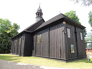
Koźle is a village in the administrative district of Gmina Stryków, within Zgierz County, Łódź Voivodeship, in central Poland. It lies approximately 5 kilometres (3 mi) north-west of Stryków, 16 km (10 mi) north-east of Zgierz, and 20 km (12 mi) north-east of the regional capital Łódź.

<span class="mw-page-title-main">Staw, Kalisz County</span> Village in Greater Poland Voivodeship, Poland

Staw is a village in the administrative district of Gmina Szczytniki, within Kalisz County, Greater Poland Voivodeship, in west-central Poland. It lies approximately 22 kilometres (14 mi) east of Kalisz and 126 km (78 mi) south-east of the regional capital Poznań. It is located in the Sieradz Land.

Wodziczna is a village in the administrative district of Gmina Trzcinica, within Kępno County, Greater Poland Voivodeship, in west-central Poland. It lies approximately 16 kilometres (10 mi) south of Kępno and 159 km (99 mi) south-east of the regional capital Poznań.

<span class="mw-page-title-main">Grzegorzew</span> Village in Greater Poland Voivodeship, Poland

Grzegorzew is a village in Koło County, Greater Poland Voivodeship, in central Poland. It is the seat of the gmina called Gmina Grzegorzew. It lies approximately 6 kilometres (4 mi) south-east of Koło and 125 km (78 mi) east of the regional capital Poznań. It is located in the Łęczyca Land.

References

  1. "Lista miast w Polsce (spis miast, mapa miast, liczba ludności, powierzchnia, wyszukiwarka)". Polska w liczbach.
  2. "zb_chnnu2016pdf ZIP file".
  3. Atlas historyczny Polski. Wielkopolska w drugiej połowie XVI wieku. Część II. Komentarz, indeksy (in Polish). Warszawa: Instytut Historii Polskiej Akademii Nauk. 2017. p. 254.
  4. Atlas historyczny Polski. Województwo sieradzkie i województwo łęczyckie w drugiej połowie XVI wieku. Część II. Komentarz, indeksy (in Polish). Warszawa: Instytut Historii Polskiej Akademii Nauk. 1998. p. 67.
  5. Atlas historyczny Polski. Województwo sieradzkie i województwo łęczyckie w drugiej połowie XVI wieku. Część II. Komentarz, indeksy (in Polish). Warszawa: Instytut Historii Polskiej Akademii Nauk. 1998. p. 68.