Pureba, South Australia

Last updated

Pureba
South Australia
Australia South Australia location map.svg
Red pog.svg
Pureba
Coordinates 31°57′22″S134°12′35″E / 31.956240°S 134.209670°E / -31.956240; 134.209670 Coordinates: 31°57′22″S134°12′35″E / 31.956240°S 134.209670°E / -31.956240; 134.209670 [1]
Population0 (SAL 2016) [2] [3]
Established1999 [4]
Postcode(s) 5680 [5]
Time zone ACST (UTC+9:30)
 • Summer (DST) ACST (UTC+10:30)
Location
LGA(s)
Region Eyre Western [7]
County Dufferin [1]
Way [1]
State electorate(s) Flinders [8]
Giles [9]
Federal division(s) Grey [10]
Mean max temp [11] Mean min temp [11] Annual rainfall [11]
23.5 °C
74 °F
10.4 °C
51 °F
294.6 mm
11.6 in
Suburbs around Pureba:
See Surrounding localities
FootnotesLocations [5] [1]
Adjoining localities [1]

Pureba is a locality in the Australian state of South Australia located on the west coast of Eyre Peninsula and on land to the immediate north of the peninsula about 528 kilometres (328 miles) north-west of the state capital of Adelaide and about 52 kilometres (32 miles) north-east and 90 kilometres (56 miles) north respectively of the municipal seats of Ceduna and Streaky Bay. [1] [5]

Pureba's boundaries were created in January 1999 with its name ultimately derived from Pureba Hill, a hill located within its boundaries. [1] [12] Pureba’s boundaries were altered on 26 April 2013 “to ensure the whole of the Pureba Conservation Park is within the locality of the same name.” [1]

The land use within Pureba is mainly concerned with the Pureba Conservation Park, although “approved mineral exploration and mining” is allowed under the National Parks and Wildlife Act 1972 . [13]

Pureba is located within the federal division of Grey, the state electoral district of Giles, the local government areas of the District Council of Ceduna and the District Council of Streaky Bay, and the state’s Pastoral Unincorporated Area. [10] [8] [1] [6]

Surrounding localities

Pureba is surrounded by the following localities gazetted under the South Australian Geographical Names Act 1991: [14]

Related Research Articles

<span class="mw-page-title-main">District Council of Ceduna</span> Local government area in South Australia

The District Council of Ceduna is a local government area located on the far west coast of the Eyre Peninsula in South Australia. The district has a diverse business and industry with an estimated 240,000 tourists passing through every year. The township of Ceduna is the focal point of the district.

Perlubie is a locality in the Australian state of South Australia located on the west coast of Eyre Peninsula about 472 kilometres (293 mi) north-west of the state capital of Adelaide and about 24 kilometres (15 mi) north-east of the municipal seat of Streaky Bay.

<span class="mw-page-title-main">Nullarbor, South Australia</span> Town in South Australia

Nullarbor is a locality in the Australian state of South Australia located 295 kilometres (183 mi) to the west of the town of Ceduna in the western part of the state immediately adjoining the border with Western Australia.

<span class="mw-page-title-main">Yumbarra Conservation Park</span> Protected area in South Australia

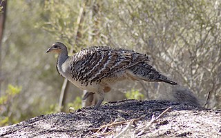
Yumbarra Conservation Park, formerly the Yumbarra National Park, is a protected area in the Australian state of South Australia located about 55 kilometres north of the town centre of Ceduna.

Calca is a small township around 20 kilometres (12 mi) south-east of Streaky Bay, on the southern border of the Calpatanna Waterhole Conservation Park, Eyre Peninsula.

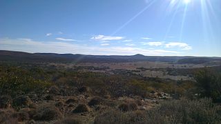
Yellabinna is a locality in the Australian state of South Australia located to the north of the town of Ceduna in the western part of the state.

Koonibba is a locality and an associated Aboriginal community in South Australia located about 586 kilometres (364 mi) northwest of the state capital of Adelaide and about 38 km (24 mi) northwest of the municipal seat in Ceduna and 5 km (3.1 mi) north of the Eyre Highway.

<span class="mw-page-title-main">Mortana, South Australia</span> Suburb of District Council of Streaky Bay, South Australia

Mortana is a rural locality in South Australia, located on the Eyre Peninsula. It is traversed by the Flinders Highway. The boundaries for the locality were established in April 2001 in respect of the long established local name.

<span class="mw-page-title-main">Gawler Ranges, South Australia</span> Suburb of Pastoral Unincorporated Area, Wudinna District Council, South Australia

Gawler Ranges is a locality in the Australian state of South Australia located on Eyre Peninsula about 380 kilometres north-west of the Adelaide city centre and about 48 kilometres north of the town centre of Wudinna and which is associated with the protected area known as the Gawler Ranges National Park.

<span class="mw-page-title-main">Sleaford, South Australia</span> Suburb of District Council of Lower Eyre Peninsula, South Australia

Sleaford is a locality in the Australian state of South Australia located at the southern tip of the Eyre Peninsula overlooking the Great Australian Bight about 260 kilometres west of the state capital of Adelaide and about 17 kilometres west of the municipal seat of Port Lincoln.

<span class="mw-page-title-main">Lake Gilles, South Australia</span> Suburb of Pastoral Unincorporated Area, South Australia

Lake Gilles is a locality in the Australian state of South Australia located on the Eyre Peninsula about 278 kilometres north west of the state capital of Adelaide and about 35 kilometres to the north-east of the town of Kimba.

Laura Bay is a locality in the Australian state of South Australia located on the west coast of the Eyre Peninsula overlooking the Great Australian Bight about 533 kilometres north-west of the Adelaide city centre and about 19 kilometres south east of the town centre of Ceduna.

Nadia is a locality in the Australian state of South Australia located on the state's west coast overlooking a bay associated with Great Australian Bight about 567 kilometres north-west of the Adelaide city centre and about 17 kilometres west of the town centre of Ceduna.

Charra is a locality in the Australian state of South Australia located on the state’s west coast overlooking the Great Australian Bight about 584 kilometres north-west of the state capital of Adelaide and about 33 kilometres west of the municipal seat of Ceduna.

Bookabie is a town and locality in the Australian state of South Australia located on the state’s west coast overlooking the Great Australian Bight about 648 kilometres north-west of the state capital of Adelaide and about 103 kilometres west of the town centre of Ceduna.

Boondina Conservation Park is a protected area in the Australian state of South Australia located in the west of the state in the gazetted locality of Yellabinna about 38 kilometres (24 mi) north-east of the town centre in Fowlers Bay.

Pureba Conservation Park is a protected area in the Australian state of South Australia located in the west of the state in the gazetted locality of Pureba about 74 kilometres (46 mi) east of the town centre in Ceduna.

<span class="mw-page-title-main">County of Way</span> Cadastral in South Australia

The County of Way is one of the 49 counties of South Australia on the state's west coast. It was proclaimed circa 1889 by Governor William Robinson and named for Samuel Way, the Chief Justice of the state's Supreme Court at the time.

Kellidie Bay is a locality in the Australian state of South Australia located on the Eyre Peninsula in the state’s west overlooking parts of the body of water known as Coffin Bay about 290 kilometres (180 mi) west of the state capital of Adelaide and about 42 kilometres (26 mi) south-west of the municipal seat of Cummins.

Moseley is a locality in the Australian state of South Australia located on the Eyre Peninsula about 286 kilometres (178 mi) north-west of the state capital of Adelaide and about 14 kilometres (8.7 mi) north-east of the municipal seat in Kimba.

References

Notes
  1. The locality of Kondoolka appears twice in the list of adjoining localities for Pureba's eastern boundary because Yondoolka fully surrounds the locality of Pinjarra Station on all sides except on the boundary with Pureba.
Citations
  1. 1 2 3 4 5 6 7 8 9 10 11 12 "Search results for 'Pureba, LOCB' with the following datasets being selected – 'NPW and Conservation Properties'. 'Suburbs and Localities', 'Counties', 'Local Government Areas', 'SA Government Regions' and 'Gazetteer'". Location SA Map Viewer. Government of South Australia. Retrieved 10 June 2018.
  2. Australian Bureau of Statistics (27 June 2017). "Pureba (Suburb and Locality)". Australian Census 2016.  OOjs UI icon edit-ltr-progressive.svg
  3. Australian Bureau of Statistics (27 June 2017). "Pureba (Suburb and Locality)". Australian Census 2016 QuickStats. Retrieved 28 June 2022.  OOjs UI icon edit-ltr-progressive.svg
  4. Kentish, R.M. (28 January 1999). "GEOGRAPHICAL NAMES ACT 1991 Notice to Assign Boundaries and Names to Places (in the District Council of Ceduna)" (PDF). The South Australian Government Gazette. South Australian Government. p. 610. Retrieved 9 June 2018.
  5. 1 2 3 "Postcode for Pureba, South Australia (Postcode)". postcodes-australia.com. Retrieved 23 January 2017.
  6. 1 2 "Development Plan, Land Not Within a Council Area Eyre, Far North, Riverland and Whyalla Consolidated – 18 October 2012". Department of Planning Transport and Infrastructure. 2012. pp. 110, 162 and 167. Archived from the original on 24 September 2015. Retrieved 4 September 2015.
  7. "Eyre Western SA Government region" (PDF). The Government of South Australia. Retrieved 10 October 2014.
  8. 1 2 "District of Flinders Background Profile". Electoral Commission SA. Retrieved 9 September 2015.
  9. "District of Giles Background Profile". ELECTORAL COMMISSION SA. Retrieved 20 August 2015.
  10. 1 2 "Federal electoral division of Grey" (PDF). Australian Electoral Commission. Retrieved 24 July 2015.
  11. 1 2 3 "Monthly climate statistics: Summary statistics CEDUNA AMO (nearest weather station)". Commonwealth of Australia , Bureau of Meteorology. Retrieved 21 July 2016.
  12. "Search result for "Pureba Conservation Park" (Record no SA0057155 with the following layers selected - "Suburbs and Localities" and "Place names (gazetteer)"". Property Location Browser. Government of South Australia. Archived from the original on 12 October 2016. Retrieved 23 January 2017.
  13. "Yellabinna Reserves Management Plan" (PDF). Department of Environment, Water and Natural Resources (DEWNR). 2013. p. 1. Retrieved 23 January 2017.
  14. Proposed Locality Boundaries for Pastoral Areas (PDF) (Map). Department for Planning, Transport and Infrastructure, Government of South Australia. 31 October 2012. Rack Plan 951. Archived from the original (PDF) on 23 September 2015. Retrieved 5 September 2015.