Pîtres

Last updated • a couple of secsFrom Wikipedia, The Free Encyclopedia

Pîtres
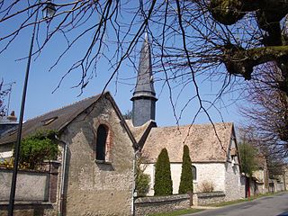
Eglise Pitres3.jpg
The church in Pîtres
Blason ville fr Pitres (Eure).svg
Location of Pîtres
Pitres
France location map-Regions and departements-2016.svg
Red pog.svg
Pîtres
Normandie region location map.svg
Red pog.svg
Pîtres
Coordinates: 49°19′13″N1°13′37″E / 49.3203°N 1.2269°E / 49.3203; 1.2269
Country France
Region Normandy
Department Eure
Arrondissement Les Andelys
Canton Pont-de-l'Arche
Intercommunality CA Seine-Eure
Government
  Mayor (20202026) Florence Lambert [1]
Area
1
10.97 km2 (4.24 sq mi)
Population
 (2021) [2]
2,596
  Density240/km2 (610/sq mi)
Time zone UTC+01:00 (CET)
  Summer (DST) UTC+02:00 (CEST)
INSEE/Postal code
27458 /27590
Elevation7–138 m (23–453 ft)
(avg. 14 m or 46 ft)
1 French Land Register data, which excludes lakes, ponds, glaciers > 1 km2 (0.386 sq mi or 247 acres) and river estuaries.

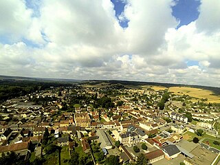
Pîtres (French pronunciation: [pitʁ] ; medieval Pistres) is a commune in the Eure department in Normandy in north-western France. It lies on the Seine.

Contents

History

Historically, it had a bridge to prevent Vikings from sailing up the river to Paris. It was here that King Charles the Bald promulgated the Edict of Pîtres in 864.

Economy

The metal processing company Manoir Industries was founded in 1917.

Population

Historical population
YearPop.±% p.a.
1793 1,000    
1800 1,053+0.74%
1806 971−1.34%
1821 963−0.06%
1831 990+0.28%
1836 1,045+1.09%
1841 1,026−0.37%
1846 1,028+0.04%
1851 1,074+0.88%
1856 980−1.82%
1861 930−1.04%
1866 914−0.35%
1872 905−0.16%
1876 888−0.47%
1881 1,054+3.49%
1886 939−2.28%
1891 1,005+1.37%
1896 972−0.67%
YearPop.±% p.a.
1901 983+0.23%
1906 904−1.66%
1911 900−0.09%
1921 925+0.27%
1926 937+0.26%
1931 1,036+2.03%
1936 982−1.06%
1946 1,063+0.80%
1954 1,045−0.21%
1962 1,278+2.55%
1968 1,848+6.34%
1975 2,374+3.64%
1982 2,312−0.38%
1990 2,285−0.15%
1999 2,290+0.02%
2007 2,127−0.92%
2012 2,428+2.68%
2017 2,519+0.74%
Source: EHESS [3] and INSEE (1968-2017) [4]

See also

Related Research Articles

<span class="mw-page-title-main">Eure</span> Department of France

Eure is a department in Normandy in Northwestern France, named after the river Eure. Its prefecture is Évreux. In 2021, Eure had a population of 598,934.

<span class="mw-page-title-main">Pont-Audemer</span> Commune in Normandy, France

Pont-Audemer is a commune in the Eure department in the Normandy region in northern France. On 1 January 2018, the former commune of Saint-Germain-Village was merged into Pont-Audemer.

<span class="mw-page-title-main">Pacy-sur-Eure</span> Commune in Normandy, France

Pacy-sur-Eure is a commune in the Eure department, Normandy, France. On 1 January 2017, the former commune of Saint-Aquilin-de-Pacy was merged into Pacy-sur-Eure.

Saint-Sébastien-de-Morsent is a commune in the Eure department in the Normandy region in northern France.

<span class="mw-page-title-main">Jouy-sur-Eure</span> Commune in Normandy, France

Jouy-sur-Eure is a commune in the Eure department in Normandy in northern France.

<span class="mw-page-title-main">Saint-Marcel, Eure</span> Commune in Normandy, France

Saint-Marcel is a commune in the Eure department in Normandy in northern France.

<span class="mw-page-title-main">Saint-Georges-sur-Eure</span> Commune in Centre-Val de Loire, France

Saint-Georges-sur-Eure is a commune in the Eure-et-Loir department in northern France.

<span class="mw-page-title-main">Cailly-sur-Eure</span> Commune in Normandy, France

Cailly-sur-Eure is a commune in the Eure department and Normandy region of France.

Les Damps is a commune in the Eure department in northern France.

<span class="mw-page-title-main">Ézy-sur-Eure</span> Commune in Normandy, France

Ézy-sur-Eure is a commune in the Eure department in the Normandy region in northern France.
<span class="mw-page-title-main">Gasny</span> Commune in Normandy, France

Gasny is a commune in the Eure department in northern France.

<span class="mw-page-title-main">Romilly-sur-Andelle</span> Commune in Normandy, France

Romilly-sur-Andelle is a commune in the Eure department in northern France.

Saint-Laurent-des-Bois is a commune in the Eure department in Normandy in northern France.
<span class="mw-page-title-main">Vaux-sur-Eure</span> Commune in Normandy, France

Vaux-sur-Eure is a commune in the Eure department in Normandy in northern France.

<span class="mw-page-title-main">Bonneval, Eure-et-Loir</span> Commune in Centre-Val de Loire, France

Bonneval is a commune in the Eure-et-Loir department in northern France.

<span class="mw-page-title-main">Lucé, Eure-et-Loir</span> Commune in Centre-Val de Loire, France

Lucé is a commune in the Eure-et-Loir department in northern France.

<span class="mw-page-title-main">Mainvilliers, Eure-et-Loir</span> Commune in Centre-Val de Loire, France

Mainvilliers is a commune in the Eure-et-Loir department in northern France. The sixth largest city in the department by population, its inhabitants are called Mainvillois and Mainvilloises.

<span class="mw-page-title-main">Sandarville</span> Commune in Centre-Val de Loire, France

Sandarville is a commune in the Eure-et-Loir department in northern France.

<span class="mw-page-title-main">Santeuil, Eure-et-Loir</span> Commune in Centre-Val de Loire, France

Santeuil is a commune in the Eure-et-Loir department in northern France.

<span class="mw-page-title-main">Saussay, Eure-et-Loir</span> Commune in Centre-Val de Loire, France

Saussay is a commune in the Eure-et-Loir department and Centre-Val de Loire region of north-central France. It lies 47 km north of Chartres and some 70 km west of Paris.

References

  1. "Répertoire national des élus: les maires" (in French). data.gouv.fr, Plateforme ouverte des données publiques françaises. 13 September 2022.
  2. "Populations légales 2021" (in French). The National Institute of Statistics and Economic Studies. 28 December 2023.
  3. Des villages de Cassini aux communes d'aujourd'hui: Commune data sheet Pîtres, EHESS (in French).
  4. Population en historique depuis 1968, INSEE