Rancho de los Californios | |
---|---|
Locale | |
Coordinates: 36°47′34.98″N120°07′57.68″W / 36.7930500°N 120.1326889°W | |
Country | United States |
State | California |
County | Fresno County |
Elevation | 210 ft (60 m) |
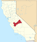
Rancho de los Californios is a former settlement in Fresno County, California. [2] It was named after the Californios (Hispanic people from California).
It was located east of Pueblo de las Juntas on high ground near the south bank of the San Joaquin River. [2] Its site is near the corner of Ashlan and North Lake Avenues, 4 miles north of the Whitesbridge Road and 6 miles west of Biola, California. [3]
Located on the Eastern route of El Camino Viejo, the place was used as a hideout for horse thieves during Spanish and Mexican rule, and continued to be a place of relative safety for outlaws during the early years of American rule. [2]
Santa Nella is an unincorporated village and census-designated place (CDP) in Merced County, California, United States. It is located 10 miles (16 km) west-northwest of Los Banos at an elevation of 154 feet (47 m). As of the 2020 census, Santa Nella had a population of 2,211, up from 1,380 at the 2010 census.
Rocha House is a historic site in Los Angeles, California, that was designated Los Angeles Historic-Cultural Monument #13 in 1963. It is located in Reynier Village in Mid-City, Los Angeles.
Asphalto is an archaic place name in Kern County, California. Asphalto, also known as La Brea, was located on the railroad 3 miles (4.8 km) northeast of McKittrick, at an elevation of 932 feet. Asphalto still appeared on maps as of 1932. The name comes from the local asphaltum deposits.
Rancho Vega del Río del Pájaro was a 4,310-acre (17.4 km2) Spanish land concession in present day Monterey County, California given in 1821 by Pablo Vicente de Solá to Antonio María Castro. The grant was confirmed by Mexican Governor José Figueroa in 1833. The name means "a meadow along the Pajaro River". The rancho lands bordered the Pajaro River and include the present day Vega and Watsonville.
Rancho Los Vergeles was a 8,760-acre (35.5 km2) Mexican land grant in present-day Monterey County and San Benito County, California given in 1835 by Governor José Castro to José Joaquín Gómez. The name means "flower garden". Rancho La Natividad and Rancho Los Vergeles were adjoining ranchos, north of present-day Salinas. The rancho headquarters of each were close to the entrance to the pass through the Gabilan Range to San Juan Bautista.
Rancho Cholame was a 26,622-acre (107.74 km2) Mexican land grant in present-day Monterey County and San Luis Obispo County, California given in 1844 by Governor Manuel Micheltorena to Mauricio Gonzales. The grant extended along the Cholame Valley, and encompassed present day Cholame.
Rancho Panoche de San Juan y Los Carrisalitos was a 22,175-acre (89.74 km2) Mexican land grant in present-day Merced County, California given in 1844 by Governor Manuel Micheltorena to Julian Ursua and Pedro Romo. The name means "raw sugar of San Juan and the little patches of reeds" in Spanish.
El Camino Viejo a Los Ángeles, also known as El Camino Viejo and the Old Los Angeles Trail, was the oldest north-south trail in the interior of Spanish colonial Las Californias (1769–1822) and Mexican Alta California (1822–1848), present day California. It became a well established inland route, and an alternative to the coastal El Camino Real trail used since the 1770s in the period.
La Libertad, California is a former settlement in Fresno County, California that was 1/2 mile south and 5 miles east of Burrel, California. It was an early Mexican settlement in San Joaquin Valley, on the eastern route of El Camino Viejo that existed there at least until 1870.
Poso de Chane or Poso Chane is a former settlement in Fresno County, California situated around the waterhole of that name, northwest just below the confluence of the Jacalitos Creek with Los Gatos Creek, 6 miles (9.7 km) east of Coalinga and northwest of the Guijarral Hills.
Vaca Adobe or Vaca Dugout is a former settlement in what was then Tulare County, now Kings County, California. It was located at a stopping place on the eastern route of the El Camino Viejo about 3 miles north of the site of what is now Kettleman City close to the shore of Tulare Lake. The adobe at the site was known as the Vaca Dugout, and was built in 1863 by vaqueros Juan Perria and Pablo Vaca. In 1863, California was in the midst of the severe 1863-64 drought that would kill most of the cattle in the southern part of the state. Tulare Lake and the tules marshes around it were one of the few places cattle could get feed and water. The adobe was the headquarters for the vaqueros who were tending the herds in the vicinity.
Zapato Chino Creek formerly known both as Arroyo de Las Polvarduras and Arroyo de Zapata Chino, is a creek in Fresno County, California. Its source is in Zapato Chino Canyon on the east slope of Mustang Peak in the Diablo Range. From there it runs northwest through Zapato Chino Canyon, in the Krayenhagen Hills, then passed across Pleasant Valley to the Guijarral Hills, then east through the Polvadero Gap, then runs northeast to its confluence with Los Gatos Creek. It usually dissipates in the San Joaquin Valley, 11 miles east of Coalinga. However it reaches Los Gatos Creek in years of heavy rainfall.
Jacalitos Creek formerly known as Arroyo de Jacelitos, is a creek in Fresno County, California.
Canoas Creek formerly known as Arroyo de Las Canoas is a creek in Fresno County, California. Its source is on the north slope of Black Mountain, 1.25 miles west of Zwang Peak in the Diablo Range. Its course, in its canyon, runs almost directly northeast through Reef Ridge and the Kreyenhagen Hills, from which it flows north northeast into the Kettleman Plain where it turns north northwest 4.6 miles northwest of Avenal near the Kettleman Hills to terminate in the Kettleman Plain, 7.1 miles northwest of Avenal and 3000 feet east of Zapato Chino Creek.
Cox & Clark Trading Post was an adobe building on the west shore of Tulare Lake. It was at that time the only building on that side of the lake and was located on the lakeshore 3 miles (4.8 km) southwest of the modern Kettleman City.
Widow Smith's Station, also known as Major Gordon's Station and Clayton's Station, was a stagecoach station of the Butterfield Overland Mail 1st Division from 1858 to 1861 in southern California.
Lone Willow Station was a former settlement in Merced County, California, located near present-day Los Banos.
Alférez Juan Prado Mesa was a prominent Californio military commander in Alta California. He was born a subject of the Spanish Empire, and performed his military duties as an officer of the Republic of Mexico,
The Pico family is a prominent Californio family of Southern California. Members of the family held extensive rancho grants and numerous important positions, including Governor of Alta California, signer of the Constitution of California, and California State Senator, among numerous others. Numerous locations are named after the family across California.
Don Antonio María Pico was a Californio politician, ranchero, and a signer of the California Constitution in 1849. He also served twice as Alcalde of San José.
36°47′35″N120°07′58″W / 36.79305°N 120.13269°W