Orange Cove, California | |
---|---|
City of Orange Cove | |
Coordinates: 36°37′28″N119°18′49″W / 36.62444°N 119.31361°W | |
Country | United States |
State | California |
County | Fresno |
Incorporated | January 20, 1948 [1] |
Government | |
• Mayor | Diana Guerra Silva [2] |
• Mayor Pro Tem | Diana Guerra Silva [2] |
• State Senator | Anna Caballero (D) [3] |
• Assemblymember | Joaquin Arambula (D) [4] |
• U. S. Rep. | David Valadao (R) [5] |
Area | |
• Total | 1.79 sq mi (4.64 km2) |
• Land | 1.79 sq mi (4.64 km2) |
• Water | 0.00 sq mi (0.00 km2) 0% |
Elevation | 423 ft (129 m) |
Population | |
• Total | 9,649 |
• Estimate (2019) [9] | 10,273 |
• Density | 5,400/sq mi (2,100/km2) |
Time zone | UTC-8 (PST) |
• Summer (DST) | UTC-7 (PDT) |
ZIP codes | 93646, 93675 |
Area code | 559 |
FIPS code | 06-54008 |
GNIS feature IDs | 277569, 2411327 |
Website | www |
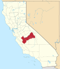
Orange Cove is a city in Fresno County, California, United States. The population was 9,078 at the 2010 census, up from 7,722 at the 2000 census.
Almost all of Orange Cove's residents are Hispanic, many of them farmers. [10] Orange Cove is located in the San Joaquin Valley, 8 miles (13 km) east-northeast of Reedley, [11] at an elevation of 423 feet (129 m). [7]
According to the United States Census Bureau, the city has a total area of 1.9 square miles (4.9 km2), all of its land.
According to the Köppen Climate Classification system, Orange Cove has a hot-summer Mediterranean climate, abbreviated "Csa" on climate maps. [12]
Elmer M. Sheridan founded the town in 1914, and named it prior to large scale citrus growing. [11] The first post office opened in 1914. [11] The city incorporated in 1948. [11]
Census | Pop. | Note | %± |
---|---|---|---|
1950 | 2,392 | — | |
1960 | 2,885 | 20.6% | |
1970 | 3,392 | 17.6% | |
1980 | 4,027 | 18.7% | |
1990 | 5,608 | 39.3% | |
2000 | 7,721 | 37.7% | |
2010 | 9,073 | 17.5% | |
2019 (est.) | 10,273 | [9] | 13.2% |
U.S. Decennial Census [13] |
At the 2010 census Orange Cove had a population of 9,078. The population density was 47,488,869.6 people per square mile (1,800/km2). The racial makeup of Orange Cove was 3,940 (43.4%) White, 72 (0.8%) African American, 131 (1.4%) Native American, 101 (1.1%) Asian, 3 (0.03%) Pacific Islander, 4,481 (49.4%) from other races, and 350 (3.9%) from two or more races. Hispanic or Latino of any race were 8,413 persons (92.7%). [14]
The census reported that 9,078 people (100% of the population) lived in households, no one lived in non-institutionalized group quarters and no one was institutionalized.
There were 2,068 households, out of which 1,459 (70.6%) had children under the age of 18 living in them, 1,202 (58.1%) were opposite-sex married couples living together, 430 (20.8%) had a single female householder, 222 (10.7%) had a single male householder. There were 207 (10%) unmarried opposite-sex partnerships, and 10 (0.5%) same-sex married couples or partnerships. 174 households (8.4%) were one person and 88 (4.3%) had someone living alone who was 65 or older. The average household size was 4.39. There were 1,854 families (89.7% of all households); the average family size was 4.53.
The age distribution was 3,619 people (39.9%) under the age of 18, 1,113 people (12.3%) aged 18 to 24, 2,398 people (26.4%) aged 25 to 44, 1,435 people (15.8%) aged 45 to 64, and 513 people (5.7%) who were 65 or older. The median age was 23.6 years. For every 100 females, there were 100.9 males. For every 100 females age 18 and over, there were 100.1 males.
There were 2,231 housing units at an average density of 1,167.0 per square mile (450/km2), of which 2,068 were occupied, of which 893 (43.2%) were owner-occupied, and 1,175 (56.8%) were occupied by renters. The homeowner vacancy rate was 0.8%; the rental vacancy rate was 9.5%. 4,047 people (44.6% of the population) lived in owner-occupied housing units and 5,031 people (55.4%) lived in rental housing units.
At the 2000 census there were 7,722 people, 1,694 households, and 1,512 families in the city. The population density was 5,030.4 people per square mile (1,900/km2). There were 1,767 housing units at an average density of 1,151.1 per square mile (440/km2). The racial makeup of the city was 33.55% White, 0.31% Black or African American, 2.42% Native American, 1.49% Asian, 58.84% from other races, and 3.38% from two or more races. 90.60% of the population were Hispanic or Latino of any race. [15] There were 1,694 households, 62.7% had children under the age of 18 living with them, 61.2% were married couples living together, 18.6% had a female householder with no husband present, and 10.7% were non-families. 7.1% of households were one person and 3.7% were one person aged 65 or older. The average household size was 4.56 and the average family size was 4.66.
The age distribution was 40.4% under the age of 18, 13.9% from 18 to 24, 28.1% from 25 to 44, 12.6% from 45 to 64, and 5.0% 65 or older. The median age was 23 years. For every 100 females, there were 107.7 males. For every 100 females age 18 and over, there were 108.7 males.
The median income for a household in the city was US$ 22,357, and the median family income was $22,525. Males had a median income of $21,042 versus $16,821 for females. The per capita income for the city was $7,126. About 39.9% of families and 44.5% of the population were below the poverty line, including 54.6% of those under age 18 and 20.0% of those age 65 or over.
Orange Cove's local government includes an elected mayor, mayor pro tem, and a three-member city council. [16] As of 2020, its current mayor is Victor P. Lopez. [16] Lopez was mayor of Orange Cove for over three decades before being voted out of office in 2010. [17] He was later elected to the city council in 2013 and re-elected as mayor in 2014 in what he claimed would be his last term in office, [18] but he then went on to win re-election as mayor again in 2018. [19]
The community of Orange Cove maintained its own police department for many years. In 1992 however, the city disbanded its police department, due to an inadequate budget and began contracting with the Fresno County Sheriff's Department for police services.
As of December 16, 2009, the city restarted its police department. Frank Steenport was the Chief. [20] Later, Marty Rivera became the Chief of Police. [21]
Schools in Orange Cove are part of the Kings Canyon Unified School District. Orange Cove has one High School (Orange Cove High School) and Middle School (Citrus Middle School) as well as three Elementary Schools: Sheridan Elementary School, McCord Elementary School, and A.L. Conner Elementary School.
Orange Cove is served by State Route 63 (SR 63), which approaches the city from Orosi. SR 63 bypasses the city along Hills Valley Road, while straddling the Fresno–Tulare county line, and continues north toward SR 180. Hills Valley Road continues south as County Route J19, which connects to Reedley (via Manning Avenue) and Dinuba. [22]
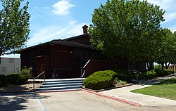
Orange Cove was formerly served by the Atchison, Topeka and Santa Fe Railway along its Porterville-Orosi District branch line. The station serving this line was listed on the National Register of Historic Places in 1978. [23]
Wickes is a city in Polk County, Arkansas, United States. The population was 754 at the 2010 census.
Biggs is a city in Butte County, California, United States. The population was 1,707 at the 2010 census, down from 1,793 at the 2000 census. The 2018 population estimate is 1,724.
Angels Camp, also known as City of Angels, is the only incorporated city in Calaveras County, California, United States. The population was 3,836 at the 2010 census, up from 3,004 at the 2000 census. It lies at an elevation of 1381 feet.
San Joaquin is a city in Fresno County, California, United States. The population was 4,001 at the 2010 census, up from 3,270 at the 2000 census. The nearest high school in the area is Tranquillity High School in Tranquillity. San Joaquin is located 11 miles (18 km) southwest of Kerman, at an elevation of 174 feet.
McFarland is a city in the San Joaquin Valley, in Kern County, California, United States. McFarland is located 25 miles (40 km) north-northwest of Bakersfield and 6.5 miles (10 km) south of Delano, at an elevation of 354 feet (108 m). The population of McFarland was 12,707 at the 2010 census and an estimated 15,506 as of 2019.
La Verne is a city in Los Angeles County, California, United States. The population was 31,334 at the 2020 census.
South El Monte is a city in the San Gabriel Valley, in Los Angeles County, California, United States. At the 2010 census, the city had a population of 20,116, down from 21,144 at the 2000 census.
West Carson is an unincorporated community in the South Bay region of Los Angeles County, California. The population was 22,870 at the 2020 census. For statistical purposes, the United States Census Bureau has defined West Carson as a census-designated place (CDP).
Sand City is a city in Monterey County, California, United States, located on the shores of Monterey Bay, and surrounded on most sides by the larger city of Seaside. Sand City is located 2 miles (3 km) northeast of Monterey, at an elevation of 72 feet. The population was 325 at the 2020 census. The city is predominantly a business community, and has a number of larger retail stores. The West End area of Sand City, once an industrial area, hosts a growing artists' colony. Every August, the artists of Sand City and neighboring areas hold a street fair called the "West End Celebration".
American Canyon is a city located in southern Napa County, California, United States, 35 miles (55 km) northeast of San Francisco, part of the San Francisco Bay Area. The 2020 census reported the city's population as 21,837. Its ZIP Code is 94503, and its area code is 707. It is in the Pacific Time time zone and observes Daylight-Saving Time. The city was incorporated in 1992.
Highgrove is a census-designated place (CDP) and an unincorporated community in Riverside County, California, United States. The population was 3,988 at the 2010 census, up from 3,445 at the 2000 census. The latest 2020 census shows 7,515 total population, an 88.4% increase from last 2010 census, which makes it the fastest-growing location in entire Riverside County. The city of Riverside, California has plans to annex Highgrove in the near future.
Highland is a city in San Bernardino County, California, United States located 65 miles east of Downtown Los Angeles and roughly 50 miles west of Palm Springs, California. The city's population, inclusive to its neighboring East Highlands community was 56,999 at the 2020 census.
Lemon Cove is a census-designated place (CDP) in the San Joaquin Valley in Tulare County, California, United States. The population was 308 at the 2010 census, up from 298 at the 2000 census.
Belle Isle is a city in Orange County, Florida, United States. The population was 7,032 at the 2020 census. It is part of the Orlando–Kissimmee–Sanford Metropolitan Statistical Area.
Hunter's Creek is a master planned, unincorporated community and census-designated place in Orange County, Florida, United States. It is part of the Orlando–Kissimmee–Sanford, Florida Metropolitan Statistical Area. The population was 14,321 at the 2010 census. It has grown up around a large planned community named Hunter's Creek, though the CDP name given by the United States Census Bureau lacks the apostrophe.
Orange City is a town in Volusia County, Florida, United States. It is a part of the Deltona–Daytona Beach–Ormond Beach metropolitan area. As of the 2020 US census, the city had a population of 12,632.
Oyster Bay Cove is a village located within the Town of Oyster Bay in Nassau County, on Long island, in New York. The population was 2,197 at the 2010 census. it is part of the Greater Oyster Bay area anchored by Oyster Bay.
Cove is a city in Union County, Oregon, United States. The population was 620 at the 2020 census.
Cove is a city in Chambers County, Texas, United States. The population was 525 at the 2020 census, up from 510 at the 2010 census.
West Orange is a city in Orange County, Texas, United States. The population was 3,459 at the 2020 census, an increase over the figure of 3,443 tabulated in 2010. It is part of the Beaumont–Port Arthur Metropolitan Statistical Area.