Rasah | |
|---|---|
 | |
| Country | |
| State | |
| District | Seremban |

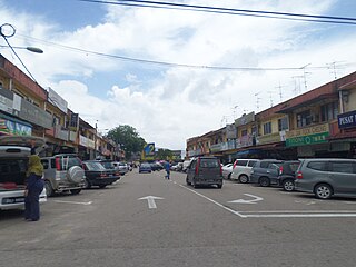
Rasah is a mukim in Seremban District, Negeri Sembilan, Malaysia. [1]
Rasah | |
|---|---|
| | |
| Country | |
| State | |
| District | Seremban |
Rasah is a mukim in Seremban District, Negeri Sembilan, Malaysia. [1]
There are places of worship for many faiths in Rasah. The most prominent one is Rasah Shri Mahamariamman Temple, situated in the foothills near Tuanku Ja'afar Hospital
Rasah consist of 46.5% Chinese, 30.7% Malay and 22.4% Indian and 0.4% others.
| Ethnic groups in Mukim Rasah, 2010 census | ||
|---|---|---|
| Ethnicity | Population | Percentage |
| Chinese | 39,558 | 44.5% |
| Bumiputera | 26,149 | 29.4% |
| Indian | 19,048 | 21.4% |
| Others | 393 | 0.4% |
| Non-citizens | 3,783 | 4.3% |
| Total | 88,931 | 100% |
Rasah has many housing estates encircling it including Kampung Dato Mansor, Kampung Pasir, Taman Sri Pulasan, Taman Lian, Taman Nee Yan, Taman Klana Jubli, Taman Bukit Chedang, Taman Dato' Raja Mohd Hanifah, Taman Rasah, Rasah Jaya, Taman Desa Rasah, Taman Harapan Baru, Taman Happy, Taman Thivy Jaya, Taman Sri Putih, Taman Nuri Indah, Taman Anggur, Taman Bukit Rasah, Taman Belimbing and Taman Limau Emas.

The Batu Pahat District is a district in the state of Johor, Malaysia. It lies southeast of Muar, southwest of Kluang, northwest of Pontian, south of Segamat and Tangkak District. The capital of the district is Bandar Penggaram.
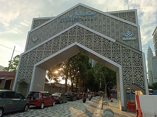
Johor Bahru, Malaysia, has the following notable landmarks.
Ulu Tiram is a suburb in Johor Bahru, Johor, Malaysia. The town lies along the Tebrau Highway, a section of Malaysia Federal Route 3, a major trunk road on Peninsular Malaysia's east coast that connects Ulu Tiram with major towns and cities such as Mersing, Kuantan and Kota Bharu.

Cheras is a suburban and a district, straddling both the Federal Territory of Kuala Lumpur and Hulu Langat District in the state of Selangor, Malaysia.

Ampang, or Ampang Hilir, is a ward and city district, in the eastern part of Kuala Lumpur (KL) in the Titiwangsa constituency. Its area in Kuala Lumpur can be identified as being along the Ampang Road and Ampang Hilir.

Bukit Beruang is a town in Melaka Tengah District, Malacca, Malaysia named after its eponymous hill with a height of 116.3 metres (382 ft), a famous spot for hiking. The most famous landmark in Bukit Beruang is the state branch of Multimedia University, a private university owned by Telekom Malaysia, a Malaysian telecommunication company.
Kampung Baru or Kampong Bharu is a Malay enclave in central Kuala Lumpur, Malaysia. One of the most valuable tracts of land in the capital, it has been estimated to be worth up to US$1.4 billion.

Puchong is a major town and a parliamentary constituency in the Petaling District, in the state of Selangor, Malaysia. Bordering Kuala Lumpur, it is part of the Greater Kuala Lumpur area. It is bordered by Petaling Jaya in the north, Subang Jaya in the west, Cyberjaya and Putrajaya in the south, and Seri Kembangan in the east.

Segambut is a sub-district in Kuala Lumpur, Malaysia. The federal constituency represented in the Dewan Rakyat is Segambut.
Lembah Pantai is a sub-district and parliamentary constituency in south-western Kuala Lumpur, Malaysia. Constituencies adjacent to Lembah Pantai are Seputeh, Segambut and Bukit Bintang. The total number of population is 148,094 as of 2020 census.

This article lists important figures and events in Malaysian public affairs during the year 1996, together with births and deaths of notable Malaysians.
Bukit Antarabangsa is a hillside township located in Ulu Klang, Ampang District, Selangor, Malaysia. The area is well known for being an affluent residential suburb occupied by occasional celebrities and political figures alike.

The Seremban District is one of 7 districts in Negeri Sembilan, Malaysia. This is where the capital of Negeri Sembilan, Seremban is located.

Kampung Sungai Penchala is a small Malay village in the Segambut constituency in northwestern Kuala Lumpur, Malaysia, with the postcode 60000 KUALA LUMPUR, lying along the Federal Territory–Selangor border. This village is next to Taman Tun Dr Ismail in Kuala Lumpur, Malaysia which also shares the same 60000 KUALA LUMPUR postcode, and adjacent to Mutiara Damansara and Bandar Utama that were once part of a large oil palm plantation across the interstate border.

Tebrau or Teberau is a mukim and a town in Johor Bahru District, Johor, Malaysia. It is the third largest mukim in the district.
Batu Pahat Municipal Council is a local authority which administrates West Batu Pahat District in Johor, Malaysia. This agency is under Johor state government. MPBP are responsible for public health and sanitation, waste removal and management, town planning, environmental protection and building control, social and economic development and general maintenance functions of urban infrastructure. The MPBP main headquarters is located at Jalan Pejabat, Bandar Penggaram, Batu Pahat.
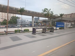
The Kampung Dato Harun Komuter station is a commuter train station located in Petaling Jaya, Selangor near PJS 2 Flyover New Pantai Expressway Bangsar bount, and served by the Port Klang Line.

Seremban is a city in the Seremban District and the capital of the state of Negeri Sembilan in Peninsular Malaysia. The city's administration is run by the Seremban City Council. Seremban gained its city status on 20 January 2020.
Capital: Seremban, Royal town: Seri Menanti | |||||||||||
| Topics |
| ||||||||||
| Society | |||||||||||
| Administrative divisions |
| ||||||||||
2°42′N101°56′E / 2.700°N 101.933°E
| | This Negeri Sembilan location article is a stub. You can help Wikipedia by expanding it. |