Simpang Durian

Last updated • 4 min readFrom Wikipedia, The Free Encyclopedia
Simpang Durian
Flag of Malaysia.svg Town in Malaysia
Negeri Sembilan location map.svg
Red pog.svg
Simpang Durian
Simpang Durian in Negeri Sembilan, Malay Peninsular and Malaysia
West Malaysia location map.svg
Red pog.svg
Simpang Durian
Simpang Durian (Peninsular Malaysia)
Malaysia location map.svg
Red pog.svg
Simpang Durian
Simpang Durian (Malaysia)
Coordinates: 3°1′N102°11′E / 3.017°N 102.183°E / 3.017; 102.183
Country Flag of Malaysia 23px.svg  Malaysia
State Flag of Negeri Sembilan.svg  Negeri Sembilan
District Jelebu
Time zone UTC+8 (MYT)
Postal code
72400
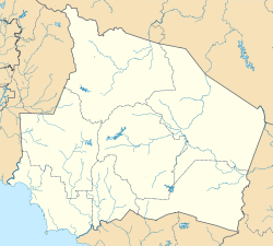
Simpang Durian in Jelebu District Map of Jelebu District, Negeri Sembilan.svg
Simpang Durian in Jelebu District

Simpang Durian is a small town in Jelebu District, Negeri Sembilan, Malaysia. It is situated about 10 km from the Pahang border and about 130 km from Kuala Lumpur. Simpang Durian is also a popular stopover destination for super bikers from Singapore and southern states of West Malaysia to rest and refuel before proceeding to Genting Highlands.

Contents

History

Simpang Durian is believed to have been occupied by Orang Asli a long time ago. The name of Simpang Durian means junction of durian. About 100 years ago, there were many durian plantations ran by the British colonial government and these durian trees were planted all the way to the junction. The name then was widely adapted by locals, and as such the name Simpang Durian became the norm. During the Communist time or emergency time, the government relocated the people from the surrounding area by the insurgent communist threat. The government declared the area as a settlement with army observation.

Demographics

The population in Simpang Durian is Malay 70%, Chinese 25%, Indian 1% and Orang Asli 4%. Most are immigrants and settlers from Sumatera (mostly Minangkabau descendants from Luak 50 Koto, Sumatera Barat) while Chinese from mainland China came to work in tin mines. Others are aboriginals such as Semang, Temuan people, Besisi and Jakun people.

Climate

Due to its proximity to the Equator, the climate of Simpang Durian is hot and humid all year round and is one of Malaysia's driest places.

Location

Simpang Durian is rapidly developing due to its strategic location between the road to Johor Bahru and Gua Musang. Radius distance to Kuala Lumpur is about 50 km. Some of the nearest town is Bahau (45 km), Kuala Pilah (50 km), (Kuala Klawang 35 km), (Seremban 70 km), and Karak (50 km). People from the south part of Malaysia can reach the town via Bahau, from Kuala Lumpur via Seremban, or Karak either Hulu Langat district in Selangor or Kuala Klawang in Jelebu district of Negeri Sembilan. This road is known for its many dangerous and sharp corners. There is no bus service to Simpang Durian, but there are taxi services to and from Seremban, Bahau or Kuala Klawang.

Economy

Historically, the major source of income in Simpang Durian was the timber industry which greatly contributed to the town's growth in the past decades. The cultivation of palm oil and rubber also had a significant impact on Simpang Durian's economy. Sugarcane plantations are abundant in Simpang Durian, and the town is said to produce the best sugarcane in the country due to its hot climate and minimal rainfall. Sugarcane produce is also widely imported to Singapore.

Culture

Most of the Malay people in Simpang Durian follow Adat Perpatih, (also known as Lareh Bodi Caniago), customary laws that originated from the Minangkabau Highlands Sumatra, Indonesia. It was founded by a Minangkabau leader named Sutan Balun or more famously known as Dato' Perpatih Nan Sebatang. In Malaysia, Adat Perpatih is a combination of practices and rules of life for the Minangkabau people and other aboriginals who were mostly farmers at that time. Over time, this custom has been adapted by other ethnicities in parts of Malacca, Masjid Tanah in particular, and parts of Johor.

Local cuisine

Masak lemak cili api, a traditional hot and spicy Negeri Sembilan dish, is the famous food in the area. "Cili padi" was included in the dish's name as one of the main ingredients used is the cili padi, a scorching chilli pepper. Other popular dishes include rendang (pieces of beef cooked in coconut milk and chillies),Masak Lomak Cili Padi, fish, meat, or vegetables cooked in coconut milk blended with turmeric and ground chilli padi. Another Negeri Sembilan speciality is "lomang", glutinous rice cooked in coconut milk in a bamboo stem over an open fire and is normally served with rendang.

Places of interest

Simpang Durian is known for its mountain and paddy field views. There is also an annual kayaking event called Kenaboi River Challenge.

Accommodation

There are a few homestays available in Simpang Durian. The nearest hotel is Hotel Seri Klawang which cost about Rm80 per night.

Other facilities

There are a 24 hours Petronas petrol station (petrol and diesel only) with ATM. Other facilities include Agrobank, post office, 7-Eleven, and restaurants with wifi until 2:30 am. Even though Simpang Durian is a small town, people from surrounding areas and smaller towns stop by in Simpang Durian to refuel and use an ATM service.

Flora and fauna

The rainforest around Simpang Durian is home to various flora and fauna, such as tongkat ali (ginseng), and kacip Fatimah, and many endangered species of wildlife. Reserved forest areas such as Hutan Simpan Triang and Hutan Simpan Kenaboi have been established, which serves as a natural habitat for wild animals such as tigers, wild boars, bears, tapirs, and monkeys.

Related Research Articles

<span class="mw-page-title-main">Negeri Sembilan</span> State of Malaysia

Negeri Sembilan, historically spelled as Negri Sembilan, is a state in Malaysia which lies on the western coast of Peninsular Malaysia. It borders Selangor on the north, Pahang in the east, and Malacca and Johor to the south.

<span class="mw-page-title-main">Rendang</span> Spicy Minangkabau meat dish

Rendang is a Minangkabau dish. It is a rich meat-based dish that is slow-cooked, braised in coconut milk, and seasoned with herb and spice mixture over a period of several hours. As the liquids evaporate, the meat turns dark brown and tender, caramelizing and infusing it with rich flavours.
<span class="mw-page-title-main">Seri Menanti</span> Royal capital in Negeri Sembilan, Malaysia

Seri Menanti is a town, a mukim and a state assembly constituency in Kuala Pilah District, central Negeri Sembilan, Malaysia, located 33 km east of the state capital city of Seremban and 14 km southwest of Kuala Pilah. It is the royal capital of the state of Negeri Sembilan and houses the seat of the Yang Di-Pertuan Besar of Negeri Sembilan or Yamtuan Besar, the ruler of the state of Negeri Sembilan. The royal palace is known as Istana Besar.

<span class="mw-page-title-main">Jelebu District</span> District in Negeri Sembilan, Malaysia

The Jelebu District is the second largest district in Negeri Sembilan, Malaysia after Jempol, with a population over 40,000. Jelebu borders on the Seremban District to its west and Kuala Pilah District to its south, Jempol District to its southeast, Bentong and Bera Districts, Pahang to its east and Hulu Langat District, Selangor to the north. Jelebu is a suburban district with blossoming semi-agricultural industry. Jelebu is also a parliamentary constituency of the Dewan Rakyat in the Malaysian Parliament. Kuala Klawang is the principal town of the district.

<span class="mw-page-title-main">Sungai Muntoh</span> Town in Jelebu, Negeri Sembilan, Malaysia

Sungai Muntoh is a semi-agricultural small town in Jelebu District, Negeri Sembilan, Malaysia with less than 3,500 in total population. The town is located about 30 miles southeast of Kuala Lumpur and is situated near the border between Negeri Sembilan and Selangor.
<span class="mw-page-title-main">Titiwangsa Mountains</span> Mountain range in Thailand and Malaysia

The Titiwangsa Mountains, also known as Banjaran Besar by locals, is the chain of mountains that forms the backbone of the Malay Peninsula. The northern section of the range is in southern Thailand, where it is known as Sankalakhiri Range.

<span class="mw-page-title-main">Bahau</span> Town in Negeri Sembilan, Malaysia

Bahau is the principal town of Jempol District, Negeri Sembilan, Malaysia.

<span class="mw-page-title-main">Jempol District</span> District in Negeri Sembilan, Malaysia

The Jempol District is the largest district in the Malaysian state of Negeri Sembilan. The district borders Jelebu District to the northwest, Kuala Pilah District to the west, Tampin District to the south, Bera District, Pahang to the northeast and Segamat District, Johor to the east. Bandar Seri Jempol and Bahau are the principal towns in Jempol.

Federal Route 86, also known as Jalan Jelebu or Jalan Seremban–Simpang Pertang, is a main federal roads in Negeri Sembilan, Malaysia. The roads connects Seremban town in the south to Simpang Pertang, Jelebu in the north. It was the earliest federal roads in Negeri Sembilan, built in 1911 by the Federated Malay States (FMS) government.

<span class="mw-page-title-main">Kuala Klawang</span> Town and district capital in Jelebu, Negeri Sembilan, Malaysia

Kuala Klawang is a mukim and the district capital of Jelebu District, Negeri Sembilan, Malaysia.

<span class="mw-page-title-main">Rais Yatim</span> Malaysian politician

Tan Sri Dato' Seri Utama Dr. Rais bin Yatim is a Malaysian politician and lawyer who served as the 18th President of the Dewan Negara from September 2020 to June 2023, 8th Menteri Besar of Negeri Sembilan from 1978 to 1982 and the Member of Parliament (MP) for Jelebu from November 1999 to May 2013.

<span class="mw-page-title-main">Seremban District</span> District in Negeri Sembilan, Malaysia

The Seremban District is one of 7 districts in Negeri Sembilan, Malaysia. This is where the capital of Negeri Sembilan, Seremban is located.

The city of Seremban, Negeri Sembilan, Malaysia is linked by rail from KTMB's Seremban station to Kuala Lumpur, Singapore and the coastal town of Port Dickson, and has a commuter rail network. It lacks its own airport and is served by the nearby Kuala Lumpur International Airport. Local and longer-distance bus services use a bus station at Terminal 1 Bus Terminal and Shopping Centre, Negeri Sembilan's primary transportation hub. Major roads include Federal Route 1, Federal Route 51, Federal Route 86, Federal Route 366, North–South Expressway Southern Route (E2), Kajang-Seremban Highway (E21), Seremban-Port Dickson Highway (E29), and the Seremban Inner Ring Road (SIRR). The major streets in the city have been renamed since colonial days.

The flag and the coat of arms of Negeri Sembilan are state symbols of Negeri Sembilan, Malaysia. The symbols are predominantly depicted in red, black and yellow, traditional colours of the Minangkabau people who are the original settlers in the present-day state. Also recognised in the symbols are the political history of Negeri Sembilan, its ruler, and the state's past relationship with the British Empire.

<span class="mw-page-title-main">Simpang Pertang</span> Town in Jelebu, Negeri Sembilan, Malaysia

Simpang Pertang is a small town in Jelebu District, Negeri Sembilan, Malaysia. It is a few kilometres away from the town of Pertang, which the intersection is named after.

<span class="mw-page-title-main">Seremban</span> State capital city and district capital in Negeri Sembilan, Malaysia

Seremban is a city in the Seremban District and the capital of the state of Negeri Sembilan in Peninsular Malaysia. The city's administration is run by the Seremban City Council. Seremban gained its city status on 20 January 2020.

<span class="mw-page-title-main">Kuala Pilah (town)</span> Town and district capital in Negeri Sembilan, Malaysia

Kuala Pilah, or simply Pilah, is a town in Kuala Pilah District, Negeri Sembilan, Malaysia.

<span class="mw-page-title-main">Rembau District</span> District in Negeri Sembilan, Malaysia

The Rembau District is a district that is located in the state of Negeri Sembilan, Malaysia. The district is a stronghold of the matrilineal system known as adat perpatih, a customary practice inherited from the Minangkabaus, of Sumatra. The district borders Seremban District to the north, Port Dickson District to the west, Tampin District to the east, Kuala Pilah District to the northeast and Alor Gajah District, Malacca to the southwest.

<span class="mw-page-title-main">Minangkabau Malaysians</span> People of Minangkabau descent in Malaysia

The Minangkabau Malaysians are citizens of the Malaysia whose ancestral roots are from Minangkabau of central Sumatra. This includes people born in the Malaysia who are of Minangkabau origin as well as Minangkabau who have migrated to Malaysia. Today, Minangkabau comprise about 989,000 people in Malaysia, and Malaysian law considers most of them to be Malays. They are majority in urban areas, which has traditionally had the highest education and a strong entrepreneurial spirit. The history of the Minangkabau migration to Malay peninsula has been recorded to have lasted a very long time. When the means of transportation were still using the ships by down the rivers and crossing the strait, many Minang people migrated to various regions such as Negeri Sembilan, Malacca, Penang, Kedah, Perak, and Pahang. Some scholars noted that the arrival of the Minangkabau to the Malay Peninsula occurred in the 12th century. This ethnic group moved in to peninsula at the height of the Sultanate of Malacca, and maintains the Adat Perpatih of matrilineal kinships system in Negeri Sembilan and north Malacca.

References