
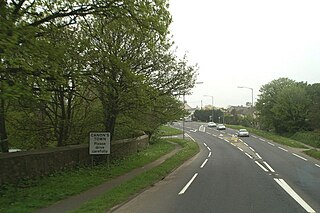
St Columb Major is a town and civil parish in Cornwall, England, United Kingdom. Often referred to locally as St Columb, it is approximately seven miles (11 km) southwest of Wadebridge and six miles (10 km) east of Newquay The designation Major distinguishes it from the nearby settlement and parish of St Columb Minor on the coast. An electoral ward simply named St Columb exists with a population at the 2011 census of 5,050. The town is named after the 6th-century AD Saint Columba of Cornwall, also known as Columb.

Helford Passage is a village in west Cornwall, England, United Kingdom. It is situated on the north bank of the Helford River opposite Helford approximately five miles (8 km) south-southwest of Falmouth. The village is in the civil parish of Mawnan; before 1986, it was in the parish of Constantine.

Helford is a village in the civil parish of Manaccan. It is on the south bank of the Helford River in west Cornwall, England, United Kingdom, approximately five miles (8 km) south-southwest of Falmouth and lies within the Cornwall Area of Outstanding Natural Beauty (AONB). The village was rated as among the "20 most beautiful villages in the UK and Ireland" by Condé Nast Traveler in 2020. The village has a pub, a village shop, and a sailing club. A pedestrian ferry operates daily from Easter to October between Helford and Helford Passage.
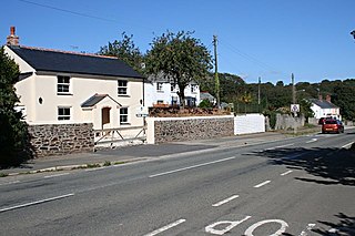
Canon's Town or Canonstown is a hamlet in west Cornwall, England, UK, situated on the A30 road in the civil parish of Ludgvan, between Penzance and Hayle. It is southwest of St Erth railway station. It is in the civil parish of St Erth

Whitstone is a village and civil parish in east Cornwall, England, United Kingdom. It is roughly halfway between the towns of Bude and Launceston. The population at the 2011 census was 590.

St Just in Roseland is a village and civil parish in Cornwall, England, United Kingdom. The village is 6 miles (10 km) south of Truro and 2 miles (3 km) north of St Mawes, a small village within the parish of St Just in Roseland. The 2011 Census recorded the parish population as 1,158.
High Cross is a hamlet in south Cornwall, England, United Kingdom. It is situated one mile east of Constantine village and approximately four miles (6 km) southwest of Falmouth.

The Par River, also known as the Luxulyan River is a river draining the area north of St Blazey in Cornwall, in the United Kingdom.
Otterham is a village and a civil parish in north Cornwall, England, United Kingdom. The village is situated approximately ten miles (16 km) south of Bude and six miles (9.7 km) north of Camelford.

Warleggan or Warleggon is a hamlet and civil parish on the southern edge of Bodmin Moor in Cornwall, England.

Devoran is a village in south Cornwall, England, United Kingdom. It is 4 miles (6.4 km) southwest of Truro at grid reference SW 793 392. Formerly an ecclesiastical parish, Devoran is now in the civil parish of Feock.

The River Allen in north Cornwall is one of two rivers in Cornwall which share this name. In this case the name is the result of a mistake made in 1888 by Ordnance Survey, replacing the name Layne with Allen which is the old name for the lower reaches of the Camel. The other River Allen runs through Truro.

Scorrier is a village in Cornwall, England, United Kingdom. It is in the civil parish of St Day, about 2 miles (3 km) northeast of the centre of Redruth and 3 miles (5 km) southeast of the coast at Porthtowan, on the A30 road at the junction of the A3047 road that leads west to Camborne and the B3298 road south to Carharrack. The Plymouth to Penzance railway line passes through the village and between 1852 and 1964 it had its own station. A. E. Rodda & Son, the principal maker of clotted cream is based here.

The De Lank River is a small river in north Cornwall, England. It is a tributary of the River Camel and is approximately nine miles (14.5 km) long from its source on Bodmin Moor to its confluence with the Camel two miles (3 km) south of St Breward.

Restronguet Creek is a tidal ria in south Cornwall, United Kingdom. It is a tributary of Carrick Roads, the estuary of the River Fal, and is situated approximately four miles (6.5 km) south of Truro and three miles (5 km) north of Falmouth.

Restronguet Point is a small narrow promontory in the civil parish of Feock in south Cornwall, England, United Kingdom. It is situated approximately three-quarters of a mile (1 km) south of Feock village.

Mylor Creek is a tidal ria in south Cornwall, United Kingdom. It is a tributary of Carrick Roads, the estuary of the River Fal and is situated approximately six miles (10 km) south of Truro and two miles (3 km) north of Falmouth .
Hewas Water is a hamlet in mid Cornwall, England, UK. It is off the A390 road near Sticker and about 3 miles (5 km) west-southwest of St Austell. It is in the civil parish of St Mewan.

Meneage Coastal Section is a coastal Site of Special Scientific Interest (SSSI) in southern Cornwall, England, UK, noted for its geological characteristics.

The River Kensey is a river in east Cornwall, England, UK which is a tributary of the River Tamar.
