Reichsstraße (Austria)

Last updated

A Reichsstraße (literally "imperial road") was the official designation from 1804 to 1918 of trunk roads in Old Austria maintained by the (from 1867 Cisleithanian) State (k.k. Ministry) – in contrast to the state roads ( Landesstraße ) maintained by the individual crown lands and the municipal roads ( Gemeindestraßen ) maintained by the parishes or municipalities (Gemeinden).

Austria Federal republic in Central Europe

Austria, officially the Republic of Austria, is a country in Central Europe comprising 9 federated states. Its capital, largest city and one of nine states is Vienna. Austria has an area of 83,879 km2 (32,386 sq mi), a population of nearly 9 million people and a nominal GDP of $477 billion. It is bordered by the Czech Republic and Germany to the north, Hungary and Slovakia to the east, Slovenia and Italy to the south, and Switzerland and Liechtenstein to the west. The terrain is highly mountainous, lying within the Alps; only 32% of the country is below 500 m (1,640 ft), and its highest point is 3,798 m (12,461 ft). The majority of the population speaks local Bavarian dialects as their native language, and German in its standard form is the country's official language. Other regional languages are Hungarian, Burgenland Croatian, and Slovene.

Cisleithania The Austrian Empire without the Kingdom of Hungary

Cisleithania was a common yet unofficial denotation of the northern and western part of Austria-Hungary, the Dual Monarchy created in the Compromise of 1867—as distinguished from Transleithania, i.e. the Hungarian Lands of the Crown of Saint Stephen east of ("beyond") the Leitha River.

<i>Landesstraße</i> type of "state roads" mainly in Austria and Germany

Landesstraßen are roads in Germany and Austria that are, as a rule, the responsibility of the respective German or Austrian federal state. The term may therefore be translated as "state road". They are roads that cross the boundary of a rural or urban district. A Landesstraße is thus less important than a Bundesstraße or federal road, but more significant than a Kreisstraße or district road. The classification of a road as a Landesstraße is a legal matter (Widmung). In the free states of Bavaria and Saxony – but not, however, in the Free State of Thuringia – Landesstraßen are known as Staatsstraßen.

Contents

Lower Austria and Vienna

The following Reichsstraßen, amongst others, emanated from the capital, Vienna: [1]

Vienna Capital city and state in Austria

Vienna is the federal capital, largest city and one of nine states of Austria. Vienna is Austria's primate city, with a population of about 1.9 million, and its cultural, economic, and political centre. It is the 7th-largest city by population within city limits in the European Union. Until the beginning of the 20th century, it was the largest German-speaking city in the world, and before the splitting of the Austro-Hungarian Empire in World War I, the city had 2 million inhabitants. Today, it has the second largest number of German speakers after Berlin. Vienna is host to many major international organizations, including the United Nations and OPEC. The city is located in the eastern part of Austria and is close to the borders of the Czech Republic, Slovakia, and Hungary. These regions work together in a European Centrope border region. Along with nearby Bratislava, Vienna forms a metropolitan region with 3 million inhabitants. In 2001, the city centre was designated a UNESCO World Heritage Site. In July 2017 it was moved to the list of World Heritage in Danger.

Budapest Capital city in Hungary

Budapest is the capital and the most populous city of Hungary, and the tenth-largest city in the European Union by population within city limits. The city had an estimated population of 1,752,704 in 2016 distributed over a land area of about 525 square kilometres. Budapest is both a city and county, and forms the centre of the Budapest metropolitan area, which has an area of 7,626 square kilometres and a population of 3,303,786, comprising 33 percent of the population of Hungary.

Simmering food preparation technique

Simmering is a food preparation technique in which foods are cooked in hot liquids kept just below the boiling point of water, but higher than poaching temperature. To keep a pot simmering, one brings it to a boil and then reduces the heat to maintain the temperature.

Burgenland State of Austria

Burgenland (German pronunciation: [ˈbʊʁɡn̩lant]; Hungarian: Őrvidék; Croatian: Gradišće; Slovene: Gradiščanska; Czech: Hradsko; is the easternmost and least populous state of Austria. It consists of two statutory cities and seven rural districts, with in total 171 municipalities. It is 166 km long from north to south but much narrower from west to east. The region is part of the Centrope Project.

Upper Austria

In Upper Austria there are inter alia the following Reichsstraßen:

Upper Austria State of Austria

Upper Austria is one of the nine states or Bundesländer of Austria. Its capital is Linz. Upper Austria borders on Germany and the Czech Republic, as well as on the other Austrian states of Lower Austria, Styria, and Salzburg. With an area of 11,982 km2 (4,626 sq mi) and 1.437 million inhabitants, Upper Austria is the fourth-largest Austrian state by land area and the third-largest by population.

Braunau am Inn Place in Upper Austria, Austria

Braunau am Inn  is a town in Upper Austria. Located on the border with Germany, it is the largest town in the Upper Austrian Innviertel region. Braunau is known for being the birthplace of Adolf Hitler.

Český Krumlov Town in Czech Republic

Český Krumlov is a town in the South Bohemian Region of the Czech Republic. Its historic centre, centred around the Český Krumlov Castle, is a designated UNESCO World Heritage Site since 1992 and was given this status along with the historic Prague castle district.

Prague Capital city of the Czech Republic

Prague is the capital and largest city in the Czech Republic, the 14th largest city in the European Union and the historical capital of Bohemia. Situated in the north-west of the country on the Vltava river, the city is home to about 1.3 million people, while its metropolitan area is estimated to have a population of 2.6 million. The city has a temperate climate, with warm summers and chilly winters.

Salzburg

In Salzburg there are inter alia the following Reichsstraßen:

Salzburg City in Austria

Salzburg, literally "salt castle", is the fourth-largest city in Austria and the capital of Federal State of Salzburg.

Styria

In the Styria there are inter alia the following Reichsstraßen:

Tyrol

In Tyrol (then including South Tyrol and Trentino) there are inter alia the following Reichsstraßen:

Vorarlberg

In Vorarlberg there are inter alia the following Reichsstraßen:

Bohemia

In Bohemia (today Czech Republic) there are inter alia the following Reichsstraßen:

Moravia

In Moravia (today Czech Republic) there are inter alia the following Reichsstraßen:

Austrian-Silesia

In Austrian-Silesia (today parts of Czech Republic and Poland) there are inter alia the following Reichsstraßen:

Galicia

In Galicia (today parts of Poland and Ukraine) there are inter alia the following Reichsstraßen:

Carniola

In Carniola (known today as Slovenia) there are inter alia the following Reichsstraßen:

Related Research Articles

Bohemia Historical land in Czech Republic

Bohemia is the westernmost and largest historical region of the Czech lands in the present-day Czech Republic. In a broader meaning, Bohemia sometimes refers to the entire Czech territory, including Moravia and Czech Silesia, especially in a historical context, such as the Lands of the Bohemian Crown ruled by Bohemian kings.

Moravia Historical land in Czech Republic

Moravia is a historical region in the Czech Republic and one of the historical Czech lands, together with Bohemia and Czech Silesia. The medieval and early modern Margraviate of Moravia was a crown land of the Lands of the Bohemian Crown, an imperial state of the Holy Roman Empire, later a crown land of the Austrian Empire and briefly also one of 17 former crown lands of the Cisleithanian part of the Austro-Hungarian Empire from 1867 to 1918. During the early 20th century, Moravia was one of the five lands of Czechoslovakia from 1918 to 1928; it was then merged with Czech Silesia, and eventually dissolved by abolition of the land system in 1949.

Sudetenland

The Sudetenland is the historical German name for the northern, southern, and western areas of former Czechoslovakia which were inhabited primarily by Sudeten Germans. These German speakers had predominated in the border districts of Bohemia, Moravia, and Czech Silesia from the time of the Austrian Empire.

Karlovy Vary Statutory City in Czech Republic

Karlovy Vary or Carlsbad is a spa town situated in western Bohemia, Czech Republic, on the confluence of the rivers Ohře and Teplá, approximately 130 km (81 mi) west of Prague (Praha). It is named after Charles IV, Holy Roman Emperor and King of Bohemia, who founded the city in 1370. It is the site of numerous hot springs, and is the most visited spa town in the Czech Republic.

The German-speaking population in the interwar Czechoslovak Republic, 23.3% of the population at the 1921 census, is usually reduced to the Sudeten Germans, but actually there were linguistic enclaves elsewhere in Czechoslovakia, and among the German-speaking urban dwellers there were "ethnic Germans" and/or Austrians as well as German-speaking Jews. 14% of the Czechoslovak Jews considered themselves as Germans at the 1921 census, but a much higher percentage declared German as their colloquial tongue during the last censuses under the Austro-Hungarian Empire.

The German occupation of Czechoslovakia (1938–1945) began with the German annexation of Czechoslovakia's border regions known collectively as the Sudetenland, under terms outlined by the Munich Agreement. German leader Adolf Hitler's pretext for this action was the alleged privations suffered by the ethnic German population living in those regions. New and extensive Czechoslovak border fortifications were also located in the same area.

Congress of Laibach

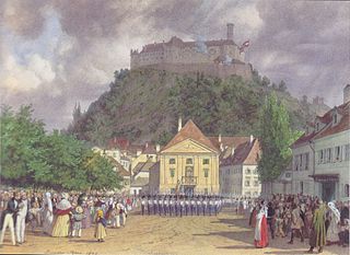
The Congress of Laibach was a conference of the allied sovereigns or their representatives, held in 1821 as part of the Concert of Europe, which was the decided attempt of the Great Powers to settle international problems after the Napoleonic Wars through discussion and collective weight rather than on the battlefield. A result of the Congress was the authorization of Austrian intervention in the Kingdom of the Two Sicilies in order to quell a liberal uprising.

Mikulov Town in Czech Republic

Mikulov is a town in the Moravia, South Moravian Region of the Czech Republic.

Floridsdorf 21st District of Vienna in Austria

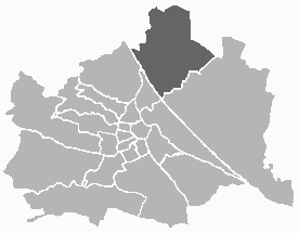
Floridsdorf is the 21st district of Vienna, located in the northern part of the city and comprising seven formerly independent communities: Floridsdorf, Donaufeld, Greater Jedlersdorf, Jedlesee, Leopoldau, Stammersdorf, and Strebersdorf.

Emperor Ferdinand Northern Railway Early Austrian railway company (1837–1907)

The Emperor Ferdinand Northern Railway was the name of a former railway company during the time of the Austrian Empire. Its main line was intended to connect Vienna with the salt mines in Bochnia near Kraków (Krakau). The term is still used today in referring to a number of railway lines formerly operated by that company.

Přemyslid dynasty dynasty

The Přemyslid dynasty or House of Přemyslid was a Czech royal dynasty which reigned in the Duchy of Bohemia and later Kingdom of Bohemia and Margraviate of Moravia, as well as in parts of Poland, Hungary, and Austria.

Slavonice Town in Czech Republic

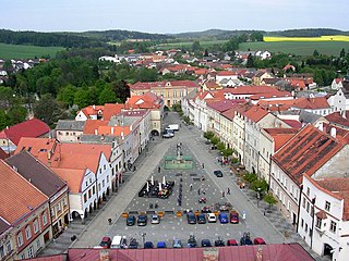
Slavonice is a town situated in the southwest of Moravia near the border with South Bohemia, Czech Republic, about a kilometre from the Austrian border, with about 2,700 inhabitants. While historically the town belongs to Moravia, it is now part of the South Bohemian Region.

Transportation in Vienna

Vienna has an extensive transport system that includes motorways, railways and public transport.

Bundesstraße 5 federal highway in Germany

The Bundesstraße 5 is a German federal highway running in a northwesterly to southeasterly direction from the Danish border near Niebüll to Frankfurt (Oder). It provides a direct route for motorists traveling between Berlin and Hamburg. In Berlin B5 forms among others the following squares and streets Heerstraße, Theodor-Heuss-Platz, Kaiserdamm, Straße des 17. Juni, Großer Stern, Unter den Linden, Karl-Liebknecht-Straße, Alexanderplatz, Karl-Marx-Allee, Frankfurter Tor, and Frankfurter Allee. The section north of Hamburg is partially paralleled by Bundesautobahn 23.

Bundesstraße 1 federal highway in Germany

The Bundesstraße 1 is a German federal highway running in an east-west direction from the Dutch border near Aachen to the Polish border at Küstrin-Kietz on the Oder River.

Bundesstraße 96 federal highway in Germany

The Bundesstraße 96 is a federal highway in Germany. It begins in Zittau in Saxony, close to the border triangle between Germany, Poland, and the Czech Republic, heads north through Berlin and ends in Sassnitz on the island of Rügen in the Baltic Sea. Some sections of B 96 form a part of the European route E22.

Austria–Czech Republic relations Diplomatic relations between the Republic of Austria and Czech Republic

Austria – Czech Republic relations are the neighborly relations between Austria and the Czech Republic, two member states of the European Union.

Bundesstraße 23 federal highway in Germany

Bundesstraße 23 is a German federal highway in Bavaria that runs from Peiting to the Austrian border near Garmisch-Partenkirchen. The road is partially a part of the “German Alpine Road”. The B 23 which together with the Bundesstraße 17 and Bundesstraße 472 the quickest way from Augsburg to Garmisch-Partenkirchen, continue along the Bundesstraße 2 to Mittenwald, Innsbruck and the Brenner Pass.

Bundesstraße 15 federal highway in Germany

The Bundesstraße 15 is a federal highway in Germany. It is located entirely within the state of Bavaria, runs in an almost perfect north-south direction, and runs from the A 9 north of Hof to the Inntal.

References

  1. Felix Czeike (Hrsg.): Historisches Lexikon Wien, Vol. 4, Verlag Kremayr & Scheriau, Vienna 1995, ISBN   3-218-00546-9, p. 650