The southern part of the priory grounds were bought by Randall Vogan in 1920, who donated them to Reigate and Banstead Borough Council. The council purchased the remainder of the grounds in 1948. Since 1948, the building has been in use as a school.
History
William de Warenne, the fifth Earl of Surrey, is thought to have founded the Augustinian priory at Reigate before 1240.[2] The fifth Earl's parents, Hamelin and Isabel de Warenne had previously presented Reigate Church to the AugustinianPriory of St Mary Overie in Southwark.[3] Early documents refer to the priory as a hospital, but in 1334 it is described as a convent and thereafter as a purely religious institution.[4] It was dedicated by the founder to the Virgin Mary and the Holy Cross.[5]
Former fish pond in Priory Park, restored in 2007
The priory was built to the south of the modern town centre, close to the Wray stream, a tributary of the Wallace Brook, and a series of fish ponds was constructed in the grounds.[3] Although the exact layout is uncertain, the buildings are thought to have been arranged around a central square cloister, with the church on the north side and the refectory on the south.[7] It is thought that the priory was constructed of the local Reigate Stone and part of the walls of the church are incorporated into those of the present school hall.[8] There was a gatehouse to the west and excavations in 1993, suggest that there was a guesthouse or infirmary to the north.[7]
The priory was created as a sub-manor of Reigate and was granted several local farms including one in each of Salfords and Horley.[4][9] It also received the manor of Southwick in West Sussex, which it gave to the Bishop of Winchester in 1335 and to compensate for the loss of income, it was awarded the annual pension from St Martin's Church in Dorking.[4] From the 1190s until at least 1291, St Martin's Church had paid an annual pension of £6 to Lewes Priory in East Sussex.[10] Later grants to Reigate Priory include land in Burstow[7] and Westhumble, as well as the advowson of St Michael's Church, Mickleham.[4] At the time of its dissolution in 1536, Reigate Priory was the least wealthy of all the Surrey religious houses.[4]
In 1541, Henry VIII granted the former priory to William Howard, 1st Baron Howard of Effingham, the uncle of Catherine Howard.[11][12] The old church was converted to a private residence and the majority of the rest of the buildings were demolished.[13] The chancel at the east end of the priory church became the Howards' private chapel.[13] A dendrochronology study carried out in 2003 showed that several of the timbers in the roof of the present building were from trees felled between 1553 and 1564.[14]
Richard Ireland, who purchased the priory in 1766 following the death of Humphrey Parsons, is primarily responsible for the appearance of the buildings today.[20] A fire destroyed much of the west wing and Ireland commissioned its rebuilding. He also shortened the length of the east wing from 75 to 25ft (22.9 to 7.6m), so that the house was symmetrical. The walls of the two wings were raised to match the main north range and the Tudor features including the windows were replaced with Georgian fixtures. Finally the south-facing walls were refaced with a cement stucco.[21] Following Ireland's death in 1780, the priory passed through a succession of owners, including Lady Henry Somerset, who remodelled the grounds between 1883 and 1895, creating a sunken garden.[22] She commissioned the rebuilding of the eastern side of the house, to provide new kitchens, a dining room, improved servants' quarters and guest bedrooms.[23] After Somerset's death in 1921, the estate was divided for sale and much of the land was purchased for housebuilding.[24]
The final private owner of the house was the racehorse trainer, Peter Beatty, who sold it to the Mutual Property Life and General Insurance Company, which relocated from London for the second half of the Second World War. In 1948, the borough council bought the grounds, having secured them as Public Open Space three years earlier.[25][26] Also in 1948, the Reigate Priory County Secondary School opened in the main priory building, with 140 children aged 13 and 14. In 1963 the boys moved to Woodhatch School and the Priory School continued as an all-girls secondary school. In 1971, the secondary school closed and Holmesdale Middle School, which had been founded in 1852, moved to the priory.[27]
The southern part of Priory Park was purchased by Randal Vogan in 1920, who donated the land to Reigate and Banstead Borough Council "to be preserved in its natural beauty for the use and quiet enjoyment of the public".[24] The remainder of the 58ha (140-acre) priory grounds were acquired by the borough council in 1948.[25] In 2007, the borough council began a restoration project, partly funded by a £4.2M lottery grant.[28] The pavilion, which houses a café, was designed by the architect, Dominique Perrault, and was constructed as part of the project.[29][30] The park offers a children's play area, tennis courts and a skate park, as well as walking trails, formal gardens and a lake.[31]
Related Research Articles
Surrey is a ceremonial county in South East England. It is bordered by Greater London to the northeast, Kent to the east, East and West Sussex to the south, and Hampshire and Berkshire to the west. The largest settlement is Woking.
Reigate and Banstead is a local government district with borough status in Surrey, England. Its council is based in Reigate and the borough also includes the towns of Banstead, Horley and Redhill. Parts of the borough are within the Surrey Hills, a designated Area of Outstanding Natural Beauty. Northern parts of the borough, including Banstead, lie inside the M25 motorway which encircles London.
Reigate is a town in Surrey, England, around 19 miles (30 km) south of central London. The settlement is recorded in Domesday Book in 1086 as Cherchefelle and first appears with its modern name in the 1190s. The earliest archaeological evidence for human activity is from the Paleolithic and Neolithic, and during the Roman period, tile-making took place to the north east of the modern centre.
Redhill is a town in the borough of Reigate and Banstead within the county of Surrey, England. The town, which adjoins the town of Reigate to the west, is due south of Croydon in Greater London, and is part of the London commuter belt. The town is also the post town, entertainment and commercial area of three adjoining communities : Merstham, Earlswood and Whitebushes, as well as of two small rural villages to the east in the Tandridge District, Bletchingley and Nutfield.
Mole Valley is a local government district in Surrey, England. Its council is based in Dorking, and the district's other town is Leatherhead. The largest villages are Ashtead, Fetcham and Great Bookham, in the northern third of the district.
Tadworth is a large suburban village in Surrey, England in the south-east of the Epsom Downs, part of the North Downs. It forms part of the Borough of Reigate and Banstead. At the 2011 census, Tadworth had a population of 7,123
Horley is a town in the borough of Reigate and Banstead in Surrey, England, south of the towns of Reigate and Redhill. The county border with West Sussex is to the south with Crawley and Gatwick Airport close to the town.
East Surrey is a constituency represented in the House of Commons of the UK Parliament since 2019 by Claire Coutinho, a Conservative who formerly served as Secretary of State for Energy Security and Net Zero. The seat covers an affluent area in the English county of Surrey.
Reigate is a constituency in Surrey represented in the House of Commons of the UK Parliament since 2024 by Rebecca Paul, of the Conservative Party.
SalfordsSAL-fudz) is a village in the borough of Reigate and Banstead in Surrey, England. It lies approximately 3 miles (4.8 km) south of Redhill on the A23 London to Brighton road. The village is within the civil parish of Salfords and Sidlow which covers a population of 3,069, and has a parish council.
Banstead is a town in the borough of Reigate and Banstead in Surrey, England. It is 3 miles (5 km) south of Sutton, 5 miles (8 km) south-west of Croydon, 8 miles (13 km) south-east of Kingston-upon-Thames, and 13 miles (21 km) south of Central London.
Earlswood is a suburb of Redhill in Surrey, England, which lies on the A23 between Redhill and Horley. Earlswood Common is a local nature reserve that separates the suburb from the southern outskirts of Reigate and has two lakes and picnic areas. Earlswood station is on the Brighton Main Line. To the east of the line are Royal Earlswood Park, the East Surrey Hospital and Whitebushes.
Nork is a residential area of the borough of Reigate and Banstead in Surrey and borders Greater London, England. Nork is separated from its post town Banstead only by the A217 dual carriageway, and the built-up area is also contiguous with similar parts of Tattenham Corner and Burgh Heath. A thin belt of more open land separates it from the communities to the north: Epsom, Ewell, Cheam and Belmont. There are two parades of shops, one called the Driftbridge and another at the north-eastern end of Nork Way, the street which runs centrally through the residential area. Nork lies on chalk near the top of the gentle north-facing slope of the North Downs, 175 m (575 ft) above sea level at its highest point.
Burgh Heath is a residential neighbourhood with a remnant part of the Banstead Commons of the same name. Immediately north of Upper Kingswood on the A217 road, it adjoins part of Banstead to the north. The north of the area is more specifically called Great Burgh, but the terms are largely interchangeable.
Kingswood or Kingswood with Burgh Heath is a residential area on the North Downs in the borough of Reigate and Banstead in Surrey, England. Part of the London commuter belt, Kingswood is just to the east of the A217 separating it from Tadworth and has a railway station. Burgh Heath in its north is combined with it to form a ward. Reigate is 3.6 miles (5.8 km) south of its centre and London is 15.5 miles (24.9 km) to the north northeast. Kingswood with Burgh Heath had a population of 6,891 in 2011.
One third of Reigate and Banstead Borough Council in Surrey, England is elected each year, followed by one year without election. Since the boundary changes in 2019, 45 councillors have been elected from 15 wards.
Reigate Castle is a former castle in the town of Reigate in the county of Surrey, England. None of the castle buildings survive today, but a cave below the site, considered to be part of the castle, still exists. Known as "Baron's Cave", it is occasionally open to the public for tours.
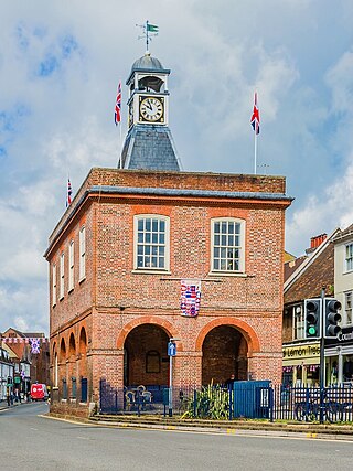
The Old Town Hall is a municipal building in the High Street, Reigate, Surrey, England. It is a Grade II* listed building.
Woodhatch Place is a large office building on Cockshot Hill, Reigate, Surrey, England, which serves as the headquarters of Surrey County Council. The main building was built in 1998–1999 as the head office of Canon (UK) Limited, in the grounds of a Georgian house, previously called Woodhatch Lodge, with the original house being retained and restored as part of the development. The complex was bought by Surrey County Council in 2020 and converted to become the council's main offices and meeting place.
References
↑ "Reigate Priory". The List. Historic England. Retrieved 12 November 2021.
↑ Moore, Alan (27 December 2006). "Reigate Priory and its owners". Redhill and Reigate Life. Archived from the original on 13 October 2021. Retrieved 13 October 2021.
↑ Moore, Alan (23 January 2007). "Gates were too close to a pub". Redhill and Reigate Life. Archived from the original on 13 October 2021. Retrieved 13 October 2021.
Places listed are articles notable as settlements, arranged by post town The two principal towns are emboldened The M23 motorway follows approximately a boundary and is chiefly included for its regional importance.
This page is based on this Wikipedia article Text is available under the CC BY-SA 4.0 license; additional terms may apply. Images, videos and audio are available under their respective licenses.