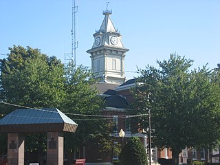
Reynoldsburg, Illinois

Last updated
Reynoldsburg, Illinois
Unincorporated community
USA Illinois location map.svg
Red pog.svg
Reynoldsburg
Usa edcp location map.svg
Red pog.svg
Reynoldsburg
Coordinates: 37°30′55″N88°46′33″W / 37.51528°N 88.77583°W / 37.51528; -88.77583 Coordinates: 37°30′55″N88°46′33″W / 37.51528°N 88.77583°W / 37.51528; -88.77583
Country United States
State Illinois
County Johnson
Elevation 574 ft (175 m)
Time zone Central (CST) (UTC-6)
  Summer (DST) CDT (UTC-5)
Area code(s) 618
GNIS feature ID 426937 [1]

Reynoldsburg is an unincorporated community in Johnson County, Illinois, United States. The community is located at the intersection of Gum Springs Road and Reynoldsburg Road 9.6 miles (15.4 km) northeast of Vienna. [2] Reynoldsburg had a post office from 1860 to 1879. [1]
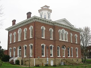
Johnson County, Illinois County in the United States

Johnson County is a county located in the U.S. state of Illinois. According to the 2010 census, it has a population of 12,582. Its county seat is Vienna. It is located in the southern portion of Illinois known locally as "Little Egypt".

Illinois State of the United States of America

Illinois is a state in the Midwestern and Great Lakes region of the United States. It has the fifth largest gross domestic product (GDP), the sixth largest population, and the 25th largest land area of all U.S. states. Illinois is often noted as a microcosm of the entire United States. With Chicago in northeastern Illinois, small industrial cities and immense agricultural productivity in the north and center of the state, and natural resources such as coal, timber, and petroleum in the south, Illinois has a diverse economic base, and is a major transportation hub. Chicagoland, Chicago's metropolitan area, encompasses over 65% of the state's population. The Port of Chicago connects the state to international ports via two main routes: from the Great Lakes, via the Saint Lawrence Seaway, to the Atlantic Ocean and from the Great Lakes to the Mississippi River, via the Illinois Waterway to the Illinois River. The Mississippi River, the Ohio River, and the Wabash River form parts of the boundaries of Illinois. For decades, Chicago's O'Hare International Airport has been ranked as one of the world's busiest airports. Illinois has long had a reputation as a bellwether both in social and cultural terms and, through the 1980s, in politics.

Vienna, Illinois City in Illinois, United States

Vienna is a city in Johnson County, Illinois, United States. The population was 1,434 at the 2010 census. It is the county seat of Johnson County and the site of two well-known state penitentiaries.

Related Research Articles

Edwards County, Illinois County in the United States

Edwards County is a county located in the U.S. state of Illinois. As of the 2010 census, the population was 6,721. Its county seat is Albion. It is located in the southern portion known locally as "Little Egypt".

Creal Springs, Illinois City in Illinois, United States

Creal Springs is a city in Williamson County, Illinois, United States. The population was 543 at the 2010 census.

Reynoldsburg, Ohio City in Ohio, United States

Reynoldsburg is a city in Fairfield, Franklin, and Licking counties in the U.S. state of Ohio. It is a suburban community in the Columbus, Ohio metropolitan area. The population was 35,893 at the 2010 census.

Lusk's Ferry Road was an early road in Illinois that provided an overland connection between the main settlement, Fort Kaskaskia, on the Mississippi River, and Lusk's Ferry, an important crossing point on the Ohio River. The overland route afforded an alternative to the river route, which required a difficult trip upstream on the Mississippi.

Blacklick, Ohio Unincorporated community in Ohio, United States

Blacklick is a small unincorporated community in southern Jefferson Township, Franklin County, Ohio, United States. Blacklick is also included in the Columbus Metropolitan area.

Illinois Route 166 is a 14.43-mile (23.22 km) north–south state road in southern Illinois, United States. The route runs from its southern terminus at U.S. Route 45 in New Burnside to its northern terminus at Illinois Route 13 east of Marion. Route 166 serves the counties of Johnson and Williamson. It is maintained by the Illinois Department of Transportation (IDOT).

Truro Township, Franklin County, Ohio Township in Ohio, United States

Truro Township is one of the seventeen townships of Franklin County, Ohio, United States. The 2010 census found 26,837 people in the township, 1,304 of whom lived in the unincorporated portions of the township.

Etna Township, Licking County, Ohio Township in Ohio, United States

Etna Township is one of the twenty-five townships of Licking County, Ohio, United States. The 2010 census found 16,373 people in the township, 8,311 of whom lived in the unincorporated portions of the township.

Gilmer, Illinois Unincorporated community in Illinois, United States

Gilmer is an unincorporated community in Lake County, Illinois, United States. Gilmer is located along Gilmer Road and the Canadian National Railway north of Hawthorn Woods.

Aptakisic, Illinois Unincorporated community in Illinois, United States

Aptakisic is an unincorporated community in Lake County, Illinois, United States. Aptakisic is located along Aptakisic Road and the Canadian National Railway; it borders Buffalo Grove to the west and Lincolnshire to the east.

Stiritz, Illinois Unincorporated community in Illinois, United States

Stiritz is an unincorporated community in Williamson County, Illinois, United States. The community is located along Stiritz Road 1.6 miles (2.6 km) northwest of Johnston City.

Pond, Illinois Unincorporated community in Illinois, United States

Pond is an unincorporated community in Johnson County, Illinois, United States. The community is located along Illinois Route 147 4.1 miles (6.6 km) east-northeast of Vienna.

Reevesville, Illinois Unincorporated community in Illinois, United States

Reevesville is an unincorporated community in Johnson County, Illinois, United States. The community is located along County Route 10 and the Canadian National Railroad 11 miles (18 km) east-southeast of Vienna.

Crossroads, Illinois Unincorporated community in Illinois, United States

Crossroads is an unincorporated community in Johnson County, Illinois, United States. The community is located along County Route 5 6.3 miles (10.1 km) southeast of Vienna.

Ganntown, Illinois Unincorporated community in Illinois, United States

Ganntown is an unincorporated community in Johnson County, Illinois, United States. The community is located along County Route 10 7.2 miles (11.6 km) east-southeast of Vienna.

White Hill, Illinois Unincorporated community in Illinois, United States

White Hill is an unincorporated community in Johnson County, Illinois, United States. The community is located along Illinois Route 37 3.2 miles (5.1 km) south of Cypress.

Newburg, Illinois Unincorporated community in Illinois, United States

Newburg is an unincorporated community in Friends Creek Township, Macon County, Illinois, United States. The community is located at the intersection of Newburg Road and Cemetery Road 1 mile (1.6 km) east of Argenta.

Prairie Hall, Illinois Unincorporated community in Illinois, United States

Prairie Hall is an unincorporated community in Mount Zion Township, Macon County, Illinois, United States. The community is on Prairie Hall Road 4.9 miles (7.9 km) east-southeast of Mount Zion.

Ticona, Illinois Unincorporated community in Illinois, United States

Ticona is an unincorporated community in Eden Township, LaSalle County, Illinois, United States. Ticona is located at the junction of East 550th Road and North 2101st Road, approximately 1 mile (1.6 km) northeast of Tonica. Ticona shares a ZIP code with Tonica.

References