Ribeira Julião

Last updated
Ribeira Julião
Cape Verde location map.svg
Red pog.svg
Coordinates: 16°51′20″N24°59′56″W / 16.8555°N 24.999°W / 16.8555; -24.999 Coordinates: 16°51′20″N24°59′56″W / 16.8555°N 24.999°W / 16.8555; -24.999
Country Cape Verde
Island São Vicente
Municipality São Vicente
Civil parish Nossa Senhora da Luz
Population (2010) [1]
  Total 611

Ribeira Julião, commonly as Ribeira de Julião (Cape Verdean Creole of São Vicente: Rbera Jilion) is a village located in the central part of the island of Sao Vicente, Cape Verde. Its 2010 population was 611 for the village, its estimate may be between 3,000 to 4,000 as of 2015 with recent housing and building developments occurring. It is situated in the hills southeast of the island capital Mindelo, approximately 6 km southeast of the city centre and is connected with the road linking Mindelo and Calhau along with the east of the island and an unpaved road to Monte Verde and the north of the island and is named after its nearby stream Ribeira de Julião. The growing population not made it a part of the Mindelo Urban Area but with other parts of the island growing developing to be a village of the São Vicente Metro Area.

São Vicente, Cape Verde island in Cape Verde

São Vicente is one of the Barlavento Islands, the northern group within the Cape Verde archipelago in the Atlantic Ocean, off the west African coast. It is located between the islands of Santo Antão and Santa Luzia, with the Canal de São Vicente separating it from Santo Antão.

Cape Verde Country comprising ten islands off the Northwest coast of Africa

Cape Verde or Cabo Verde, officially the Republic of Cabo Verde, is an island country spanning an archipelago of 10 volcanic islands in the central Atlantic Ocean. It forms part of the Macaronesia ecoregion, along with the Azores, Canary Islands, Madeira, and the Savage Isles. In ancient times these islands were referred to as "the Islands of the Blessed" or the "Fortunate Isles". Located 570 kilometres (350 mi) west of the Cape Verde Peninsula off the coast of Northwest Africa, the islands cover a combined area of slightly over 4,000 square kilometres (1,500 sq mi).

Mindelo Settlement in São Vicente, Cape Verde

Mindelo is a port city in the northern part of the island of São Vicente in Cape Verde. Mindelo is also the seat of the parish of Nossa Senhora da Luz, and the municipality of São Vicente. The city is home to 93% of the entire island's population. Mindelo is known for its colourful and animated carnival celebrations, with roots in Portuguese traditions.

Contents

Subdivisions

About the village

The population has been growing since the 1980s and the 1990s. The buildings are concentrated in the western and the southern parts, the center is to the west, the rest along with farmlands and plantations are sporadically located within the stream, the main road and the foot of the mountains, several forests are within the stream, the rest of the area composes of grasslands. The center of town runs north to south and has a main street and two local north-south streets. Large homes dominates the north, campuses in the western part, moderate size homes in other parts and recently a new facility in the east built in 2014 and completed in 2016.

It has a church named Saint John the Baptist (São João Batista). Ribeira de Julião is best known for the festival of Saint John the Baptist celebrated each year on June 24 with traditional colá music.

Colá

Colá is a musical genre of Cape Verdean music

It is the home of the School of Maritime Sciences which belongs to the University of Cape Verde since 2006, until 2008 it was known as ISCEMAR (Instituto Superior de Engenharia e Ciências do Mar, High Institute of Engineering and Maritime Sciences). It signaled the entity responsible for the national domain .cv, Cape Verde for the Internet , since August 2009, it is now signaled by the National Communications Agency. Also it has the campuses of the University of Mindelo and other lesser universities, Uni. CV and the University of Mindelo de São Vicente may have built additional facilities and campuses in the east at the Phase II area of Chã de Matia.

The University of Cape Verde is the only public university of Cape Verde. The main campus is in Palmarejo, Praia, but there are also institutes in Mindelo, Assomada and São Jorge dos Órgãos. It has over 5000 students. A new campus for Uni-CV is under construction in Palmarejo, financed by the Chinese government. It should be completed by July 2020. It will have capacity for 4,890 students and 476 professors, with a library, dorms, cafeterias and sports facilities. It will have 61 class rooms, five auditoriums with a capacity of 150 seats, eight computer rooms, eight reading rooms and 34 laboratories.

.cv is the country code top-level domain (ccTLD) for Cape Verde. It is managed by the National Communications Agency. It was introduced on 21 October 1996 and initially it was managed by the Instituto Superior de Engenharia e Ciências do Mar (ISECMAR), later it became the School of Maritime Sciences, it became a campus of the University of Cape Verde until its redelegation in August 2009 by the current National Communications Agency.

Related Research Articles

Tarrafal de São Nicolau, Cape Verde Settlement in São Nicolau, Cape Verde

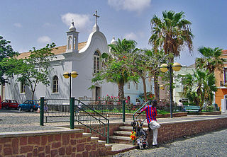
Tarrafal de São Nicolau is a city in the western part of the island of São Nicolau, Cape Verde. With a population of 3,733, it is the most populous settlement of the island. It is the seat of the Tarrafal de São Nicolau Municipality, and the main port of the island. It is situated on the west coast, 9 km southwest of Ribeira Brava.

Rabil Settlement in Boa Vista, Cape Verde

Rabil is a town on the island of Boa Vista, Cape Verde. It was the island's former capital. Rabil is the island's second largest town, located 6 kilometres (3.7 mi) southeast of the island capital of Sal Rei. Its population was 1,248 in 2010. The island's airport, Aristides Pereira International Airport, is situated northwest of the town.

Ribeira da Barca Settlement in Santiago, Cape Verde

Ribeira da Barca is a town in the municipality of Santa Catarina, on the island of Santiago, Cape Verde. In 2010 its population was 2,317. It is situated on the west coast, at the mouth of the stream Ribeira da Barca, 11 km northwest of Assomada. The settlement was mentioned as "Rivera das Baras" in the 1747 map by Jacques-Nicolas Bellin.

Achada Monte Settlement in Santiago, Cape Verde

Achada Monte is a town in the northern part of the island of Santiago, Cape Verde and is part of the municipality of São Miguel. It is situated near the east coast, 8 km northwest of Calheta de São Miguel. In 2010 its population was 1,652. It is on the road connecting Praia and Tarrafal through Pedra Badejo, the EN1-ST02. The small bay Mangue de Sete Ribeiras is located east of the settlement. Ribeira Principal flows west of the village.

Nossa Senhora da Lapa (Ribeira Brava) Civil parish in São Nicolau, Cape Verde

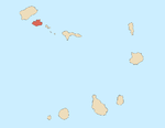
Nossa Senhora da Lapa is a freguesia of Cape Verde. It covers the smaller northwestern part of the municipality of Ribeira Brava, on the island of São Nicolau.

Nossa Senhora do Livramento, Cape Verde Civil parish in Santo Antão, Cape Verde

Nossa Senhora do Livramento is a freguesia of Cape Verde. It covers the northern part of the municipality of Ribeira Grande, on the island of Santo Antão.

Nossa Senhora do Rosário (Ribeira Grande) Civil parish in Santo Antão, Cape Verde

Nossa Senhora do Rosário is a freguesia of Cape Verde. It covers the eastern part of the municipality of Ribeira Grande, on the island of Santo Antão.

Santo Crucifixo Civil parish in Santo Antão, Cape Verde

Santo Crucifixo is a freguesia of Cape Verde. It covers the southern part of the municipality of Ribeira Grande, on the island of Santo Antão. The seat of the parish is Coculi. The parish covers much of the Ribeira Grande valley.

São Pedro Apóstolo Civil parish in Santo Antão, Cape Verde

São Pedro Apóstolo is a freguesia of Cape Verde. It covers the western part of the municipality of Ribeira Grande, on the island of Santo Antão.

Ribeira da Vinha Settlement in São Vicente, Cape Verde

Ribeira da Vinha is a village in the central part of the island of Sao Vicente, Cape Verde. It is situated in the plain southwest of the island capital Mindelo, approximately 3 km from the city centre.

Ribeira Grande, Cape Verde Settlement in Santo Antão, Cape Verde

Ribeira Grande is the largest town of the Ribeira Grande Municipality on the island of Santo Antão, Cape Verde. It has become a city in 2010. In 2010 its population was 2,564. It is situated in the northeastern part of the island, near the outflow of the river Ribeira Grande and its tributary Ribeira da Torre into the Atlantic Ocean. Neighborhoods include Tarrafal, Rua de Agua, Rua d'Horta and Penha de França.

Porto Novo, Cape Verde Settlement in Santo Antão, Cape Verde

Porto Novo is a city in the island of Santo Antão, in Cape Verde. It is the seat of the Porto Novo municipality. At the 2010 census, the town had 9,310 inhabitants, which makes it the most populous settlement of the island.

Ribeira Bote Neighborhood in Mindelo, São Vicente Island, Cape Verde

Ribeira Bote is a subdivision of the city of Mindelo in the island of São Vicente, Cape Verde. Its population was 3,956 at the 2010 census. It borders the city centre to the northwest and Fonte Cónego to the north. The Hospital Velho and the church Nossa Senhora Auxiliadora are located in Ribeira Bote.

Lajedo, Cape Verde Settlement in Santo Antão, Cape Verde

Lajedo is a settlement in the southcentral part of the island of Santo Antão, Cape Verde. In 2010 its population was 558. It is situated in the valley of Ribeira das Patas, about 11 km west of the island capital Porto Novo. The settlement consists of several localities, including Ponte Sul, Lajedo proper and Vascona. The road from Porto Novo to Ribeira da Cruz in the north of the island passes through Lajedo.

Chã de Pedras Settlement in Santo Antão, Cape Verde

Chã de Pedras is a settlement in the northcentral part of the island of Santo Antão, Cape Verde. In 2010 its population was 1,266. It is situated about 5 km south of Coculi, 8 km southeast of the city Ribeira Grande and 12 km northwest of the island capital Porto Novo. It consists of 21 localities in the valley of the Ribeira de Chã de Pedras, a right tributary of the Ribeira Grande. The elevation of the largest village, Pia de Cima, is about 430 metres.

City center of Mindelo Neighborhood in Mindelo, São Vicente Island, Cape Verde

The City center of Mindelo or Morada is the historic center of the Mindelo in the island of São Vicente, Cape Verde. Its population was 1,553 at the 2010 census. It is the place where the island's first settlement was founded in 1793. Many public buildings are situated in the city centre. It lies along the Porto Grande Bay. Adjacent neighbourhoods include Fortinho to the northwest, Alto Miramar to the northeast, Fonte Cônego to the east and Ribeira Bote to the southeast.

Alto Miramar Neighbourhood in Mindelo, São Vicente Island, Cape Verde

Alto Miramar is a subdivision of the city of Mindelo in the island of São Vicente, Cape Verde. Its population was 524 at the 2010 census. It is situated directly northeast of the city centre. The main streets of the neighbourhood are Rua Unidade Africana and Rua da Paz.

Fonte Cónego Neighborhood in Mindelo, São Vicente Island, Cape Verde

Fonte Cónego is a subdivision of the city of Mindelo in the island of São Vicente, Cape Verde. Its population was 236 at the 2010 census. It is situated directly east of the city centre. Adjacent neighborhoods include Alto Miramar to the northwest, Alto Santo António to the north, Alto Solarine/Forca to the northeast and Ribeira Bote to the south.

References