
Roedean is a village in the city of Brighton and Hove, England, UK, east of the seaside resort of Brighton.
Roedean is a village in the city of Brighton and Hove, England, UK, east of the seaside resort of Brighton.
Roedean Gap is a slight dip in the cliffs between Black Rock and Ovingdean Gap, and has been known by the name since at least 1724. It was the site of a toll-gate on the Newhaven turnpike, and Roedean Farm stood on the clifftop until the construction of the Marine Drive road in the early 1930s. There was also a windmill at Roedean from around 1750 to about 1790, and the old mill-house was amongst the buildings cleared for the road construction.
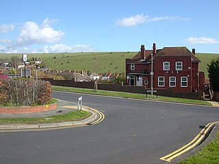
Roedean Road itself opened between Arundel Road and the coast road at Roedean Farm in 1897 as an alternative to the cliff-top road which had become unusable to the east of Black Rock owing to cliff erosion; seventy-five feet of land had disappeared in fifty years. The new road to Rottingdean, Marine Drive, was opened on 22 July 1932 by Percy John Pybus, Minister of Transport, with the cliffs protected by the Undercliff Walk sea-wall. [1]

The village is known for its independent school, Roedean School. [2]

White Lodge, The Cliff, is an atypically small house by Sir Edwin Lutyens, built for Victoria Sackville. It was one of the architect's first commissions, and herringbone-style vertically laid floor tiles in the garden were in part laid by the architect himself. [3]
John Howard House at the western end of Roedean Road (which today would be considered part of the mid-late 20th century East Brighton estate of Whitehawk) was opened in 1914 at the expense of Sir John Howard as a convalescent home for gentlewomen, but it was almost immediately requisitioned for use as an officers' hospital in World War I. In 1974 it became a home of the Royal Hospital and Home for Incurables, which is based in Putney and run on a voluntary basis. [1] It is now the site of the Brighton Steiner School.

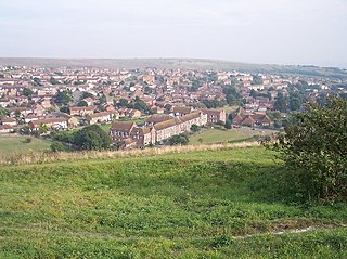
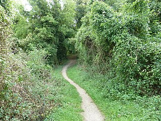
Roedean Bottom extends northwards from the gap and has been the site of a number of Roman finds. In about 1900 an isolated row of coastguard cottages now known as Roedean Terrace was erected to the west of the valley. The Roedean estate, which was developed around the terrace from the 1930s, is now one of Brighton's most exclusive residential districts with a population of around 600. The open spaces along the cliff top were acquired by the corporation in 1928–35. The miniature golf-course opened in April 1957, but was reduced to 16 holes in 1988 for the new layout of Marine Drive to cater for Marina traffic; the adjacent area to the north of Roedean Road has also been used as a pitch-and-putt golf course. [1]
Stretching north, between the pitch and putt golf course and the Roedean School is a downland meadow. On its east slope of the Bottom there is a little piece of aboriginal Downland turf, where in late summer autumn ladies tresses orchid grow, with carline thistle and hairy violet. Tiny moss snail in the turf demonstrates the site’s antiquity. [4] In autumn migrant birds gather there and on the grazed fields yellow wagtails gather and in the trees above the school Pallas' Warbler was seen in 2020. [5]

The East Brighton Golf Club in Roedean Road is a private club, founded in 1893 as the Kemp Town Golf Club. [6] Initially it had just a few holes alongside Roedean Road, but it was soon extended to nine holes across the Downs, and in 1897 changed its name to East Brighton with the addition of another nine holes. The small clubhouse was near the present fourth tee, but the present clubhouse was erected in 1897 and extended several times until 1912. The course itself is 6,291 yards long and was remodelled in 1903 along Wick Bottom; the land is leased from the corporation which acquired it in September 1913 as part of the East Brighton estate. Past presidents of the club include the Duke of Norfolk, Marquess of Abergavenny, Earl of Chichester and Earl Haig. [6] Unlike many Downland courses still has its roughs to scrub thickets and woodland and in winter short-eared owls often reside in the area. [5]

Brighton is a seaside resort and one of the two main areas of the city of Brighton and Hove in the county of East Sussex, England. It is located 47 mi (76 km) south of London. Archaeological evidence of settlement in the area dates back to the Bronze Age, Roman and Anglo-Saxon periods. The ancient settlement of "Brighthelmstone" was documented in the Domesday Book (1086). The town's importance grew in the Middle Ages as the Old Town developed, but it languished in the early modern period, affected by foreign attacks, storms, a suffering economy and a declining population. Brighton began to attract more visitors following improved road transport to London and becoming a boarding point for boats travelling to France. The town also developed in popularity as a health resort for sea bathing as a purported cure for illnesses.

Hove is a seaside resort. It is one of the two main parts of the city of Brighton and Hove, in East Sussex, England.
Brighton and Hove is a unitary authority with city status in East Sussex, England. There are multiple villages alongside the seaside resorts of Brighton and Hove in the district. It is administered by Brighton and Hove City Council, which is currently under Labour majority control.

Seaford is a town in East Sussex, England, east of Newhaven and west of Eastbourne.
Portslade is a western suburb of the city of Brighton and Hove in the ceremonial county of East Sussex, England. Portslade Village, the original settlement a mile inland to the north, was built up in the 16th century. The arrival of the railway from Brighton in 1840 encouraged rapid development of the coastal area and in 1898 the southern part, formerly known as Copperas Gap, was granted urban district status and renamed Portslade-by-Sea, making it distinct from Portslade Village. After World War II the district of Mile Oak to the north was added. Today, Portslade is bisected from east to west by the old A27 road between Brighton and Worthing, each part having a distinct character.
Whitehawk is a suburb in the east of Brighton, England, south of Bevendean and north of Brighton Marina. The area is a large, modern housing estate built in a downland dry valley historically known as Whitehawk Bottom. The estate was originally developed by the local council between 1933 and 1937 and included nearly 1,200 residences. Subsequently, the Swanborough flats were built in 1967, and in the 1970s and 1980s much of the estate was rebuilt by altering the road layouts and increasing the number of houses. Whitehawk is part of the East Brighton ward of Brighton and Hove City Council.

Bevendean is a district of the city of Brighton and Hove, in East Sussex, England.
Piddinghoe is a village and civil parish in the Lewes District of East Sussex, England. It is located in the valley of the River Ouse between Lewes and Newhaven, five miles (8 km) south of the former, downstream of Southease.

Iford is a village and civil parish in the Lewes District of East Sussex, England. The village is located two miles (3.2 km) south of Lewes. The parish lies on slopes of the South Downs in the valley of the River Ouse.
St Ann Without is a civil parish in the Lewes District of East Sussex, England. It covers an area to the west of the town of Lewes, including Long Hill.

Newtimber is a small village and civil parish in the Mid Sussex District of West Sussex, England. It is located north-west of Brighton. The parish also includes the hamlet of Saddlescombe. The parish lies almost wholly with the South Downs National Park, with the exception of a small section of the parish north of the B2117 road. The planning authority for Newtimber is therefore the South Downs National Park Authority (SDNPA), the statutory planning authority for the National Park area. The downland scarp, which includes Newtimber Hill, Newtimber Holt, Saddlescombe chalk quarry and Summer Down, is mostly part of the Beeding Hill to Newtimber Hill, designated Site of Special Scientific Interest.

Pyecombe is a village and civil parish in the Mid Sussex District of West Sussex, England. Pyecombe is located 7 miles (11 km) to the north of Brighton. The civil parish covers an area of 887 hectares and has a population of 200, increasing at the 2011 Census to a population of 237.
Woodingdean is an eastern suburb of the city of Brighton and Hove, East Sussex, separated from the main part of the city by downland and the Brighton Racecourse. The name Woodingdean came from Woodendean Farm which was situated in the south end of what is now Ovingdean.

Hollingbury is an area of the city of Brighton and Hove, East Sussex. The area sits high on a hillside across the north of the city, east of Patcham which lies in a valley to the west, Coldean in a valley to the east, and the A27 bypass forming the northern limit. To the south it blends into the leafy Surrenden area and the busy Fiveways local shopping area.

Hangleton is a suburb of Brighton and Hove, in the ceremonial county of East Sussex, England. The area was developed in the 1930s after it was incorporated into the Borough of Hove, but has ancient origins: its parish church was founded in the 11th century and retains 12th-century fabric; the medieval manor house is Hove's oldest secular building. The village became depopulated in the medieval era and the church fell into ruins, and the population in the isolated hilltop parish only reached 100 in the early 20th century; but rapid 20th-century development resulted in more than 6,000 people living in Hangleton in 1951 and over 9,000 in 1961. By 2013, the population exceeded 14,000.

Mile Oak is a locality forming the northern part of the former parish of Portslade in the northwest corner of the city of Brighton and Hove, England. Now mostly residential, but originally an area of good-quality agricultural land, it covers the area north of Portslade village as far as the urban boundary.

Patcham is a suburb in the city of Brighton and Hove, in the ceremonial county of East Sussex, England. It is about 3 miles (5 km) north of the city centre. It is bounded by the A27 to the north, Hollingbury to the east and southeast, Withdean to the south and the Brighton Main Line to the west. The A23 passes through the area.

Westdene is an area of the city of Brighton and Hove, East Sussex. It is an affluent northern suburb of the city, west of Patcham, the A23 and the London to Brighton railway line, north of Withdean and northeast of West Blatchington. It is on the Brighton side of the historic parish boundary between Brighton and Hove and is served by Preston Park railway station. It is known for its greenery and woodland and is very close to the South Downs, from which it is separated by the Brighton Bypass, and was built on the slopes of two hills.

Benfield Hill is an 11.8-hectare (29-acre) Local Nature Reserve (LNR) on the northern outskirts of Hove in East Sussex and is within the boundaries of the South Downs National Park. It is owned and managed by Brighton and Hove City Council.

David Bangs is a field naturalist, social historian, public artist, author and conservationist. He has written extensively on the countryside management, both historically and present day in the English county of Sussex.
50°48′54.8″N0°5′43.5″W / 50.815222°N 0.095417°W
City of Brighton and Hove | |||||||||||||
|---|---|---|---|---|---|---|---|---|---|---|---|---|---|
| Topics | |||||||||||||
| Events | |||||||||||||
| Culture | |||||||||||||
| Politics | |||||||||||||
| Transport |
| ||||||||||||
| Media | |||||||||||||
| Sport |
| ||||||||||||
| Buildings | |||||||||||||
| Parks | |||||||||||||
| Areas |
| ||||||||||||