
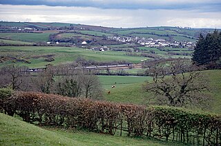
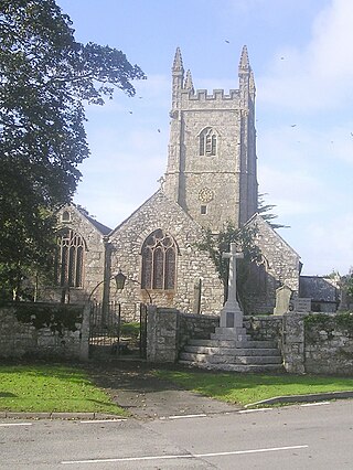
Rosenithon (Cornish : Ros an Eythin) is a hamlet east of St Keverne in west Cornwall, England. [1]
The name Rosenithon comes from the Cornish language Ros an Eythin, which means 'the hill-spur of gorse'. [2]
Rosenithon (Cornish : Ros an Eythin) is a hamlet east of St Keverne in west Cornwall, England. [1]
The name Rosenithon comes from the Cornish language Ros an Eythin, which means 'the hill-spur of gorse'. [2]
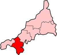
Kerrier was a local government district in Cornwall, England, United Kingdom. It was the most southerly district in the United Kingdom, other than the Isles of Scilly. Its council was based in Camborne. Other towns in the district included Redruth and Helston. The district also contained the Lizard Peninsula.
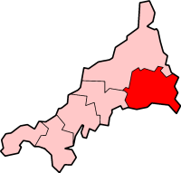
Restormel was a borough of Cornwall, England, one of the six administrative divisions that made up the county. Its council was based in St Austell; its other towns included Newquay.
Caradon was a local government district in Cornwall, England, United Kingdom. It contained five towns: Callington, Liskeard, Looe, Saltash and Torpoint, and over 80 villages and hamlets within 41 civil parishes. Its District Council was based in Liskeard 50.453°N 4.465°W.

North Cornwall is an area of Cornwall, England, United Kingdom. It is also the name of a former local government district, which was administered from Bodmin and Wadebridge 50.516°N 4.835°W. Other towns in the area are Launceston, Bude, Padstow, and Camelford.

The Roseland Peninsula, or just Roseland, is a district of west Cornwall, England. Roseland is located in the south of the county and contains the town of St Mawes and villages such as St Just and Gerrans. It is a peninsula, separated from the remainder of Cornwall by the River Fal.
The Truro River is a river in the city of Truro in Cornwall, England, UK. It is the product of the convergence of the two rivers named Kenwyn and Allen which run under the city: the Truro River flows into the River Fal, estuarial waters where wildlife is abundant, and then out into the Carrick Roads. The river is navigable up to Truro.
Stithians, also known as St Stythians, is a village and civil parish in Cornwall, England, United Kingdom. It lies in the middle of the triangle bounded by Redruth, Helston and Falmouth. Its population (2001) is 2,004, increasing to 2,101 at the 2011 census An electoral ward in the same name also exists but stretches north to St Day. The population here also at the 2011 census was 5,023.
The Rame Peninsula is a peninsula in south-east Cornwall. It is surrounded by the English Channel to the south, Plymouth Sound to the east, the Hamoaze to the northeast and the estuary of the River Lynher to the north-west. On a clear day, the Atlantic Ocean can be seen from advantageous points from Rame Head. The largest settlement is Torpoint, which is on the eastern coast, facing Devonport in Plymouth, Devon.

The River Hayle is a small river in West Cornwall, England, United Kingdom which issues into St Ives Bay at Hayle on Cornwall's Atlantic coast.
There are seventeen disused railway stations on the Cornish Main Line between Plymouth in Devon and Penzance in Cornwall, England. The remains of nine of these can be seen from passing trains. While a number of these were closed following the so-called "Beeching Axe" in the 1960s, many of them had been closed much earlier, the traffic for which they had been built failing to materialise.
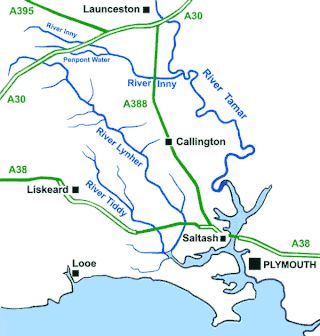
The River Inny is a small river in East Cornwall, England, United Kingdom. A tributary of the River Tamar, the Inny is about twenty miles (32 km) long from its source near Davidstow on the eastern flank of Bodmin Moor to its confluence with the Tamar at Inny Foot near Dunterton.

The River Menalhyl is a river in Cornwall, England, that flows through the civil parishes of St Columb Major and Mawgan-in-Pydar. Its length is about 12 miles and it flows in a generally north-west direction. The name comes from the Cornish words melyn meaning mill and heyl meaning estuary - estuary mills. The name was recorded as Mellynheyl in the 19th century, but it had been known as Glyvion.

The River Allen in north Cornwall is one of two rivers in Cornwall which share this name. In this case the name is the result of a mistake made in 1888 by Ordnance Survey, replacing the name Layne with Allen which is the old name for the lower reaches of the Camel. The other River Allen runs through Truro.
Cornish surnames are surnames used by Cornish people and often derived from the Cornish language such as Jago, Trelawney or Enys. Others have strong roots in the region and many in the UK with names such as Eddy, Stark or Rowe are likely to have Cornish origins. Such surnames for the common people emerged in the Middle Ages, although the nobility probably had surnames much earlier on. Not until the later Middle Ages did it become necessary for a common man to have a surname. Most surnames were fully established throughout Cornwall by the end of the 15th century. Cornish surnames can be found throughout the world as part of the Cornish diaspora.

The River Ottery is a small river in northeast Cornwall, England, United Kingdom. The river is about twenty miles (32 km) long from its source southeast of Otterham to its confluence with the River Tamar at Nether Bridge, two miles (3.2 km) northeast of Launceston.

Restronguet Point is a small narrow promontory in the civil parish of Feock in south Cornwall, England, United Kingdom. It is situated approximately three-quarters of a mile (1 km) south of Feock village.

The St Austell River properly known as the River Vinnick, but historically called The White River, is a 12 kilometres (7.5 mi) long river located in south Cornwall, England, United Kingdom. 50.337°N 4.793°W. The river has also been known as the "red river" due to tin streaming and mining activity upstream.

Rosenannon is a hamlet in Cornwall, England, United Kingdom. It is within the civil parish of St Wenn, 4 miles (6.4 km) south-west of the town of Wadebridge.
A plen-an-gwarry or plain-an-gwary, is a "playing-place" or round, a medieval amphitheatre found in Cornwall. A circular outdoor space used for plays, sports, and public events, the plen-an-gwary was a Cornish variant of a construction style found across Great Britain. Formerly common across Cornwall, only two survive nearly complete today: the Plain in St Just in Penwith and Saint Piran's Round near Perranporth.

The River Lerryn is a river in east Cornwall, England, UK, a tributary of the River Fowey. The Lerryn is the largest of the tributaries which enter the estuary of the Fowey. The river is tidal up to the village of Lerryn. The landscape of the Lerryn catchment is rural and includes heathland, moorland and rough pasture in the upper reaches and broadleaf, coniferous and mixed plantation woodland in the lower. This catchment includes four SSSIs, including Redlake Meadows & Hoggs Moor. The Lerryn rises at Fairy Cross on the southern slopes of Bodmin Moor and flows south-southwest until it enters the Fowey estuary.
| Unitary authorities | |
|---|---|
| Major settlements (cities in italics) |
|
| Rivers | |
| Topics | |
50°03′02″N5°04′22″W / 50.0505995°N 5.0726889°W
| | This Cornwall location article is a stub. You can help Wikipedia by expanding it. |