Route nationale 4

Last updated

The Route nationale 4 is a trunk road (nationale) [1] in France between Paris and the frontier with Germany. [2]

Contents

Reclassification

The RN 4 has been re-classified around Nancy as the RD 400 as through traffic is now directed onto the Autoroutes A 31 and A 33.

Route

Paris-St Dizier-Nancy-Strasbourg- Germany

Paris to Saint Dizier (0 km to 191 km)

The road begins in Central Paris at the Porte Doree and a junction with the RN 6 a separate branch starts in the Bois Vincennes with a junction with the RN 34 before heading south through the park and meeting the other branch the Avenue de Gravelle. The road follows the southern edge of the park. It crosses the A4 autoroute and continues east as the Avenue des Canadiens and then crossing the river Marne. It passes through the suburbs of Joinville-le-Pont and Champigny-sur-Marne. It then passes through Chennevières-sur-Marne and an industrial area before reaching open countryside and the northern edge of the Forêt de Notre-Dame.

The road has a junction with the RN 104 and becomes a dual-carriageway and now bypasses Ozoir-la-Ferrière and then Gretz Armainvilliers south of the Forêt d'Armainvilliers. The road passes through rolling countryside past the Château de Boulayes. This is cheese county with the road taking an eastern course after Rozay-en-Brie. The road crosses the Forêt de la Traconne to Sézanne.

The road passes over open flat countryside increasingly sparsely populated reaching RN 77 and A 26. The road then drops from 200 m to 98 m at Vitry-le-François and the Marne again. There is a junction with the RD 44.

Saint Dizier to Nancy (191 km to 296 km)

The road heads south east next to the Canal de la Marne à Saône and heads into Saint-Dizier which lies on the Marne between the Forêt de la Haie Renaut and the Forêt du Val with the RN 67 branching south along the Marne valley. The RN 4 heads east up out of the valley climbing to 350 m in much steeper countryside which is also more wooded. The road then passes through the Forêt de Ligny before entering Ligny-en-Barrois itself in the Ornain valley crossing the Canal du Rhein.

The road passes to the south of the Forêt de Commercy and the village of Void-Vacon. The road is now in the valley of the river Meuse. The road passes into the town of Toul overlooked by wooded highlands including Bois de Grammont (424 m) and enters the valley of the river Moselle. The road then becomes the A 31, the old road runs parallel past the Parc de Haye in the Forêt de Haye. The road then heads east into Nancy on the river Meurthe.

Nancy to Strasbourg (296 km to 465 km)

At Nancy the road heads southeast re-classified as the D 900. Through traffic then follows the A 33 to the south. The old road passes through Saint Nicolas de Port over the river and east into Dombasle-s-Meurthe and then onward to Lunéville north of the Foret de Vitrimont. The road passes round the Forêt de Mondon and then over rolling countryside.

The road heads northeast along a ridge overlooking the Cornée de Réchicourt and Étang de Gondrexange in the Forêt de Réchicourt. The road then enters Alsace and the town of Sarrebourg. The road is doubled again as it meets the Autoroute A 4. The RN 4 passes through the Vosges over the Col de Saverne (385 m). As it heads down to Saverne it passes a Botanical Garden. After the town the road heads south east now in the valley of the Rhine. The countryside is flat and the road heads into the City of Strasbourg. The road becomes the autoroute A 351 joins the autoroute A 35 before branching east south of the city and over the river Rhine into Germany. The road then becomes the B 28.

Related Research Articles

<span class="mw-page-title-main">Route nationale 2</span> Trunk road in France

The Route nationale 2 is a route nationale in northern France.

<span class="mw-page-title-main">Marne–Rhine Canal</span> Waterway in eastern France

The Canal de la Marne au Rhin is a canal in north-eastern France. It connects the river Marne and the Canal entre Champagne et Bourgogne in Vitry-le-François with the port of Strasbourg on the Rhine. The original objective of the canal was to connect Paris and the north of France with Alsace and Lorraine, the Rhine, and Germany. The 313 km (194 mi) long canal was the longest in France when it opened in 1853.

<span class="mw-page-title-main">Route nationale 7</span> Road in France

The Route nationale 7, or RN 7, is a trunk road (nationale) in France between Paris and the border with Italy. It was also known as Route des vacances, Route bleue, and — sarcastically, during the annual rush to the Mediterranean beaches — the Route de la mort.

The Route nationale 3 is a trunk road (nationale) in France connecting Paris to the frontier of Germany.

The Route nationale 1 is a trunk road (nationale) in France between Paris and Calais. It is approximately 339 km (211 mi) long.

The Route nationale 6 is a trunk road (nationale) in France between Paris and the frontier with Italy in the Alps.

The Route nationale 5, or RN 5, is a trunk road (nationale) in France now connecting Dijon with the frontier of Switzerland. It is also numbered the European route E21.

<span class="mw-page-title-main">Route nationale 10</span> French route nationale

Route nationale 10, or RN 10, is a trunk in France between Paris and the border with Spain via Bordeaux.

The Route nationale 11, or RN11, is a trunk road (nationale) in Southwest France between Poitiers and La Rochelle. It is part of European route E611.

The Route nationale 12, or RN12, is a trunk road (nationale) in France connecting Paris with Brittany. The road forms part of European route E50. It is approximately 570 km (350 mi) long.

The Route nationale 16, or RN16, is a trunk road (nationale) in France crossing Picardy north of Paris.

The Route nationale 17, or RN17, is a trunk road (nationale) in France connecting Paris to the border with Belgium.

<span class="mw-page-title-main">Route nationale 19</span> Road in France

The Route nationale 19 (N19) is a trunk road (nationale) in north east France. The road forms part of European route E54.

<span class="mw-page-title-main">Route nationale 20</span> Road in France

The Route nationale 20 (N20) is a trunk road (nationale) between Paris and the frontier with Spain heading south through the heart of France and passing through the Cathedral City of Orléans and Toulouse. The road forks at Col de Puymorens with one branch being the Route nationale 22 which leads to Andorra. In winter, avalanches sometimes close the road.

The Route nationale 21 (N21) is a trunk road (nationale) in south west France.

The Route nationale 23 (N23) is a trunk road (nationale) in western France.

The Route nationale 28 is a trunk road in Normandy and Picardy in northwest France. It connects the city of Rouen to the port of Dunkerque. Most of the route has been superseded by the A28 autoroute.

The Route nationale 31 is a motorway in northern France. It connects the town of Rouen to Reims, it is also the European Route 46.
<span class="mw-page-title-main">Col de Saverne</span>

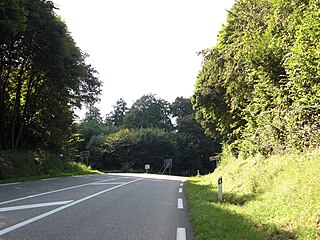
The Col de Saverne is a natural pass in the north of the Vosges mountains, near Saverne, which permits travel between the départements of Bas-Rhin and Moselle, and therefore between Alsace and Lorraine.
Transport routes that traverse the Saverne Pass include national highway RN 4 and A4 autoroute A4, the Paris-Strasbourg railway, as well as the Marne-Rhine Canal.

<span class="mw-page-title-main">Paris-Est–Strasbourg-Ville railway</span>

The railway from Paris-Est to Strasbourg-Ville is a 493-kilometre-long railway line that connects Paris to Strasbourg via Châlons-en-Champagne and Nancy, France. Officially, the line does not start at the Gare de l'Est in Paris: the first 9 km until Noisy-le-Sec is shared with the railway from Paris to Mulhouse. The railway was opened in several stages between 1849 and 1852. The opening of the LGV Est high speed line from Paris to Baudrecourt in Lorraine in 2007 has decreased the importance of the section Paris–Sarrebourg for passenger traffic.

References

  1. "RN4: VOUS AUREZ L'ALSACE ET LA LORRAINE (I)". surma-route.net (in French). Retrieved 13 August 2023.
  2. "La RN4 relie Paris à Strasbourg en passant par Nancy". L'Est Républicain (in French). 23 June 2017.