Route nationale 5

Last updated

The Route nationale 5, or RN 5, is a trunk road (nationale) [1] in France now connecting Dijon with the frontier of Switzerland. [2] It is also numbered the European route E21.

Contents

Reclassification

The RN 5 originally ran to Paris following the route now numbered RN 6 to Sens. Thereafter the road has been mostly been detrunked, with control and maintenance handed to local départments. A short section of road between Poligny and Les Rousses is still trunk.

Route

Sens-Dijon-Dole-Geneva-Thonon- Switzerland

Sens to Dijon (0 km to 199 km) (as D905)

The road branches east from Sens as the N 60 along the Vanne valley. After 8 km the D 905 turns south east over rolling wooded countryside. The TGV line runs parallel. The road crosses the ridge of the Forêt d'Othe. The road continues through Saint-Florentin where there is a junction with the RN 77. The road then runs southeast along the valley of the Armançon, following the Canal de Bourgogne, as far as Tonnerre where it crosses to the south of both canal and river and then through Lézinnes and Ancy-le-Franc. The road continues through the Bois de la Ville eventually leaving the valley at Montbard and the nearby Abbaye de Fontenay.

The road now follows the River Brenne and leaves the Canal de Bourgogne, which it has been following for almost 100 km. The road passes the Auxois to Vitteaux and then below the Forêt de Boutas et Charmot (542 m) and then along the northern shore of the Reservoir de Grosbois and then east passing over a ridge where the road meets Sombernon and the A 38. The road now enters the valley of the River Ouche eastward through the Forêt de Plombières and enters Dijon.

Dijon to Geneva (Switzerland) (199 km to 386 km)

(as D 905 from Dijon to Poligny, RN 5 until La Cure and D 1005 until Geneva (Switzerland))

The D 905 now forms part of a ring road around the south of the city heading southeast as the Rue d'Auxonne and then the Avenue du Mont Blanc, through traffic takes the A 38. The road's old course passes through Neuilly-Crimolois (as the D 905B) before it branches south from the motorway. The road then crosses the A 31.

The road crosses open countryside past Genlis and over the A 39 skirting the Bois de Mondragon. The road crosses the River Saône at Auxonne and goes through the Bois des Crochères. Before Dole the road crosses the A 36. The D 905 bypasses the town to the west while the old road is now classed the D 405 past the Forêt de Chaux.

The road follows a wooded ridge between two river valleys. The next town is Poligny. Upon crossing the RN 83 west of Poligny, the road becomes the RN 5. The road leaves to the southeast up the Culée de Vaux into the Forêt de Poligny (575 m). The countryside is then formed by ridges which rise to become the Jura mountains. The road heads through Champagnole overlooked bt Mont Fival (805 m). The road goes south along the Gorges de la Billaude to Saint-Laurent-en-Grandvaux.

There the road heads east over the Col de la Savine (984 m) in the Crête de la Joux Devant(1,094 m). The road drops into the next valley and the towns of Morbier and Morez. The road rises over the Crête des Sauges into Les Rousses alongside the Swiss border with a road heading over the Col de la Givrine (1228 m). Upon leaving La Cure the road becomes the D 1005.

The D 1005 heads along the Chaîne du Jura to the southwest in the Valmijoux before crossing the mountains towards Switzerland at the Col de la Faucille (1320 m). The road heading southeast passes through Gex and enters Switzerland at Ferney-Voltaire and Geneva Airport.

Geneva (Switzerland) to Saint-Gingolph (Switzerland) via Thonon (386 km to 436 km) (as D 1005)

The D 1005 commences again north-east of the city of Geneva on the southern shores of Lake Geneva. The road passes through the town of Douvaine, before reaching the shores of the lake at the village of Sciez. The road then enters the town of Thonon-les-Bains.

After Thonon the road crosses the River Dranse, and enters Amphion les Bains and then the town of Évian-les-Bains. The road now hugs the shores of the lake as the mountains climb steeply to the south with Mont Bénant. The road then passes the village of Meillerie and the town of Saint-Gingolph where the road reaches the frontier with Flag of Switzerland.svg Switzerland becoming the route 21 towards Martigny.

Related Research Articles

<span class="mw-page-title-main">Évian-les-Bains</span> Commune in Auvergne-Rhône-Alpes, France

Évian-les-Bains, or simply Évian, is a commune in Eastern France, by the border with Switzerland. It is located in the northern part of the Haute-Savoie department in the Auvergne-Rhône-Alpes region. In 2018, it had a population of 9,100.

<span class="mw-page-title-main">Auxonne</span> Commune in Bourgogne-Franche-Comté, France

Auxonne is a commune in the Côte-d'Or department in the Bourgogne-Franche-Comté region of eastern France. The inhabitants of the commune are known as Auxonnais or Auxonnaises.

<span class="mw-page-title-main">Mijoux</span> Commune in Auvergne-Rhône-Alpes, France

Mijoux is a commune and village in the Ain department in eastern France.

<span class="mw-page-title-main">Route nationale 2</span> Trunk road in France

The Route nationale 2 is a route nationale in northern France.

<span class="mw-page-title-main">Route nationale 7</span> Road in France

The Route nationale 7, or RN 7, is a trunk road (nationale) in France between Paris and the border with Italy. It was also known as Route des vacances, Route bleue, and — sarcastically, during the annual rush to the Mediterranean beaches — the Route de la mort.

The Route nationale 3 is a trunk road (nationale) in France connecting Paris to the frontier of Germany.

The Route nationale 1 is a trunk road (nationale) in France between Paris and Calais. It is approximately 339 km (211 mi) long.

The Route nationale 6 is a trunk road (nationale) in France between Paris and the frontier with Italy in the Alps.

The Route nationale 4 is a trunk road (nationale) in France between Paris and the frontier with Germany.

<span class="mw-page-title-main">Route nationale 10</span> French route nationale

Route nationale 10, or RN 10, is a trunk in France between Paris and the border with Spain via Bordeaux.

The Route nationale 12, or RN12, is a trunk road (nationale) in France connecting Paris with Brittany. The road forms part of European route E50. It is approximately 570 km (350 mi) long.

The Route nationale 16, or RN16, is a trunk road (nationale) in France crossing Picardy north of Paris.

The Route nationale 17, or RN17, is a trunk road (nationale) in France connecting Paris to the border with Belgium.

<span class="mw-page-title-main">Route nationale 19</span> Road in France

The Route nationale 19 (N19) is a trunk road (nationale) in north east France. The road forms part of European route E54.

<span class="mw-page-title-main">Route nationale 20</span> Road in France

The Route nationale 20 (N20) is a trunk road (nationale) between Paris and the frontier with Spain heading south through the heart of France and passing through the Cathedral City of Orléans and Toulouse. The road forks at Col de Puymorens with one branch being the Route nationale 22 which leads to Andorra. In winter, avalanches sometimes close the road.

<span class="mw-page-title-main">CEVA rail</span> Railway line from Geneva, Switzerland to Annemasse, France

CEVA (Cornavin‒Eaux-Vives‒Annemasse) is an orbital rail line designed to connect the main railway station of Geneva, Switzerland on the north of Lake Geneva with the Gare d'Annemasse in Annemasse, France, to the south of Lake Geneva. The link allows through running between the main Swiss rail network and the until then isolated line east of Annemasse in Haute-Savoie, which was served until 2013 by French SNCF services. A new station was constructed on the route at Gare des Eaux-Vives and the line between this station and the border was replaced with a double track line in tunnel. Track already existed as far as Stade de Genève station; the full route opened on 15 December 2019 to Léman Express and RegioExpress services.

<span class="mw-page-title-main">Athée, Côte-d'Or</span> Commune in Bourgogne-Franche-Comté, France

Athée is a commune in the Côte-d'Or department in the Bourgogne-Franche-Comté region of eastern France.

<span class="mw-page-title-main">Sciez</span> Commune in Auvergne-Rhône-Alpes, France

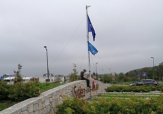
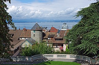
Sciez is a commune in the Haute-Savoie department in the Auvergne-Rhône-Alpes region in south-eastern France. Sciez forms part of a transborder agglomeration known as Grand Genève.

<span class="mw-page-title-main">France–Switzerland border</span> International border

The France–Switzerland border is 572 km (355 mi) long. Its current path is mostly the product of the Congress of Vienna of 1815, with the accession of Geneva, Neuchâtel and Valais to the Swiss Confederation, but it has since been modified in detail, the last time being in 2002. Although most of the border, marked with border stones, is unguarded, several checkpoints remain staffed, most notably on busy roads.

<span class="mw-page-title-main">Route nationale 205</span> Road in France

The Route nationale 205 is a Route nationale of France that is located entirely within the Department of Haute-Savoie. It starts off from the France–Switzerland border in the commune of Gaillard which is adjacent to Geneva; and ends at Chamonix, at the French side of the Mont Blanc Tunnel. It is also nicknamed the Route blanche due to its snowiness, and shares the title with the A40 autoroute, also nicknamed the Autoroute blanche.

References

    1. "RN5: PARIS DANS LE RETROVISEUR (I)". surma-route.net (in French). Retrieved 13 August 2023.
    2. "Le transfert de compétences vers Dijon métropole a été acté". Département de la Côte-d’Or (in French). Retrieved 2022-04-06.