A36 autoroute

Last updated
Autoroute francaise 36.svg
A36 autoroute
La Comtoise
Autoroute 36.png
Route information
Maintained by APRR
Length237 km (147 mi)
Major junctions
West end Autoroute francaise 31.svg A31 in Ladoix-Serrigny
East end Bundesautobahn 5 number.svg A5 (Germany) in Neuenburg am Rhein, Germany
Location
Country France
Highway system
  • Roads in France
A36 (France) Route marker.gif

The A36 autoroute is a toll motorway in northeastern France connecting the German border with Burgundy. It is also known as La Comtoise. The road forms part of European route E60.

Junctions

A36 near Belfort 140614-Autoroute-A36-01.jpg
A36 near Belfort
A36 near Mulhouse 140614-Autoroute-A36-02.jpg
A36 near Mulhouse
Exit/JunctionDestination
Sinnbild Autobahnkreuz.svgExchange A31-A36 Autoroute starts with a junction on the Autoroute francaise 31.svg A 31 to Lyon (south), Dijon/Metz (north)
Aire de pique-nique.png  Rest Area: Villy-le-Moutier (eastbound) Argilly (westbound)
Aire d'autoroute - station essence.png  Service Area: Bois-Guillerot (eastbound) Glanon (westbound)
Sinnbild Autobahnausfahrt.svg  1 (Seurre) Towns served: Seurre
Aire de pique-nique.png  Rest Area: Les Noues (eastbound) St-Jean-de-Losne (westbound)
Sinnbild Autobahnkreuz.svgExchange A36-A39 or St Seine Junction with the Autoroute francaise 39.svg A 39 to Dijon (north west) Bourg en Bresse (south east)
Aire de pique-nique.png  Rest Area: Sampans (eastbound) Bois des Potets (westbound)
Sinnbild Autobahnausfahrt.svg  2 (Dole Authume) Towns served: Dole, Authume
Aire d'autoroute - station essence.png  Service Area: Dole-Audelange (westbound)
Aire d'autoroute - station essence.png  Service Area: Dole-Romange (eastbound)
Sinnbild Autobahnausfahrt.svg  2.1 (Dampierre-Gendrey) Towns served: Dampierre, Gendrey
Aire de pique-nique.png  Rest area: Hyombre
Aire de pique-nique.png  Rest Area: Bois de Servole
Sinnbild Autobahnausfahrt.svg  3 (Besançon Planoise) Towns served: Marnay, Dannamarie
Aire de pique-nique.png  Rest Area: Bois de Frachère/Pelousey
Sinnbild Autobahnausfahrt.svg  4 (Besançon centre) Towns served: Route nationale francaise 57.svg N 57 , Besançon, Vesoul
Aire d'autoroute - station essence.png  Service Area: Besançon-Marchaux (eastbound) Besançon-Champoux (westbound)
Sinnbild Autobahnausfahrt.svg  4.1 (Marchaux-Besançon Palente) Towns served: Marchaux
Aire de pique-nique.png  Rest Area: Chevaney (eastbound) Les Grands Brocards (westbound)
Sinnbild Autobahnausfahrt.svg  5 (Baume-les-Dames) Towns served: Baume les Dames
Aire de pique-nique.png  Rest Area: La Combe de Fougère (eastbound) Le Boulet (westbound)
Aire de pique-nique.png  Rest Area: Charme
Aire de pique-nique.png  Rest Area: Galiot
Sinnbild Autobahnausfahrt.svg  6 (L'Isle-sur-le-Doubs) Towns served: L'Isle-sur-le-Doubs
Peage.png  Péage de St-Maurice
Aire d'autoroute - station essence.png  Service Area: Ecot (eastbound) La Combe Ronde (westbound)
Sinnbild Autobahnausfahrt.svg  6.1 (Pont de Roide) Towns served: Mathay
Sinnbild Autobahnausfahrt.svg  7 (Voujeaucourt) Towns served: Voujeaucourt
Sinnbild Autobahnausfahrt.svg  8 (Montbéliard) Towns served: Montbéliard
Sinnbild Autobahnausfahrt.svg  9 (Exincourt-Etupes) Towns served: Exincourt, Etupes, Sochaux
Sinnbild Autobahnausfahrt.svg  10 (Grand-Charmont) Towns served: Grand-Charmont
Aire de pique-nique.png  Rest Area: Dambenois
Sinnbild Autobahnausfahrt.svg  11 (Route nationale francaise 1019.svg N 1019 to Héricourt, Route nationale francaise 19.svg N 19 to Delle) Towns served: Delle, Héricourt
Aire de pique-nique.png  Rest area: Grand Bois
Sinnbild Autobahnausfahrt.svg  12a (Danjoutin-Bavilliers) Towns served: Danjoutin, Bavilliers
Sinnbild Autobahnausfahrt.svg  12b (Belfort centre) Towns served: Belfort
Sinnbild Autobahnausfahrt.svg  13 (Belfort Glacis-du-Château) Towns served: Belfort
Sinnbild Autobahnausfahrt.svg  14 (Colmar-Mulhouse par RN/Belfort centre) Towns served: Route nationale francaise 83.svg N 83 , Chèvremont
Aire de pique-nique.png  Rest Area: Les Grands-Prés
Aire de pique-nique.png  Rest Area: La Forêt
Sinnbild Autobahnausfahrt.svg  14.1 (Fontaine) Towns served: Fontaine
Aire de pique-nique.png  Rest Area: Fontaine
Peage.png  Péage de Fontaine
Aire de pique-nique.png  Rest Area: Angeot
Aire de pique-nique.png  Rest Area: Le Haut Bois
Aire d'autoroute - station essence.png  Service Area: La Porte d'Alsace
Sinnbild Autobahnausfahrt.svg  15 (Route nationale francaise 466.svg N 466 Colmar/Belfort) Towns served: Colmar, Belfort
Sinnbild Autobahnausfahrt.svg  16a (Route nationale francaise 66.svg N 66 Mulhouse le Coteau-Epinal) Towns served: Mulhouse
Sinnbild Autobahnausfahrt.svg  16b (Mulhouse le Coteau) Towns served: Altkirch, Remiremont
Sinnbild Autobahnausfahrt.svg  17 (Pfastatt-Lutterbach-Mulhouse Dornach) Towns served: Pfastatt, Lutterbach, Dornach
Sinnbild Autobahnausfahrt.svg  18 (Route departementale francaise 430.svg D 430(68), Mulhouse Centre-Guebwiller) Towns served: Mulhouse, Guebwiller
Sinnbild Autobahnausfahrt.svg  19 (Mulhouse-Centre) Towns served: Mulhouse
Sinnbild Autobahnausfahrt.svg  20 (Sausheim) Towns served: Sausheim
Sinnbild Autobahnkreuz.svgExchange A36-A35 Strasbourg - Basel Junction with Autoroute francaise 35.svg A 35 Strasbourg (north), Basel (Switzerland) (south)
Sinnbild Autobahnausfahrt.svg  21 (Usine Peugeot) Towns served: Peugeot Factory
Sinnbild Autobahnausfahrt.svg  22 (Ottmarsheim) Towns served: Ottmarsheim
Customs post Douane d'Ottmarsheim
Flag of Germany.svg Germany Autoroute joins the Bundesautobahn 5 number.svg A 5 to Freiburg (north), Weil am Rhein (south)

Related Research Articles

<span class="mw-page-title-main">M27 motorway</span> Motorway in Hampshire, England

The M27 is a motorway in Hampshire, England. It is 27.9 miles (44.9 km) long and runs between Cadnam and Portsmouth. It was opened in stages between 1975 and 1983, providing the largest two urban areas in Hampshire with a direct motorway link. An extension into the county of West Sussex was planned but never constructed. A number of smaller motorways were proposed, connecting the city centres of Southampton and Portsmouth to the motorway; of these only the M271 and M275 were built. Three sections of the M27 have since been widened to four lanes each way, the first between junctions 7 and 8, the second between junctions 3 and 4, and the third begins at the slip road where junction 11 joins until mid-way to junction 12.

<span class="mw-page-title-main">A36 road</span> Major road in south-west England

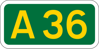
The A36 is a trunk road and primary route in southwest England that links the port city of Southampton to the city of Bath. At Bath, the A36 connects with the A4 to Bristol, thus providing a road link between the major ports of Southampton and Bristol. It also provides a link between Bristol and London via the A303.

<span class="mw-page-title-main">A31 road</span> Major trunk road in southern England

The A31 is a major trunk road in southern England that runs from Guildford in Surrey to Bere Regis in Dorset. Its most well known section is the Hog's Back, a hilly ridge forming part of the North Downs, in the Surrey stretch between Guildford and Farnham.

<span class="mw-page-title-main">A361 road</span> Longest three-digit road in England

The A361 is an A class road in southern England, which at 195 miles (314 km) is the longest three-digit A road in the UK.

<span class="mw-page-title-main">A350 road</span> Road in England

The A350 is a north–south primary route in southern England, that runs from the M4 motorway in Wiltshire to Poole in Dorset.

<span class="mw-page-title-main">Autoroutes of France</span> Highway system of France

The autoroute system in France consists largely of toll roads. It is a network of 11,882 km (7,383 mi) of motorways as of 2014. On road signs, autoroute destinations are shown in blue, while destinations reached through a combination of autoroutes are shown with an added autoroute logo. Toll autoroutes are signalled with the word péage.

A36, A 36 or A-36 may refer to:

<span class="mw-page-title-main">A36 road (Northern Ireland)</span>

The A36 is a road in Northern Ireland. It travels through County Antrim, connecting the large towns of Ballymena and Larne.

<span class="mw-page-title-main">A338 road</span> Road in southern England

The A338 is a major primary route in southern England, that runs from the junction with the A35 at Poole in Dorset to the junction with the A420 at Besselsleigh in Oxfordshire, a distance of 84 miles (135 km).

<span class="mw-page-title-main">Wellow, Hampshire</span> Human settlement in England

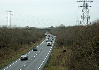
Wellow is a village and civil parish in Hampshire, England that falls within the Test Valley district. The village lies just outside the New Forest, across the main A36 road which runs from the M27 motorway to Salisbury. The nearest town is Romsey, 4 miles (6.4 km) to the east, and the closest city is Southampton, 9 miles (14 km) to the southeast. The parish had a population of 3,239 in the 2021 census.

A36 steel is a common structural steel alloy utilized in the United States. The A36 standard was established by the ASTM International. The standard was published in 1960 and has been updated several times since. Prior to 1960, the dominant standards for structural steel in North America were A7 and A9. Note that SAE/AISI A7 and A9 tool steels are not the same as the obsolete ASTM A7 and A9 structural steels.

<span class="mw-page-title-main">A5 autoroute</span> Controlled-access highway from Pariss Francilienne to the A31 near Beauchemin

The A5 Autoroute, which was constructed in 1990 to relieve the A6, links the Parisian region with the Langres area. It is a 238 km toll road under the management of the Autoroutes Paris-Rhin-Rhône (APRR). It makes up parts of the European routes E54, E511, and E17. Before the A5 was completed, the section linking Troyes with Langres was known as the A26. This route crosses the departments of Seine-et-Marne, Yonne, Aube and Haute-Marne.

<span class="mw-page-title-main">École-Valentin</span> Commune in Bourgogne-Franche-Comté, France

École-Valentin is a commune in the Doubs department in the Bourgogne-Franche-Comté region in eastern France.

<span class="mw-page-title-main">Pouilley-Français</span> Commune in Bourgogne-Franche-Comté, France

Pouilley-Français is a commune in the Doubs department in the Bourgogne-Franche-Comté region in eastern France. This village is close to the Jura and Haute-Saône departments.

<span class="mw-page-title-main">A16 motorway (Switzerland)</span> Motorway in Switzerland

The A16, a motorway in north-central Switzerland, is a divided freeway connecting the border to France to the A5 motorway, 84 kilometres (52 mi) to the south on the Swiss plateau.

<span class="mw-page-title-main">Ower</span> Human settlement in England

Ower is a hamlet in the New Forest district of Hampshire, England. Its nearest towns are Totton – approximately 3 miles (4.8 km) to the southeast, and Romsey – around 4 miles (6.4 km) to the north-east.

<span class="mw-page-title-main">López Serrano Building</span> Residential in Havana, Cuba

The López Serrano Building was the tallest residential building in Cuba until the construction of the FOCSA in 1956. Designed by the architect Ricardo Mira in 1929, who in 1941 who also designed La Moderna Poesia bookstore on Obispo Street for the same owner, it is often compared to the Bacardi Building in Old Havana built two years before the López Serrano Building because of their similarity in massing and central tower. The congressman, senator, and presidential candidate Eduardo Chibás was living on the fourteenth-floor penthouse when he committed suicide in August 1951 on the air at CMQ Radio Station.

<span class="mw-page-title-main">Autostrada A36</span>

Autostrada A36, also called Pedemontana Lombarda, is a motorway in northern Italy that aims to speed up travel in the north of Milan, creating a road outside the Metropolitan City of Milan to connect the province of Varese with that of Bergamo, as well as the Milan Malpensa Airport with the Orio al Serio International Airport.